Highlights:
Mostly high elevation, forested land in southwest Utah, in 4 separate units, bordering several national parks and containing similar scenery of canyons, mountains and eroded rocks
Nearby town:
Management:
USFS
Location:
38.026, -111.345 (UT 12 across Boulder Mountain)
Rating (1-5):
★★★★★
Seasons:
Spring, summer and fall are the main seasons, as most land is snow-covered in winter

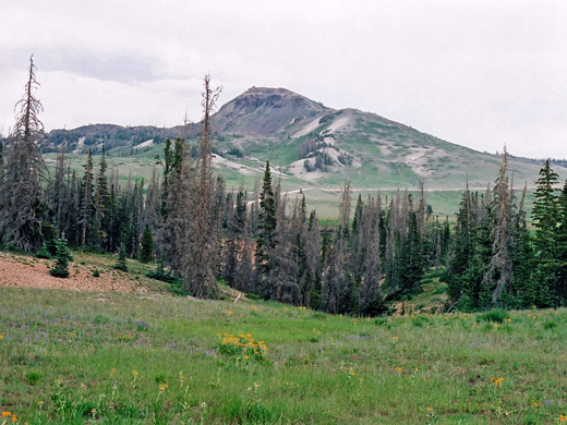
About 3,000 square miles of southwest Utah are contained within four separate units of the Dixie National Forest (see map) - the largest area of public lands in the state, bordering four national parks or monuments (Cedar Breaks, Bryce Canyon, Grand Staircase-Escalante and Capitol Reef), and containing comparable scenery of canyons, mountains and eroded rock formations, though the majority is dense woodland. Most is high in elevation, with several peaks over 10,000 feet, and vegetation zones ranging from above the timberline to semi-desert.
A fair amount has quite easy access, as several main roads cross some of the most scenic parts, in particular UT 12 between Long Valley and Torrey, and UT 14/UT 143 around Cedar Breaks, then many side roads branch off through the trees, leading to distant peaks and valleys, lakes and waterfalls, plus more unusual sites like lava fields and Anasazi ruins. As with all national forests, camping is allowed free of charge, and the woods offer a cool retreat in summer when the desert lands to the south may be excessively hot.
A fair amount has quite easy access, as several main roads cross some of the most scenic parts, in particular UT 12 between Long Valley and Torrey, and UT 14/UT 143 around Cedar Breaks, then many side roads branch off through the trees, leading to distant peaks and valleys, lakes and waterfalls, plus more unusual sites like lava fields and Anasazi ruins. As with all national forests, camping is allowed free of charge, and the woods offer a cool retreat in summer when the desert lands to the south may be excessively hot.
Dixie National Forest Table of Contents
Location
Map of Dixie National Forest.
Photographs
39 views of the Dixie National Forest.
Escalante - Torrey
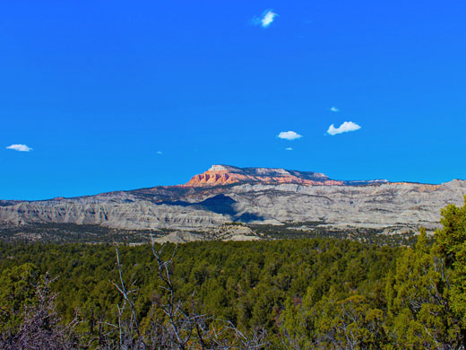
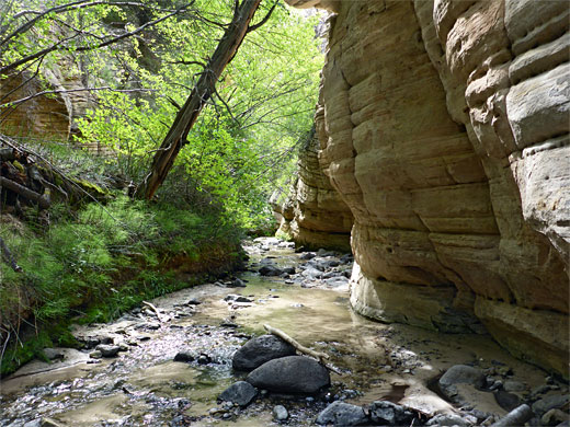
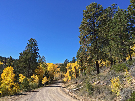
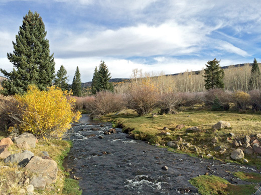
The largest section of the Dixie National Forest is in the south central part of Utah, mostly north and west of UT 12 from Tropic, through Escalante and Boulder to Torrey, though a sizeable part extends further east to the boundary of Capitol Reef National Park. This is mountainous terrain, and contained within are the Aquarius Plateau and flat-topped Boulder Mountain, which rises 3,000 feet above the surrounding sedimentary rocks of the Colorado Plateau. The land breaks up to the south in a series of valleys and narrow canyons, especially around Escalante, and some of that region's best scenery is within the forest boundary including the Box-Death Hollow Wilderness, Sand Creek, and upper Boulder Creek, both reached along the unpaved Hells Backbone Road.
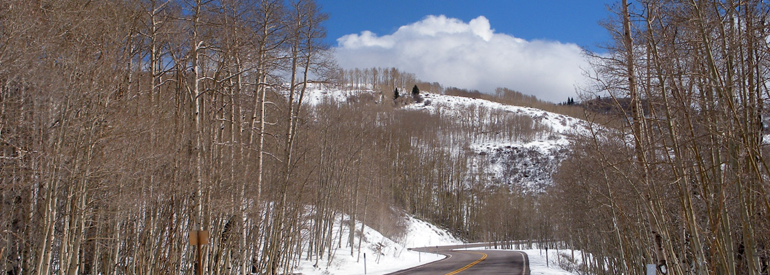
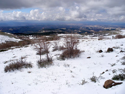
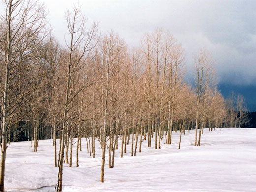
The main access into Dixie National Forest is the section of UT 12 north of Boulder, which rises to 9,200 feet, and for several miles the pine trees are replaced by aspen groves between Alpine meadows, as the highway passes various viewpoints, campsites and side tracks, such as FR165 to Kings Pasture Reservoir, start point for the Trail Point Trail, one of several routes to the Boulder Mountain plateau. Another road is UT 24 along the north edge though forest access from here is more limited. The surroundings are rather different in the southwest where the elevation is much lower; here UT 12 approaches from Escalante via a long grassy valley, passes over a small summit then descends through an expanse of eroded ravines and mesas with much exposed rock, later reaching Henrieville.
Bryce Canyon - Circleville
To the west, the next section of Dixie National Forest is nearly contiguous, separated only by a corridor of private land either side of UT 22, which joins UT 12 from the north, just above Bryce Canyon National Park. This includes the west face of the Paunsaugunt Plateau and contains similar, though smaller, eroded outcrops of red and pink sandstone that are seen most spectacularly in the national park a few miles to the east. Red Canyon lies entirely within the national forest while other sites to the south of UT 12 include Tropic Reservoir, popular for fishing, and the volcanic peak of Black Butte.
Cedar Breaks - Panguitch
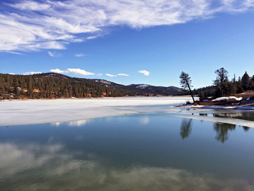
The third portion of the Dixie National Forest, east of Cedar City, is the easiest to access and receives the most visitors. The huge exposed cliff face of Cedar Breaks National Monument dominates the west edge, and other smaller eroded formations are found to the south. The resort of Brian Head is a few miles north, usually open for skiing between November and March, and offers excellent views all year from its summit, which is reached by a gravel road. From Cedar City, UT 14 climbs up through pretty Cedar Canyon, and after the side road to the national monument passes large areas of lava and several cinder cones, then runs beside to Navajo Lake - used for camping, fishing and boating, this is unusual as it has no surface outlet. Instead its waters drain underground then emerge a few miles south at Cascade Falls at the edge of the Pink Cliffs, a point reached by a 3 mile forest track and 1.1 mile foot trail. From the lake, UT 14 drops 2,000 feet through more wooded land, past Duck Creek Village to Long Valley Junction. In and around the village are several trails and campgrounds, a few small lakes for fishing, and a range of visitor facilities. The other main paved road through the national forest is UT 143 from Panguitch to Cedar Breaks, through rolling, open countryside with ranches and other pockets of settlement, especially around Panguitch Lake.
St George - Nevada border
The westernmost area of the Dixie National Forest is dominated by the Pine Valley Mountains that rise to over 10,000 feet a few miles north of St George. I-15 runs beneath the very steep east face of the mountains while UT 18, the one paved route through the forest, follows the more gently sloping west side; this road passes Snow Canyon soon after St George then crosses empty, slightly desolate land for the next 40 miles, to the junction with UT 56. This land, west of the mountains, is part of the Great Basin Desert and without much of particular interest though one site worth visiting is Old Irontown, to the northeast - remains of a small mining town that produced iron ore between 1882 and 1890, A few brick structures remain, all rather overgrown, plus various scattered mining relics. The east face of the mountains adjoins the edge of the Colorado Plateau, and the lower slopes have much eroded, red and yellow sandstone formations; sites of note include Red Cliffs Recreation Area and the Yant Flat Cliffs, plus the narrow canyons of Bitter Creek and Yankee Doodle Hollow.
Trails of the Dixie National Forest
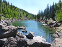
Deer Creek Lake Trail
★★★★★
★★★★★
3.8 miles, 1,200 feet
Path through meadows and light woodland to three contrasting lakes on the south side of Boulder Mountain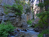
Pine Creek Box Trail
★★★★★
★★★★★
8.5 miles, 1,320 feet
Semi-maintained path along a wooded, relatively high elevation canyon, containing a permanent stream; initially shady and enclosed then much more open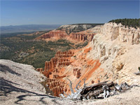
Powell Point Trail
★★★★★
★★★★★
0.8 miles, 100 feet
Short path to a spectacular, red and white rock viewpoint on the south side of Escalante Mountain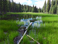
Trail Point Trail
★★★★★
★★★★★
4 miles, 1,700 feet
Little-used path that climbs to a viewpoint at the edge of the Boulder Mountain plateau, continuing across meadows to a scenic lake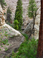
Upper Sand Creek
★★★★★
★★★★★
3 miles, 550 feet
Remote, trailless, overgrown drainage, winding beneath tall pines and sandstone cliffs, part of the Box-Death Hollow Wilderness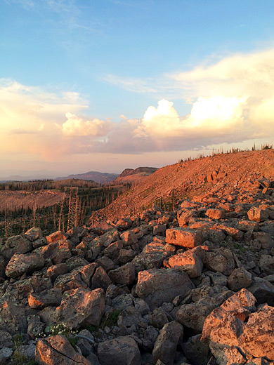
All Contents © Copyright The American Southwest | Comments and Questions | Contribute | Affiliate Marketing Disclosure | Site Map