Upper Sand Creek
The upper reaches of a remote, overgrown, trailless drainage flowing down a deepening canyon below sandstone cliffs and ponderosa pines, part of Box-Death Hollow Wilderness. Accessed from Hells Backbone Road
Length: 3 miles, to the first tributary. About 12 miles to the Boulder Mail Trail
Elevation change: 550 feet
Difficulty: Moderate to strenuous; many small obstacles, and much undergrowth
Type: One way, off-trail
Usage: Very low
Season: Late spring, summer, fall
Trailhead: Hells Backbone Road, near the junction with FR 163
Rating (1-5): ★★★★★
Elevation change: 550 feet
Difficulty: Moderate to strenuous; many small obstacles, and much undergrowth
Type: One way, off-trail
Usage: Very low
Season: Late spring, summer, fall
Trailhead: Hells Backbone Road, near the junction with FR 163
Rating (1-5): ★★★★★

Sand Creek is a major tributary of the Escalante River, originating at 10,000 feet on the southern slopes of the Aquarius Plateau, and meeting the river (at 5,290 feet) two miles west of the Hwy 12 road bridge, a location reachable by the Escalante River Trail. Upstream, the creek is confined within a moderately deep canyon for several miles, until the cliffs recede and for some distance either side of the next easily accessible point, the crossing of the Boulder Mail Trail, the land has lower relief, a mix of domes, ravines and sandy slopes.
The Mail Trail crossing is about half way along the Sand Creek drainage, which further north continues to gradually gain elevation, as cliffs return, and for around 5 miles the permanent stream is enclosed and overgrown, the vegetation now more mountain-like, with ponderosa pines and other large trees. This upper stretch, although trailless, can be explored starting from Hells Backbone Road, which crosses the stream at elevation 7,890 feet, in a shallow, forested valley just east of the big descent of the road from Hells Backbone Bridge.
From the road, the distance to the Boulder Mail Trail is 12 miles, of which over a third is through a deep canyon, starting after a mile or so; the southern section is more open. The walk through the enclosed section is slow because of thick vegetation and frequent blockages in the streamway caused by boulders, bushes and fallen trees, and it would to take all of one day to reach the Mail Trail, but for a shorter, round-trip hike, described here, one target is a tributary on the west side, joining via a short slot section; this is 3 miles from the road, and the 6 mile trip takes five hours or more. Attractions are the trickling stream, forming pools and little cascades, the varied, riparian vegetation in particular many orchids, and the eroded, sandstone cliffs, generally colored pale yellow to white, all formed of Navajo Sandstone.
This section of Sand Creek is one of three major drainages in the Box-Death Hollow Wilderness, the others being Pine Creek and Death Hollow, and is also part of the Dixie National Forest; it crosses into Grand Staircase-Escalante National Monument about 3 miles north of the Boulder Mail Trail.
34 views along upper Sand Creek.
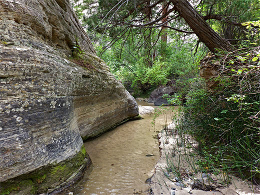
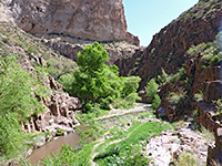
The Sand Creek crossing along Hells Backbone Road is marked with a sign, 27 miles from Escalante and 11.5 miles from Hwy 12 near Boulder. A nearby flat area serves as a parking place, while good camping places can be found alongside a track (FR 163) that follows the creek northwards. In the summer, the stream flows gently, its waters just a few inches deep, winding through a shallow ravine between trees and grassy flats, with a floor of soft sand. The easiest approach is to stay on the high ground to the east, perhaps following a disused track, then descend towards the confluence of a small tributary that joins from the east, also containing flowing water; the valley sides become rather steeper downstream. Beyond the confluence, walking is about two thirds directly in the stream and one third on benches, which are generally overgrown, with small trees, thorny bushes and manzanita; flat, open areas are infrequent.
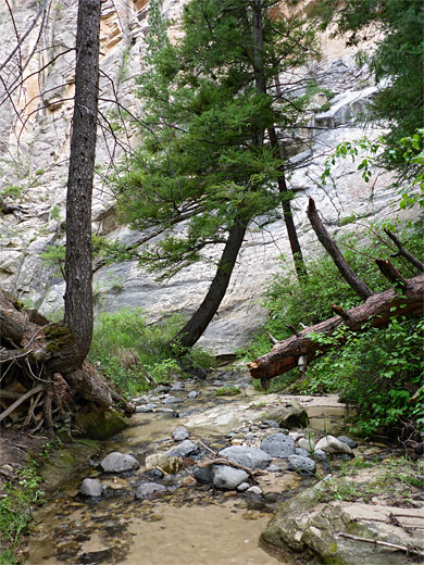
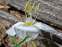
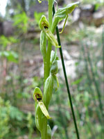
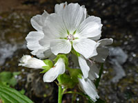
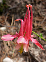
On the canyon sides are many tall pines, while numerous fallen branches and trunks criss-cross the drainage, often lying across the stream, or under the water, creating pools and little waterfalls. Only in a few places are there larger falls or deeper pools to bypass, plus some more dense patches of undergrowth. Rocks are often slippery, and large areas of the canyon floor are filled with dense clumps of horsetail. Some of the more interesting wildflowers are crimson columbine, fendler's ceanothus, spreading sandwort and white checkermallow, plus the intermountain bog orchid, of which many hundreds bloom in the summer. Fish inhabit many parts of the stream.
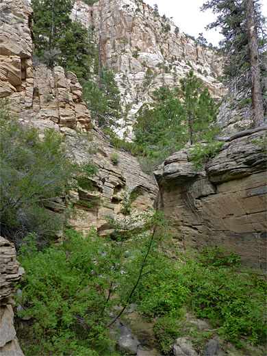
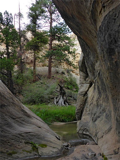
Some parts of the canyon are relatively wide, others confined and cliff-lined, but the drainage is never particularly narrow. Cliffs tend to only to be on one side of the stream, rarely both together. In some places the rocks overhang creating dark alcoves, and the stream forms some fluted cascades, but otherwise the first few miles of the canyon are rather unremarkable. Gaps between the trees allow frequent glimpses of the higher cliffs above, though not usually in sufficient detail to gauge progress by identifying landmarks. 2.3 miles from the road, another minor drainage joins from the east, its lower end forming a dryfall and short slot, then after 3 miles is a similar tributary on the west side, with a pool at the base. After here, the character of the canyon is not much different for the next 2.5 miles; more tight bends, lots of trees and vegetation, not generally narrow but with a few rock-lined sections and some deeper pools, until the cliffs recede, and for 5 miles to the Boulder Mail Trail crossing the surroundings are more open, and the canyon easier to traverse.
The Mail Trail crossing is about half way along the Sand Creek drainage, which further north continues to gradually gain elevation, as cliffs return, and for around 5 miles the permanent stream is enclosed and overgrown, the vegetation now more mountain-like, with ponderosa pines and other large trees. This upper stretch, although trailless, can be explored starting from Hells Backbone Road, which crosses the stream at elevation 7,890 feet, in a shallow, forested valley just east of the big descent of the road from Hells Backbone Bridge.
From the road, the distance to the Boulder Mail Trail is 12 miles, of which over a third is through a deep canyon, starting after a mile or so; the southern section is more open. The walk through the enclosed section is slow because of thick vegetation and frequent blockages in the streamway caused by boulders, bushes and fallen trees, and it would to take all of one day to reach the Mail Trail, but for a shorter, round-trip hike, described here, one target is a tributary on the west side, joining via a short slot section; this is 3 miles from the road, and the 6 mile trip takes five hours or more. Attractions are the trickling stream, forming pools and little cascades, the varied, riparian vegetation in particular many orchids, and the eroded, sandstone cliffs, generally colored pale yellow to white, all formed of Navajo Sandstone.
This section of Sand Creek is one of three major drainages in the Box-Death Hollow Wilderness, the others being Pine Creek and Death Hollow, and is also part of the Dixie National Forest; it crosses into Grand Staircase-Escalante National Monument about 3 miles north of the Boulder Mail Trail.
Photographs
34 views along upper Sand Creek.
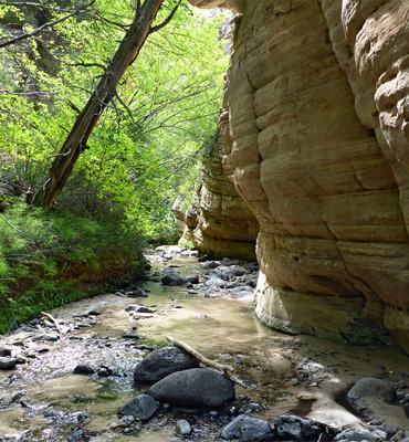
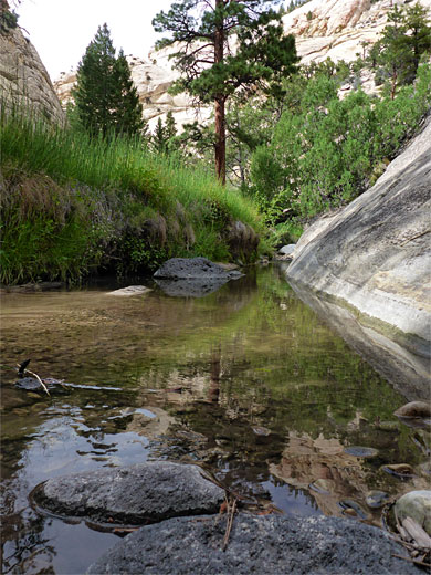
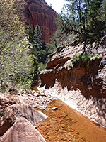
Start of the Canyon
The Sand Creek crossing along Hells Backbone Road is marked with a sign, 27 miles from Escalante and 11.5 miles from Hwy 12 near Boulder. A nearby flat area serves as a parking place, while good camping places can be found alongside a track (FR 163) that follows the creek northwards. In the summer, the stream flows gently, its waters just a few inches deep, winding through a shallow ravine between trees and grassy flats, with a floor of soft sand. The easiest approach is to stay on the high ground to the east, perhaps following a disused track, then descend towards the confluence of a small tributary that joins from the east, also containing flowing water; the valley sides become rather steeper downstream. Beyond the confluence, walking is about two thirds directly in the stream and one third on benches, which are generally overgrown, with small trees, thorny bushes and manzanita; flat, open areas are infrequent.
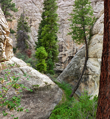
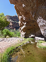
Sand Creek Vegetation
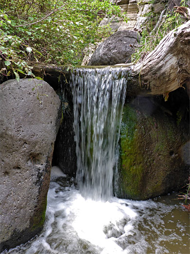
On the canyon sides are many tall pines, while numerous fallen branches and trunks criss-cross the drainage, often lying across the stream, or under the water, creating pools and little waterfalls. Only in a few places are there larger falls or deeper pools to bypass, plus some more dense patches of undergrowth. Rocks are often slippery, and large areas of the canyon floor are filled with dense clumps of horsetail. Some of the more interesting wildflowers are crimson columbine, fendler's ceanothus, spreading sandwort and white checkermallow, plus the intermountain bog orchid, of which many hundreds bloom in the summer. Fish inhabit many parts of the stream.
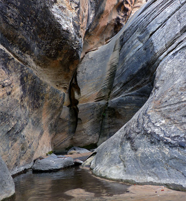
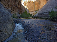
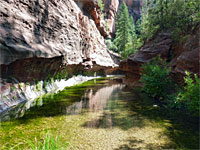
The Canyon
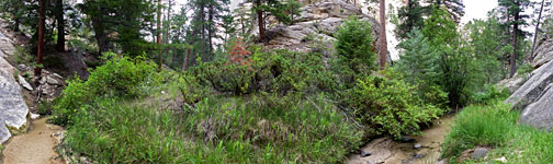
Some parts of the canyon are relatively wide, others confined and cliff-lined, but the drainage is never particularly narrow. Cliffs tend to only to be on one side of the stream, rarely both together. In some places the rocks overhang creating dark alcoves, and the stream forms some fluted cascades, but otherwise the first few miles of the canyon are rather unremarkable. Gaps between the trees allow frequent glimpses of the higher cliffs above, though not usually in sufficient detail to gauge progress by identifying landmarks. 2.3 miles from the road, another minor drainage joins from the east, its lower end forming a dryfall and short slot, then after 3 miles is a similar tributary on the west side, with a pool at the base. After here, the character of the canyon is not much different for the next 2.5 miles; more tight bends, lots of trees and vegetation, not generally narrow but with a few rock-lined sections and some deeper pools, until the cliffs recede, and for 5 miles to the Boulder Mail Trail crossing the surroundings are more open, and the canyon easier to traverse.
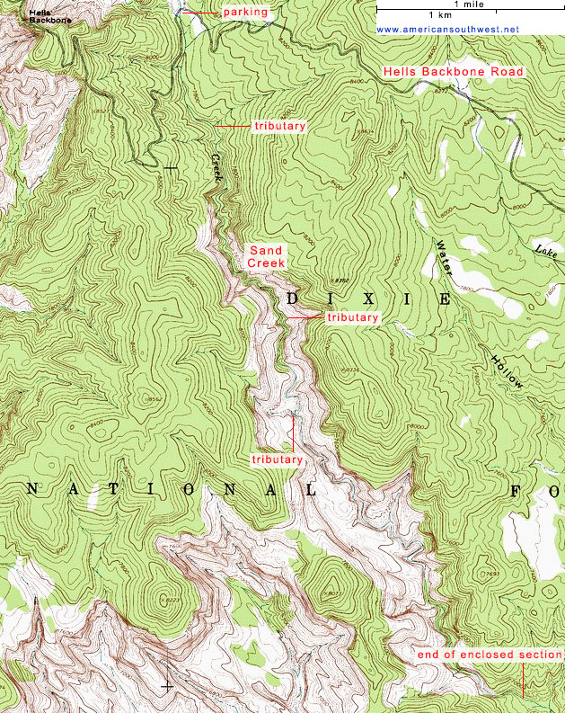
Topographic Map of Upper Sand Creek
Upper Sand Creek - Similar Hikes
All Contents © Copyright The American Southwest | Comments and Questions | Contribute | Affiliate Marketing Disclosure | Site Map