Hell's Backbone Road, Grand Staircase-Escalante National Monument
Utah > Grand Staircase-Escalante National Monument > Hell's Backbone Road
Highlights:
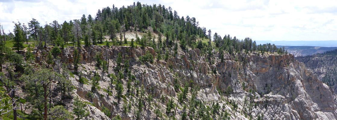
38 mile, mostly unpaved route between Escalante and Boulder that climbs high up the southern slopes of Boulder Mountain, round the upper ends of the deep canyons of Pine Creek, Death Hollow and Sand Creek

The road, which is mostly unpaved, is 39 miles in length, and without stops takes nearly 2 hours to drive. It climbs quite far up the southern slopes of Boulder Mountain, reaching a high point of 9,200 feet, and as a result is closed by snow for several months in winter, and usually impassable during the snowmelt season of late spring, but for a few months in summer the surface is smooth and dry, and the road accessible by most vehicles including small to medium RVs. The surface is regularly graded during these months. Although often very winding, the road is wide enough for two vehicles to pass easily, with only one slightly rougher section, for a mile or two east of Hell's Backbone, where the road descends a steep hillside.
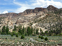

The lower reaches, at either end, cross semi-desert land with bushes and exposed sandstone, though the majority is through thick pine and aspen forests, above 8,000 feet. Only the southernmost part is within Grand Staircase-Escalante National Monument; the remainder is in the Dixie National Forest. A few side tracks branch off, most used being to Posey Lake, and there are many places suitable for free primitive camping. Views are sometimes restricted due to the trees though there are plenty of grand overlooks, in particular of the three main canyons that the road winds above - Pine Creek (The Box), Death Hollow and Sand Creek.
Hell's Backbone Road Table of Contents
- Map of Hell's Backbone Road
- Escalante to Pine Creek
- Pine Creek to Death Hollow
- Hell's Backbone to Hwy 12
Map of Hell's Backbone Road

Escalante to Pine Creek
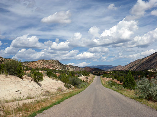
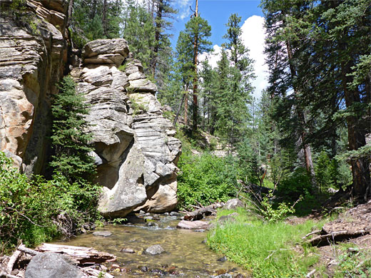
The road starts at the eastern edge of Escalante as N300E, soon crossing the river and continuing north up the wide, flat-floored valley at the lower end of Pine Creek, passing several farms. The surface becomes unpaved shortly before the Dixie National Forest boundary, and the road a little narrower, then shortly after the final ranch it veers west into the subsidiary valley of Lost Creek, just beyond the Lower Box trailhead. The Box is the deep, sometimes sheer-walled canyon formed by the upper reaches of Pine Creek, followed by a maintained, nine mile trail, the far end of which is 10.3 miles further along the road.
Pine Creek to Death Hollow
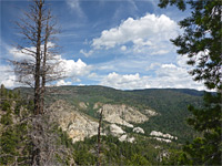
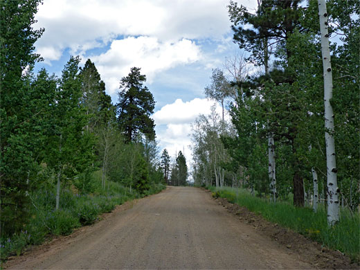
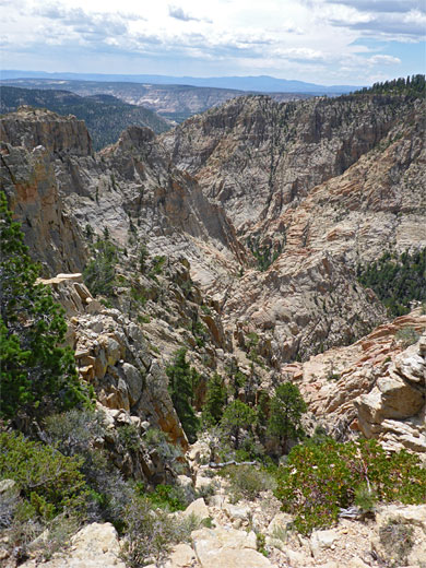
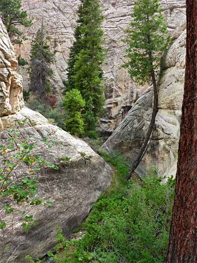
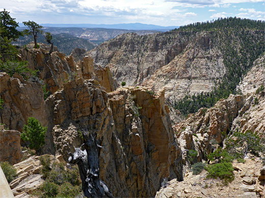
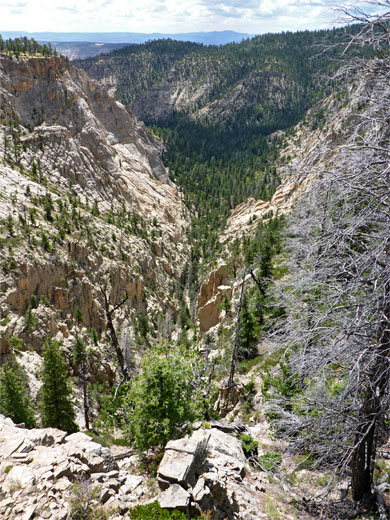
The road rounds a wide bend then straightens, following the uppermost section of the valley alongside a sagebrush plain, before climbing more steadily, now through full-size pine woods. Posey Lake Road forks off westwards, while the main route comes more winding as it approaches the Upper Box trailhead. Just before is the Blue Spring Trail (1.4 miles), a connecting path to the Great Western Trail, while just after is a northwards side road to Blue Spruce Campground. More climbing takes the road rounded the divide separating the Pine Creek drainage from the next big canyon, Death Hollow, which is much deeper, though still accessible to hiking, from a signed trailhead near its upper end. The are several dramatic vistas of cliffs and pinnacles before the road crosses a cattle grid in the middle of a narrow neck of land, and turns south, running along the Hell's Backbone ridge. Just before the cattegrid a short track branches northwards to the 1.7 mile Rogers Peak Trail, another link to the Great Western Trail, crossing the eastern slopes of the eponymous peak, though not coming anywhere near its 10,127 foot summit. At its narrowest point, the Hell's Backbone ridgeline is interrupted by a short but deep crevasse, spanned by a 100 foot long concrete bridge, the third at the site, the original wooden bridge having endured until the 1960s. The road is paved for about 1000 feet either side of the bridge, beside which is a pull-out, information board and viewpoint.
Hell's Backbone to Hwy 12
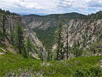
Continuing east, the road descends steeply, around several tight bends, down into the much gentler canyon of Sand Creek, which although trailless, can be followed, with moderate difficulty, by a combination of wading the stream and walking on bushy benches. On the far side of the creek, the road climbs once more, for the last time, passes over a saddle, then becomes generally flatter and straighter, with more side tracks, and increasing signs of cattle. It crosses Sweetwater Creek, another small but permanent stream, and follows its shallow valley to the south, emerging after a couple of miles to a wider valley with scattered farms and houses. The final few miles are paved, as the road crosses arid, more desert-like terrain, over one more significant drainage (Big Hollow), and onto the intersection with Hwy 12, 3 miles from Boulder. Just before is a little side road that crosses an airfield to the north end of the Boulder Mail Trail.
All Contents © Copyright The American Southwest | Comments and Questions | Contribute | Affiliate Marketing Disclosure | Site Map