Pine Creek Box Trail
Semi-maintained path along a wooded, relatively high elevation canyon, containing a permanent stream. The upper half is shady and enclosed though never particularly narrow, while the lower section is deeper and much more open
Length: 4 miles to Deep Creek (from the upper trailhead), 8.5 miles in total
Elevation change: 710 feet, 1,320 feet
Difficulty: Moderate; many stream crossings
Type: One way
Usage: Low
Season: Summer, fall; water levels may be too high in the spring
Trailhead: Two points along Hells Backbone Road from Escalante: 7.6 miles (lower), 17.9 miles (upper)
Rating (1-5): ★★★★★
Elevation change: 710 feet, 1,320 feet
Difficulty: Moderate; many stream crossings
Type: One way
Usage: Low
Season: Summer, fall; water levels may be too high in the spring
Trailhead: Two points along Hells Backbone Road from Escalante: 7.6 miles (lower), 17.9 miles (upper)
Rating (1-5): ★★★★★

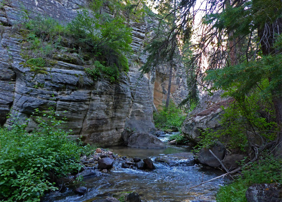
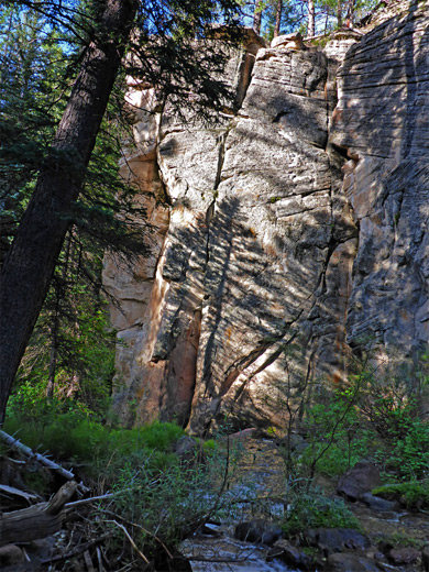
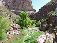
Pine Creek is one of the easiest-explored of the many long canyons near Escalante since it has a semi-maintained trail running all the way through the most scenic section, 8.5 miles, involving only a gradual elevation change and encountering no significant obstacles. Part of the Dixie National Forest rather than Grand Staircase-Escalante National Monument, the canyon contains a permanent stream which needs to be crossed in over 50 places, though the water is usually just a few inches deep and most crossings use logs or stones; only a few require shallow wading.
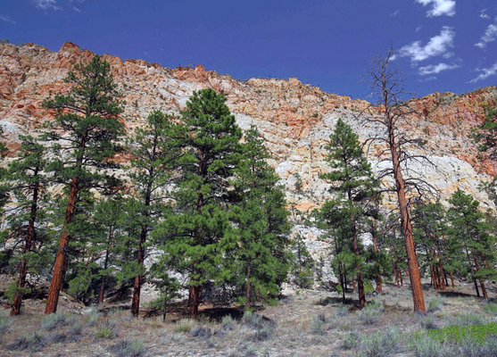
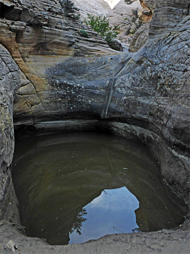
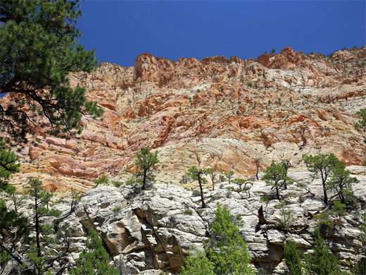
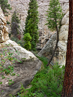
The hike explores the middle third of the drainage; the upper part, starting from springs below the summit plateau of Boulder Mountain, forms a shallow valley through forested slopes, while the lower section is flanked by a broad corridor of flat land partly used for ranching, leading to the confluence with the Escalante River just east of the town. In between, the scenic section begins where the stream, previously flowing over volcanic rocks, starts to cut down into the overlying (but lower in elevation) Navajo sandstone, creating an initially narrow gorge with some short enclosed sections, plus pools, cascades, potholes and a few junctions with tributary ravines, extending about 4 miles until the gorge opens are quite abruptly to a box canyon lined by colorful rocky slopes, up to 1,000 feet high and two thirds of a mile across at the top of the cliffs.
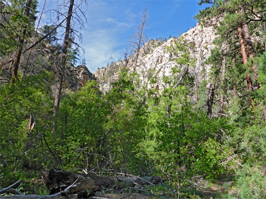
The upper portion is nearly all in shade, because of tall trees growing close to the stream - ponderosa pines and other conifers - while the lower section is much more open, the trees more scattered, so can be hot in some months though the elevation is relatively high and the hike is a good choice during the summer months when the canyons south of Hwy 12 are too hot.
The middle section of the canyon is known as The Box, part of the Box-Death Hollow Wilderness, and hike can be started from either of two trailheads along Hell's Backbone Road. Downstream is the recommended direction if walking one-way, while for shorter hikes the upper part is more scenic but the lower section is a better choice earlier in the season when the stream holds more water and the higher elevations of the road may still be impassable due to snow.
From Escalante, Hell's Backbone Road (initially N 300E) is paved for 3.5 miles, becoming unpaved shortly before the Dixie National Forest boundary. Soon after the last ranch house a short spur leads to the Lower Box Trailhead, at a divide in the drainage where Pine Creek meets the smaller Lost Creek, this providing a course for the continuation of the road, which later climbs steadily, entering forested land, and reaches the Upper Box Trailhead after another 10.3 miles, 1,300 feet before the crossing of the creek; parking is on the verge, marked by a sign stating 'Upper Box Access'. The hike described below starts from this trailhead.
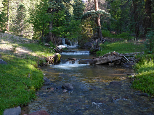
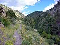
From the road, a faint path descends a sloping meadow frequented by cows and soon reaches Pine Creek, just below a pretty section including a few small waterfalls. It follows the creek downstream, past a trailhead notice and register, which suggests only one or two dozen people make the hike each month. The first stream crossing, to the east side, is just before some cliffs that rise up next to the stream, which thereafter remains similar in character for about two miles, flowing below short cliffs on one side or the other, without ever becoming properly confined.
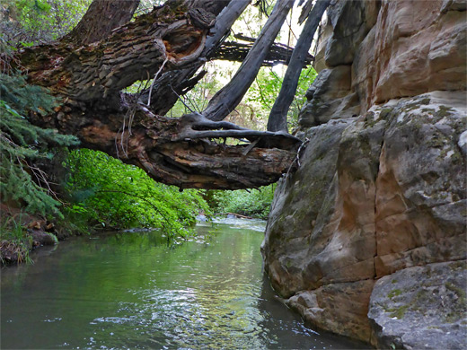
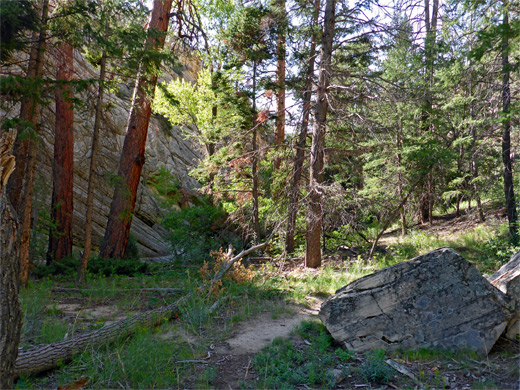
The fourth crossing, necessitated by large cliff on the east side, is perhaps aided by a log, if not this might be the first location to get wet feet. The fifth is soon after, before a sign marking the wilderness boundary, accompanied by a fence/gate to stop cows, though this is damaged, allowing them to escape. After a bushy area, the eighth crossing is the first that definitely requires wading, the waters maybe one foot deep. Next is a more open area and a stretch where the path, previously always at creek level, climbs quite high above for a time, over a bench. The canyon is now a little wider, the cliffs rising higher above, no longer near the stream, and mostly obscured by the tall trees at either side.
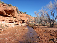
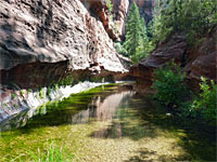
A longish flat section leads to the confluence with a large, east-side tributary, the streambed of which has a big pothole at the base and smooth slickrock above. The path alternates between woody patches and open sections as the brownish cliffs become steadily further apart. Crossings 20 and 21 are to avoid an overgrown, boulder-filled channel, then after number 22 is a sandy, mostly treeless bench, good for wildflowers in the summer. The path crosses a dry, rock-lined stream, followed by a grove of manzanita and a second sandy patch, then reaches the confluence with Deep Creek, also containing a permanent stream, flowing out of a patch of undergrowth from a canyon that is generally shallow, and seems uninteresting.
The confluence, nearly half way along the trail, marks the approximate end of the shady, enclosed upper portion of the canyon, and for the remaining 4.5 miles the path traverses ever-larger clear areas separated by increasingly sparse woodland, crossing the creek approximately another 30 times, usually to cut-off bends rather than avoid obstacles. Three significant tributaries join from the east, after 4.7, 5.3 and 6 miles then, after tighter bend, a fourth. Not ahead, the trail rises over a little ridge, a good viewpoint, and after another mile reaches the V-shaped mouth of the canyon, where the cliffs on the west side recede abruptly and the creek enters a much wider valley, where it comes close to the lower trailhead.
The hike explores the middle third of the drainage; the upper part, starting from springs below the summit plateau of Boulder Mountain, forms a shallow valley through forested slopes, while the lower section is flanked by a broad corridor of flat land partly used for ranching, leading to the confluence with the Escalante River just east of the town. In between, the scenic section begins where the stream, previously flowing over volcanic rocks, starts to cut down into the overlying (but lower in elevation) Navajo sandstone, creating an initially narrow gorge with some short enclosed sections, plus pools, cascades, potholes and a few junctions with tributary ravines, extending about 4 miles until the gorge opens are quite abruptly to a box canyon lined by colorful rocky slopes, up to 1,000 feet high and two thirds of a mile across at the top of the cliffs.
The upper portion is nearly all in shade, because of tall trees growing close to the stream - ponderosa pines and other conifers - while the lower section is much more open, the trees more scattered, so can be hot in some months though the elevation is relatively high and the hike is a good choice during the summer months when the canyons south of Hwy 12 are too hot.
The middle section of the canyon is known as The Box, part of the Box-Death Hollow Wilderness, and hike can be started from either of two trailheads along Hell's Backbone Road. Downstream is the recommended direction if walking one-way, while for shorter hikes the upper part is more scenic but the lower section is a better choice earlier in the season when the stream holds more water and the higher elevations of the road may still be impassable due to snow.
Pine Creek Trailheads
From Escalante, Hell's Backbone Road (initially N 300E) is paved for 3.5 miles, becoming unpaved shortly before the Dixie National Forest boundary. Soon after the last ranch house a short spur leads to the Lower Box Trailhead, at a divide in the drainage where Pine Creek meets the smaller Lost Creek, this providing a course for the continuation of the road, which later climbs steadily, entering forested land, and reaches the Upper Box Trailhead after another 10.3 miles, 1,300 feet before the crossing of the creek; parking is on the verge, marked by a sign stating 'Upper Box Access'. The hike described below starts from this trailhead.
Pine Creek
From the road, a faint path descends a sloping meadow frequented by cows and soon reaches Pine Creek, just below a pretty section including a few small waterfalls. It follows the creek downstream, past a trailhead notice and register, which suggests only one or two dozen people make the hike each month. The first stream crossing, to the east side, is just before some cliffs that rise up next to the stream, which thereafter remains similar in character for about two miles, flowing below short cliffs on one side or the other, without ever becoming properly confined.
Stream Crossings
The fourth crossing, necessitated by large cliff on the east side, is perhaps aided by a log, if not this might be the first location to get wet feet. The fifth is soon after, before a sign marking the wilderness boundary, accompanied by a fence/gate to stop cows, though this is damaged, allowing them to escape. After a bushy area, the eighth crossing is the first that definitely requires wading, the waters maybe one foot deep. Next is a more open area and a stretch where the path, previously always at creek level, climbs quite high above for a time, over a bench. The canyon is now a little wider, the cliffs rising higher above, no longer near the stream, and mostly obscured by the tall trees at either side.

Deep Creek
A longish flat section leads to the confluence with a large, east-side tributary, the streambed of which has a big pothole at the base and smooth slickrock above. The path alternates between woody patches and open sections as the brownish cliffs become steadily further apart. Crossings 20 and 21 are to avoid an overgrown, boulder-filled channel, then after number 22 is a sandy, mostly treeless bench, good for wildflowers in the summer. The path crosses a dry, rock-lined stream, followed by a grove of manzanita and a second sandy patch, then reaches the confluence with Deep Creek, also containing a permanent stream, flowing out of a patch of undergrowth from a canyon that is generally shallow, and seems uninteresting.
The Lower Canyon
The confluence, nearly half way along the trail, marks the approximate end of the shady, enclosed upper portion of the canyon, and for the remaining 4.5 miles the path traverses ever-larger clear areas separated by increasingly sparse woodland, crossing the creek approximately another 30 times, usually to cut-off bends rather than avoid obstacles. Three significant tributaries join from the east, after 4.7, 5.3 and 6 miles then, after tighter bend, a fourth. Not ahead, the trail rises over a little ridge, a good viewpoint, and after another mile reaches the V-shaped mouth of the canyon, where the cliffs on the west side recede abruptly and the creek enters a much wider valley, where it comes close to the lower trailhead.
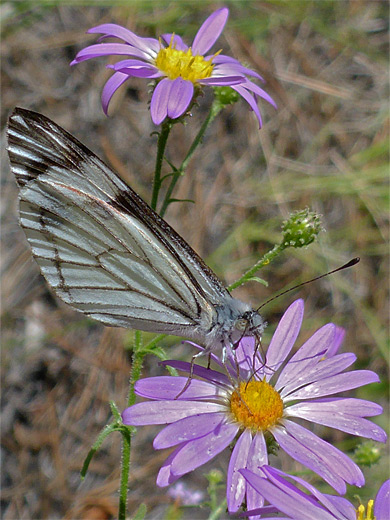
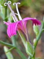
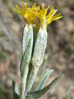
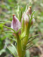
Pine Creek Wildflowers
More flowers along the canyon
 Thorny skeletonweed |
 Spineless horsebrush |
 Heller's bird's beak |
More flowers along the canyon
Pine Creek Box Trail - Similar Hikes
All Contents © Copyright The American Southwest | Comments and Questions | Contribute | Affiliate Marketing Disclosure | Site Map