Deer Creek Lake Trail
Path through meadows and light woodland to three contrasting lakes on the south side of Boulder Mountain; tree-lined Chriss Lake, the much larger and more remote Deer Creek Lake and the secluded Green Lake, scenically situated at the foot of a steep slope of scree below the summit plateau
Length: 3.8 miles
Elevation change: 1,200 feet
Difficulty: Easy to moderate
Type: One way
Usage: Low
Season: Summer, fall
Trailhead: Parking area along Hwy 12, 9 miles north of Boulder
Rating (1-5): ★★★★★
Elevation change: 1,200 feet
Difficulty: Easy to moderate
Type: One way
Usage: Low
Season: Summer, fall
Trailhead: Parking area along Hwy 12, 9 miles north of Boulder
Rating (1-5): ★★★★★

Starting along Hwy 12 across the southern slopes of Boulder Mountain in the eastern section of Dixie National Forest, a little-used, 3.8 mile path visits three high elevation lakes, each different in character. First reached, after 1.6 miles, is Chriss Lake, mostly enclosed by trees and not particularly scenic; this is the usual destination for most people. The second, after a short section of the Great Western Trail, is Deer Creek Lake, much larger and more picturesque, bordered by woodland and marshy meadows, while the last, Green Lake, has a more secluded setting in front of a dramatic talus slope, below the edge of the summit plateau. The elevation gain, 1,200 feet, is evenly spaced out, without any particularly steep sections, so the walk as a whole is relatively easy. The first two lakes are open to fishing.
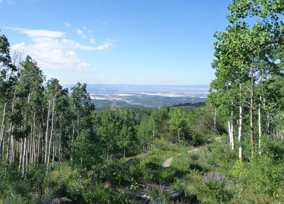
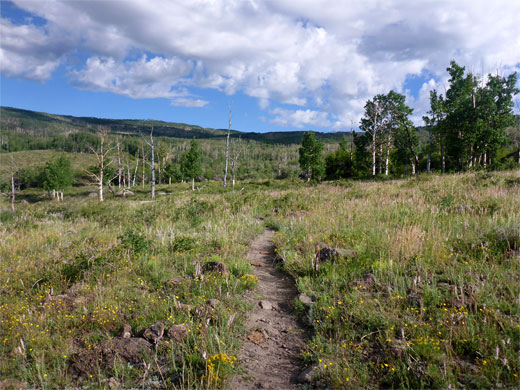
The scenery between the lakes is a mix of rough grassland, moist meadows and pine/aspen forest, and about a third of the route follows close to a stream, West Deer Creek, along which are found a good selection of wildflowers. Some sections have good views south, towards the distant canyons of the Escalante. The only negative aspect is that all areas are grazed by cattle, as is the case for the majority of Boulder Mountain and the Aquarius Plateau.
Parking for the hike is at the Chriss Lake trailhead/picnic area, 9 miles north of Boulder along UT 12, directly opposite a track into some sagebrush meadows, a suitable location for primitive camping. This is the southernmost of only two marked trailheads along the road across the mountain, the other being 1.5 miles further, for an alternative route to Deer Creek Lake.
16 views along the Deer Creek Lake Trail.
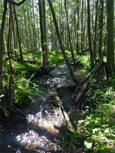
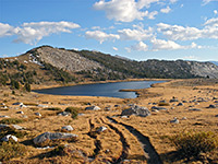
The Chriss Lake Trail (#34016) sets off northwards across open terrain, with only gentle hills and ridges ahead; there is no sign yet of the rocky cliffs below the summit plateau. The path crosses a tiny stream, a tributary of Middle Deer Creek, followed by a patch of well-spaced aspen trees, then fords a slightly bigger stream, the main channel of the creek. The gradient increases slightly as the trail climbs a broad ridge, then skirts the edge of treeless ground that affords grand views southwestwards. The surroundings change back to aspen, the land rises again and a still larger stream comes into view; West Deer Creek, which flows from Chriss Lake, half a mile further. The next section of the route ascends quite steeply up an exposed ridge with many sego lilies at the base, then into a group of darker, more closely spaced trees and finally over a little basin to a junction on the south side of the lake - the continuation, half a mile to the junction with the Great Western Trail, is left, while right is a connecting path to the Deer Creek Trail.
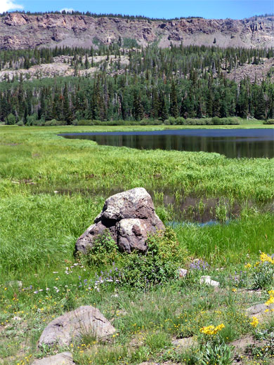
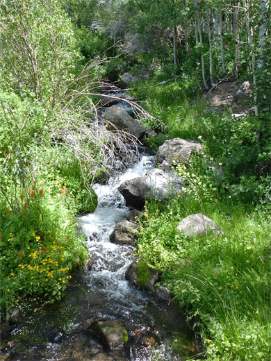
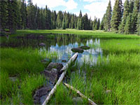
The path rounds the west side of Chriss Lake, coming close to the entry stream, which becomes enclosed by denser aspen for a while until the trees give way to a long grass meadow, and the creek moves out of sight. On the far side of the meadow is the junction with the Great Western Trail, which is just as narrow and seemingly as little-used as the previous route. Turning east, this trail crosses the stream, runs through woods for a short distance and emerges to a big flat, centered on the creek, a popular place for cattle to gather. On the far side is a pretty pond before the woodland returns, briefly, leading to another large open area with a GWT marker post at the near edge. Dear Creek Lake is now just a quarter of a mile away, reached by an unsigned path forking off northwards; this rises slightly, over the brow of a low hill and on to a big, marshy meadow beside the long, narrow west arm of Deer Creek Lake, bordered by pine woodland on the far side.
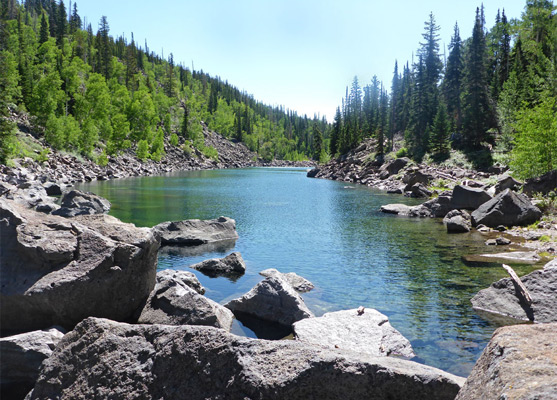
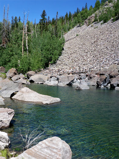
The path, now rather faint, continues cross the extensive boggy land close to the lake, and through a belt of trees while rising slightly to Green Lake, lined by piles of jagged boulders, especially to the north where the ground rises 1,000 feet over half a mile to the plateau. The water level fluctuates by several feet between summer and winter but the center is always deep, clear and cold. The trail stops at the west edge of the lake and the boulders make continuing rather difficult though it ought to be possible to follow the southern shoreline then cross a band of trees to reach the main part of Deer Creek Lake, or even, with more effort, walk northwards up the scree and eventually reach the Deer Lakes on the plateau, and link up with a forest track.
The scenery between the lakes is a mix of rough grassland, moist meadows and pine/aspen forest, and about a third of the route follows close to a stream, West Deer Creek, along which are found a good selection of wildflowers. Some sections have good views south, towards the distant canyons of the Escalante. The only negative aspect is that all areas are grazed by cattle, as is the case for the majority of Boulder Mountain and the Aquarius Plateau.
Parking for the hike is at the Chriss Lake trailhead/picnic area, 9 miles north of Boulder along UT 12, directly opposite a track into some sagebrush meadows, a suitable location for primitive camping. This is the southernmost of only two marked trailheads along the road across the mountain, the other being 1.5 miles further, for an alternative route to Deer Creek Lake.
Photographs
16 views along the Deer Creek Lake Trail.
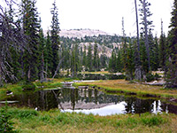
Chriss Lake
The Chriss Lake Trail (#34016) sets off northwards across open terrain, with only gentle hills and ridges ahead; there is no sign yet of the rocky cliffs below the summit plateau. The path crosses a tiny stream, a tributary of Middle Deer Creek, followed by a patch of well-spaced aspen trees, then fords a slightly bigger stream, the main channel of the creek. The gradient increases slightly as the trail climbs a broad ridge, then skirts the edge of treeless ground that affords grand views southwestwards. The surroundings change back to aspen, the land rises again and a still larger stream comes into view; West Deer Creek, which flows from Chriss Lake, half a mile further. The next section of the route ascends quite steeply up an exposed ridge with many sego lilies at the base, then into a group of darker, more closely spaced trees and finally over a little basin to a junction on the south side of the lake - the continuation, half a mile to the junction with the Great Western Trail, is left, while right is a connecting path to the Deer Creek Trail.
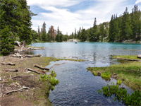
Deer Creek Lake
The path rounds the west side of Chriss Lake, coming close to the entry stream, which becomes enclosed by denser aspen for a while until the trees give way to a long grass meadow, and the creek moves out of sight. On the far side of the meadow is the junction with the Great Western Trail, which is just as narrow and seemingly as little-used as the previous route. Turning east, this trail crosses the stream, runs through woods for a short distance and emerges to a big flat, centered on the creek, a popular place for cattle to gather. On the far side is a pretty pond before the woodland returns, briefly, leading to another large open area with a GWT marker post at the near edge. Dear Creek Lake is now just a quarter of a mile away, reached by an unsigned path forking off northwards; this rises slightly, over the brow of a low hill and on to a big, marshy meadow beside the long, narrow west arm of Deer Creek Lake, bordered by pine woodland on the far side.
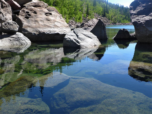
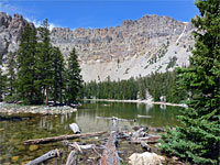
Green Lake
The path, now rather faint, continues cross the extensive boggy land close to the lake, and through a belt of trees while rising slightly to Green Lake, lined by piles of jagged boulders, especially to the north where the ground rises 1,000 feet over half a mile to the plateau. The water level fluctuates by several feet between summer and winter but the center is always deep, clear and cold. The trail stops at the west edge of the lake and the boulders make continuing rather difficult though it ought to be possible to follow the southern shoreline then cross a band of trees to reach the main part of Deer Creek Lake, or even, with more effort, walk northwards up the scree and eventually reach the Deer Lakes on the plateau, and link up with a forest track.
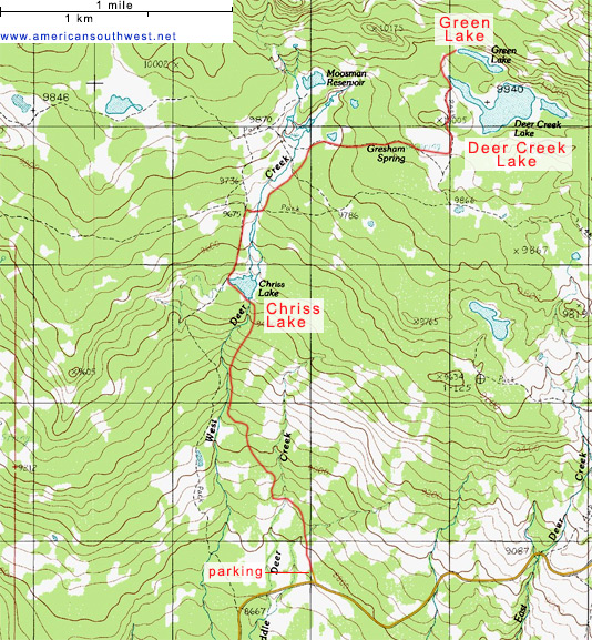
Topographic Map of the Deer Creek Lake Trail
Deer Creek Lake Wildflowers
More flowers along the trail
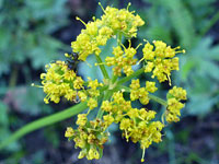 Mountain parsley |
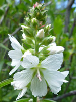 White checkermallow |
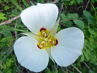 Sego lily |
Deer Creek Lake Trail - Similar Hikes
All Contents © Copyright The American Southwest | Comments and Questions | Contribute | Affiliate Marketing Disclosure | Site Map