Highlights:
First national park in the World, and possibly still the best; amazing geothermal phenomena, spectacular Rocky Mountain scenery, and a vast array of wildlife. Toured by the circular Grand Loop Road, and other routes, linking with many dozens of trails. Loosely divided into the north, northwest, east, southwest and southeast
Nearby towns:
Management:
Location:
44.460, -110.827 (Old Faithful)
Seasons:
Open all year, but fully accessible only between May and October due to very heavy winter snowfall
Rating (1-5):
★★★★★
Weather:


Yellowstone NP is part of the Yellowstone and North Utah itinerary
Yellowstone - Regions
Featured Hotel
Holiday Inn West Yellowstone
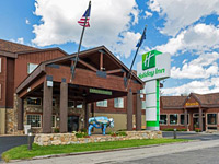 The main full service hotel in West Yellowstone, 0.4 miles from the entrance to the national park. Facilities include a fitness center, pool and restaurant/bar
Check Rates
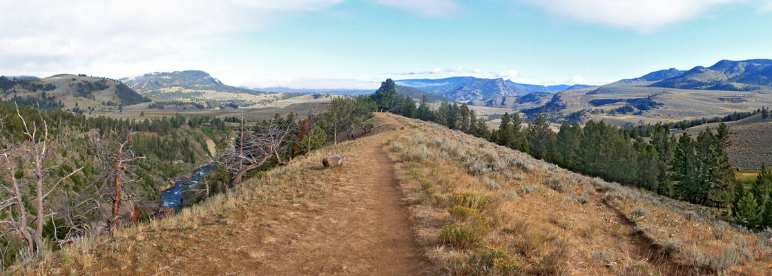
The incomparable Yellowstone National Park occupies 3,470 square miles of the Rocky Mountains in northwest Wyoming, was the World's first national park when created in 1872, and is both the second largest in the USA outside Alaska and the fifth most visited - and would be even more popular were it not for its rather remote location and limited visitor season; because of the northerly location and high elevation (mostly over 7,500 feet) the park is fully open for only seven months a year though is still partially accessible at other times for snow-based activities.
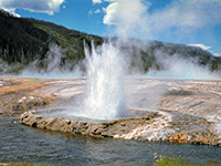
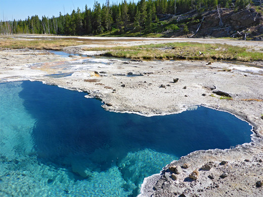
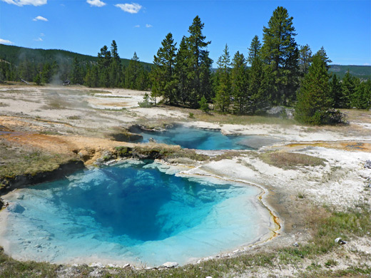
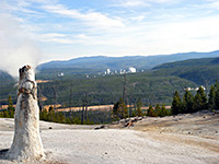
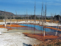
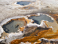
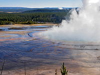
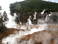
The appeal of Yellowstone is based on a unique combination of three elements, any of which in isolation would still make the area famous. First, and most remarkable, are the approximately ten thousand active geothermal features - geysers, hot springs, fumaroles (steam vents) and mudpots, which are found over one third of the park, in a circular area that was several thousand years ago part of the caldera of a huge volcano, and is thought to be close, in geological timescales, to another large eruption.
The majority of these energetic areas are located close to the main roads so are easy to visit though there are plenty more lesser-known regions in the backcountry. One half of all such features on Earth are found within the park, as are nearly 50% of all geysers - Yellowstone National Park has around 450 of these, out of a worldwide total of 970. The main thermal areas are at Heart Lake, Mammoth, Norris, Shoshone, West Thumb and the Upper, Midway and Lower Geyser Basins - this latter is home to Yellowstone's most famous geyser, Old Faithful.
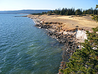
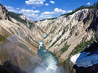
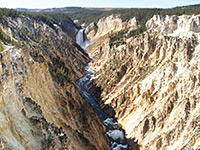
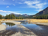
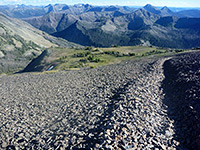
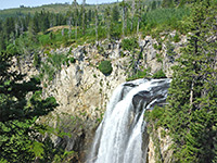
Secondly, the park has beautiful mountain scenery, with high peaks, forceful rivers flowing through steep-sided ravines and over frequent waterfalls and cascades, the 130 square mile Yellowstone Lake plus many smaller lakes, and the Grand Canyon of the Yellowstone River. This is the largest canyon in the park, 20 miles long and up to 1,000 feet deep, but made more exceptional by the striking colors and forms of the jagged, eroded volcanic rocks that comprise some of the canyon walls.
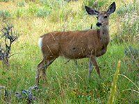
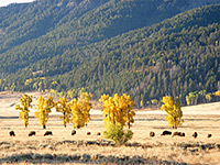
The third component is the wildlife. Yellowstone National Park is the last place in the USA where bison still roam in their natural state, and has the greatest concentration of grizzly bears south of Canada. The park has several hundred wolves, flourishing since their reintroduction in 1995, and many more black bears, together with elk, moose, deer, bighorn sheep, and numerous smaller species. The two best locations for wildlife viewing are the Hayden and Lamar valleys, both towards the northeast of the park.
The appeal of Yellowstone is based on a unique combination of three elements, any of which in isolation would still make the area famous. First, and most remarkable, are the approximately ten thousand active geothermal features - geysers, hot springs, fumaroles (steam vents) and mudpots, which are found over one third of the park, in a circular area that was several thousand years ago part of the caldera of a huge volcano, and is thought to be close, in geological timescales, to another large eruption.
The majority of these energetic areas are located close to the main roads so are easy to visit though there are plenty more lesser-known regions in the backcountry. One half of all such features on Earth are found within the park, as are nearly 50% of all geysers - Yellowstone National Park has around 450 of these, out of a worldwide total of 970. The main thermal areas are at Heart Lake, Mammoth, Norris, Shoshone, West Thumb and the Upper, Midway and Lower Geyser Basins - this latter is home to Yellowstone's most famous geyser, Old Faithful.
Secondly, the park has beautiful mountain scenery, with high peaks, forceful rivers flowing through steep-sided ravines and over frequent waterfalls and cascades, the 130 square mile Yellowstone Lake plus many smaller lakes, and the Grand Canyon of the Yellowstone River. This is the largest canyon in the park, 20 miles long and up to 1,000 feet deep, but made more exceptional by the striking colors and forms of the jagged, eroded volcanic rocks that comprise some of the canyon walls.
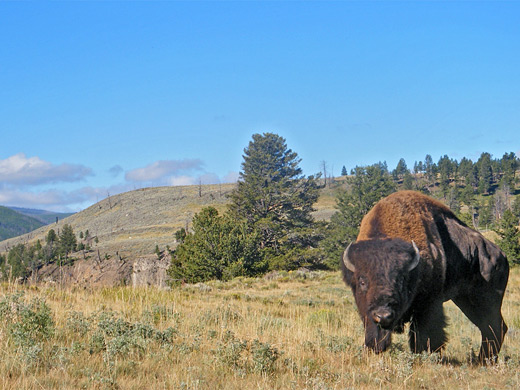
The third component is the wildlife. Yellowstone National Park is the last place in the USA where bison still roam in their natural state, and has the greatest concentration of grizzly bears south of Canada. The park has several hundred wolves, flourishing since their reintroduction in 1995, and many more black bears, together with elk, moose, deer, bighorn sheep, and numerous smaller species. The two best locations for wildlife viewing are the Hayden and Lamar valleys, both towards the northeast of the park.
Yellowstone Table of Contents
- Maps of Yellowstone
- Photographs
- Videos
- Hotels near Yellowstone
- Weather and climate for Yellowstone
- Roads
- Regions of Yellowstone National Park
- Yellowstone Wildflowers
- Yellowstone hikes - southeast
- Yellowstone hikes - east
- Yellowstone hikes - north
- Yellowstone hikes - northwest
- Tours of Yellowstone
- Yellowstone hikes - southwest
Maps of Yellowstone
Yellowstone National Park, Trail Map, Lower Geyser Basin, Norris Geyser Basin, Upper Geyser Basin
Photographs
Southeast, East, North, Northwest, Upper Basin, Midway Basin, Lower Basin, and many more.
All Yellowstone photographs.
Videos
Blacktail Deer Creek, Crater Hills, Dunanda Falls, Forest Springs, grizzly bear, Heart Lake Geyser Basin, Imperial Geyser, Monument Geyser Basin, Morning Mist Springs, Mud Volcano, Artist Paint Pots, Rustic Geyser, Sentinel Meadows, Shoshone Geyser Basin, Turbid Lake, Sylvan Springs.
Yellowstone Hotels
Accommodation in the vicinity; hotels and lodges.
Yellowstone Weather
Climate and weather for Yellowstone National Park.
Roads
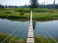
Park roads are generally good, though despite its large size, Yellowstone can become crowded, especially at popular places like Upper Geyser Basin, Hayden Valley and the south end of the Grand Canyon of the Yellowstone. There are few backcountry roads but many trails, and solitude is much easier to find here. Campsites are limited although other commercial places to stay are available just outside the five park entrances, mostly near the north (Gardiner) and west (West Yellowstone). Each entrance is also close to places for free camping, in the nearby national forests.
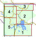
Regions of Yellowstone National Park
West Thumb Geyser Basin and Yellowstone Lake, plus Lewis Lake, Potts Hot Spring Basin and Heart Lake. Trails in the southeast
2. The East
Yellowstone Lake and Yellowstone's Grand Canyon, including Mud Volcano and Hayden Valley.Trails in the east
West Yellowstone and Norris, Madison and Gibbon Geyser Basin.
Trails in the northwest
Trails in the northwest
The Lower, Midway and Upper Geyser Basins, Lone Star Geyser and other features along the Firehole River.
Trails in the southwest
Trails in the southwest
Meadows and waterfalls in the far southwest, centered on the Bechler and Falls rivers
The Fountain area, Sentinel Meadows, Firehole Lake and nearby geysers, the River and Quagmire Groups, Morning Mist Springs
Grand Prismatic Spring, Excelsior Geyser and more large pools
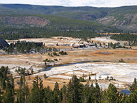
Old Faithful and countless other pools and geysers, the Biscuit and Black Sand Geyser Basins
Yellowstone Wildflowers
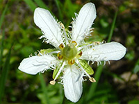
Photographs and descriptions of flowering plants found in the national park
Hiking in Southeast Yellowstone
All trails in the southeast
Featured Southeast Trails
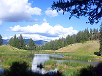
Duck Lake
★★★★★
★★★★★
0.5 miles, 100 feet
This short path passes over land recovering from the 1988 fires, up a small hill to a viewpoint of Duck Lake then down to a beach on its north shore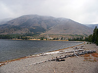
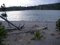
Heart Lake
★★★★★
★★★★★
7.5 miles, 700 feet
This relatively popular trail into one of Yellowstone's backcountry geyser basins also passes varied scenery of pine forest, open plateauland, mountains, river valleys and Heart Lake itself
Riddle Lake
★★★★★
★★★★★
1.75 miles, 80 feet
From a trailhead along the main road, 2.5 miles south of Grant Village and right on the continental divide, this easy hike descends gradually through new growth lodgepole forest to the upper end of Riddle Lake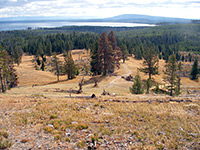
Yellowstone Lake Overlook
★★★★★
★★★★★
1 mile, 500 feet
The second of two short hikes to viewpoints that begin from the West Thumb Geyser Basin parking area, this climbs past a few small pools and gas vents to a vantage point at the edge of a wildflower-filled meadow up in the mountainsHiking in East Yellowstone
All trails in the east
Featured East Trails
Avalanche Peak
★★★★★
★★★★★
2.5 miles, 2120 feet
Consistently steep route, at first through dense forest, then across Alpine meadows and scree slopes to a 10,568 summit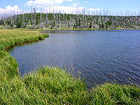
Cascade Lake/Observation Peak
★★★★★
★★★★★
5.25 miles, 1400 feet
Level path through floral meadows to a backcountry lake, where a steeper trail branches off, climbing lightly wooded slopes to a 9,397 foot summit, site of a fire lookout tower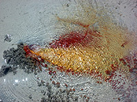
Crater Hills
★★★★★
★★★★★
1 miles, 200 feet
Off trail hike to a pristine backcountry thermal area, containing especially colorful springs and vents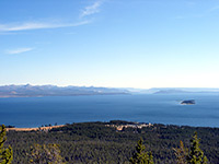
Elephant Back Mountain
★★★★★
★★★★★
3.6 miles, 800 feet
Elephant Back Mountain is a straight, flat-topped, steep-sided peak overlooking the northwest corner of Yellowstone Lake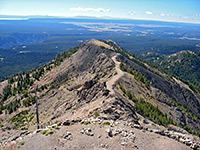
Mount Washburn
★★★★★
★★★★★
3 miles, 1600 feet
Two wide, well used trails climb lightly wooded slopes and converge at the top of an 10,243 summit, site of the main fire lookout point in the national park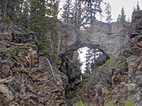
Natural Bridge
★★★★★
★★★★★
1.25 miles, 100 feet
Short, forested trail to a small rhyolite natural bridge, framing a minor stream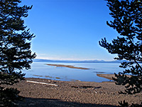
Pelican Creek
★★★★★
★★★★★
1 miles, level
At the mouth of Pelican Creek, this easy path loops through marshes and woodland south of the park road to the shore of Yellowstone Lake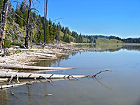
Pelican Valley/Turbid Lake
★★★★★
★★★★★
5 miles, 120 feet
Varied hike through woodland into the lower end of wildlife-filled Pelican Valley, then along a much less-used path to strange, effervescent Turbid Lake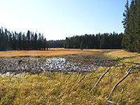
Point Sublime/Ribbon Lake
★★★★★
★★★★★
6.5 miles, 150 feet (loop)
Enjoyable loop hike visiting a viewpoint of the Grand Canyon of the Yellowstone, the top of Silver Cord Cascade, the peaceful surroundings of Ribbon Lake, and a backcountry thermal area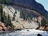
Seven Mile Hole
★★★★★
★★★★★
5.5 miles, 1400 feet
One of the best hikes in all of Yellowstone, this route winds through dense pine forest, past active and inactive thermal areas, then descends to the edge of the Yellowstone River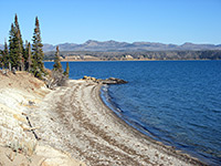
Storm Point
★★★★★
★★★★★
2.3 miles, level
A longer version of the Pelican Creek Trail, this loop passes through lodgepole pine woodland and meadows to the shores of Yellowstone LakeHiking in North Yellowstone
All trails in the north
Featured Southeast Trails
Beaver Ponds
★★★★★
★★★★★
5.0 miles, 450 feet (loop)
The pleasant trail to a group of beaver-inhabited ponds north of Mammoth village has two trailheads 1/4 mile apart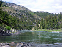
Blacktail Deer Creek
★★★★★
★★★★★
3.5 miles, 1100 feet
Most of the this trail crosses relatively open ground with grassy meadows and patches of woodland though the last part is steep, down a narrow ravine as it approaches the Yellowstone River, which is crossed on a footbridge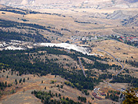
Bunsen Peak
★★★★★
★★★★★
4 miles, 1380 feet
Bunsen Peak, a circular, solitary, volcanic summit, affords excellent views of the Mammoth area and the surrounding mountains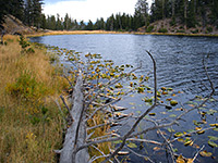
Lost Lake
★★★★★
★★★★★
4 miles, 600 feet
Starting right next to Roosevelt Lodge at Tower Junction, this loop trail climbs a wooded hillside and enters a hidden valley containing lily pad-covered Lost Lake, then follows Yancey Creek at the far side of the lake to a petrified redwood tree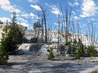
Mammoth Terraces
★★★★★
★★★★★
2.8 miles, 520 feet (loop)
The terraces, pools and dormant thermal features of Mammoth Hot Springs, viewed by walking along interconnected loop trails and a one-way road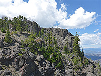
Sepulcher Mountain
★★★★★
★★★★★
11 miles, 3360 feet (loop)
Strenuous climb through forest, meadows and grassland to a high peak on the west side of Mammoth, topped by a group of volcanic pinnacles; a loop hike, including the Snow Pass Trail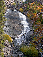
Wraith Falls
★★★★★
★★★★★
0.3 miles, 120 feet
The very short route to 100 foot Wraith Falls starts a quarter mile east of the Lava Creek Picnic area, 5 miles from Mammoth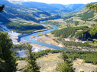
Yellowstone River Picnic Area
★★★★★
★★★★★
2 miles, 400 feet
This easy trail follows the east side of the cliffs at the downstream end of the Grand Canyon of the Yellowstone River, to a place known as The NarrowsHiking in Northwest Yellowstone
All trails in the northwest
Featured Northwest Trails
Artists Paintpots
★★★★★
★★★★★
0.6 miles, 80 feet
Especially colorful and varied collection of hot pools, mudpots and small geysers, reached by an easy path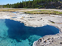
Gibbon Hill and Geyser Creek
★★★★★
★★★★★
3.6 miles, 300 feet (loop)
Off-trail hike to two backcountry thermal areas within Gibbon Geyser Basin, containing several active geysers, plus many pools, vents and mudpots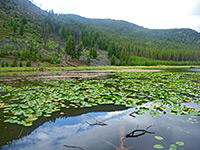
Harlequin Lake
★★★★★
★★★★★
0.4 miles, 100 feet
Harlequin is a minor, shallow lake at the foot of Purple Mountain, on the north side of the highway, 1.5 miles west of Madison Junction
Ice Lake
★★★★★
★★★★★
0.3 miles, 30 feet
This very short trail leads to a pretty, tree-lined lake in fairly level land beside the Gibbon River, covered by fir and pine trees partly burned in 1988Monument Geyser Basin
★★★★★
★★★★★
1 mile, 600 feet
Monument is a largely extinct geyser basin on a hillside at the south edge of Gibbon Meadows, consisting of dormant white geyserite cones, a few of which occasionally emit puffs of steam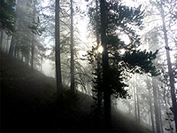
Purple Mountain
★★★★★
★★★★★
2.5 miles, 1560 feet
Trees partly obscure views from the summit of Purple Mountain, but much can still be seen, to the south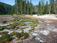
Solfatara Creek
★★★★★
★★★★★
6.5 miles, 430 feet
The longest and least-used trail in the Norris area is along Solfatara Creek, a tributary of the Gibbon River that crosses a hilly region containing a number of small hot springs and gas vents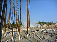
Sylvan Springs
★★★★★
★★★★★
2 miles, 170 feet
On the west edge of both Gibbon Meadows and Gibbon Geyser Basin, Sylvan Springs are a group of hot pools, bubbling springs and sulphurous fumaroles; explorable by off-trail hiking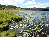
Wolf Lake
★★★★★
★★★★★
3.5 miles, 250 feet
Little-used path through woods and meadows along the upper reaches of the Gibbon River, leading to a peaceful lakeYellowstone Tours
Hiking in Southwest Yellowstone
All trails in the southwest
Featured Southwest Trails
Boundary Creek
★★★★★
★★★★★
8.4 miles, 350 feet (to Dunanda Falls)
From the Bechler River ranger station, a trail passes through flat forest and meadowland for 8 miles to the edge of a plateau, where the creek enters a ravine and flows over 150 foot Dunanda Falls. A nearby side canyon contains the 250 foot Silver Scarf Falls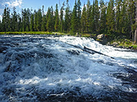
Bechler Falls
★★★★★
★★★★★
1.3 miles, 60 feet
This short hike follows the southernmost section of the Bechler River Trail starting at Cave Falls, past the Bechler River-Falls River confluence to Bechler Falls, a small waterfall but still quite powerful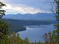
Divide Lookout
★★★★★
★★★★★
1.5 miles, 740 feet
Beginning on the main road 7 miles east of Old Faithful, this short, unmarked trail climbs up a steep, wooded ravine to a summit on the continental divide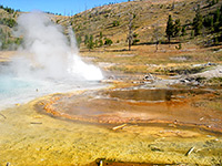
Fairy Falls and Imperial Geyser
★★★★★
★★★★★
3 miles, level overall
Popular route along a disused road behind Grand Prismatic Spring, through new growth woodland to a tall, narrow waterfall, and onwards to two backcountry geysers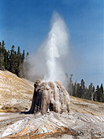
Lone Star Geyser
★★★★★
★★★★★
2.5 miles, 60 feet
The most accessible backcountry geyser basin in Yellowstone - centered around Lone Star Geyser - is reached by an easy trail that follows an old service road beside the Firehole River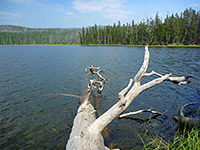
Mallard Lake
★★★★★
★★★★★
3 miles, 660 feet
This relatively popular path climbs a shallow, partly wooded ravine, crosses a ridge and descends through thicker woodland to a peaceful lake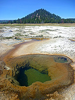
Morning Mist Springs and the Quagmire Group
★★★★★
★★★★★
2.5 miles, 250 feet (loop)
Loop hike, partly off trail, to two backcountry thermal areas of the Lower Geyser Basin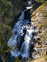
Mystic Falls
★★★★★
★★★★★
3 miles, 550 feet (loop)
Loop hike visiting a dramatic waterfall, some hidden hot springs, and a viewpoint of the Firehole River valley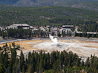
Observation Point
★★★★★
★★★★★
1.1 miles, 160 feet (loop)
Well used path that climbs a short, steep, wooded hillside to a viewpoint of Old Faithful and nearby features, then continues across the hill to Solitary Geyser, a bubbling pool in an open area of the forest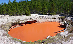
Rabbit Creek Group
★★★★★
★★★★★
3 miles, 200 feet (loop)
Off-trail route to a backcountry thermal area containing many pools and springs, displaying differing colors and activity levels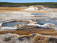
Sentinel Meadows
★★★★★
★★★★★
2.2 miles, 40 feet
At the north edge of the Lower Geyser Basin, Sentinel Meadows offers a quick hike to a backcountry thermal region, containing geyser cones and a selection of hot pools of varying sizes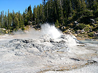
Shoshone Geyser Basin
★★★★★
★★★★★
8.5 miles, 400 feet
Long hike to Yellowstone's largest backcountry geyser area - hundreds of large and active thermal features, with a scenic setting on the north shore of Shoshone Lake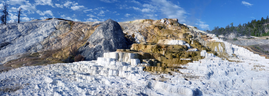
All Contents © Copyright The American Southwest | Comments and Questions | Contribute | Affiliate Marketing Disclosure | Site Map