Hike Descriptions and Trail Map for Yellowstone National Park
Wyoming > Yellowstone National Park > Trail Map
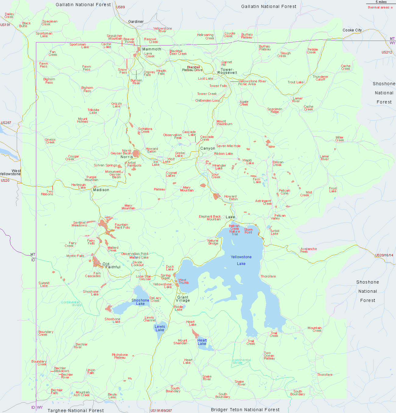
Route Descriptions for all Trails in Yellowstone
Southeast - West Thumb Geyser Basin and the southern mountains
East - Canyon, Yellowstone Lake and the high country further east
North - Mammoth Hot Springs, Tower/Roosevelt and sites further north
West - Madison Junction and Norris Geyser Basin
Southwest - the Upper, Midway & Lower geyser basins, and longer trails to Yellowstone's 'Cascade Corner'
Other Yellowstone Maps
- Grand Canyon of the Yellowstone
- Heart Lake Geyser Basin
- Lower, Midway and Upper Geyser Basins
- Lower Geyser Basin
- Midway Geyser Basin
- Mud Volcano Region
- Mystic Falls Trail
- Norris Geyser Basin
- Upper Geyser Basin
- West Thumb Geyser Basin
A map of the Lower, Midway and Upper Geyser Basins is given on the Madison - Upper Geyser Basin section, and of the upper end of the Grand Canyon of the Yellowstone in the Canyon section.
All Contents © Copyright The American Southwest | Comments and Questions | Contribute | Affiliate Marketing Disclosure | Site Map