Map of Norris Geyser Basin, Yellowstone National Park
Wyoming > Yellowstone National Park > The Northwest > Norris Geyser Basin Map
Main Yellowstone National Park Map
Other maps: Lower Geyser Basin, Midway Geyser Basin, Upper Geyser Basin
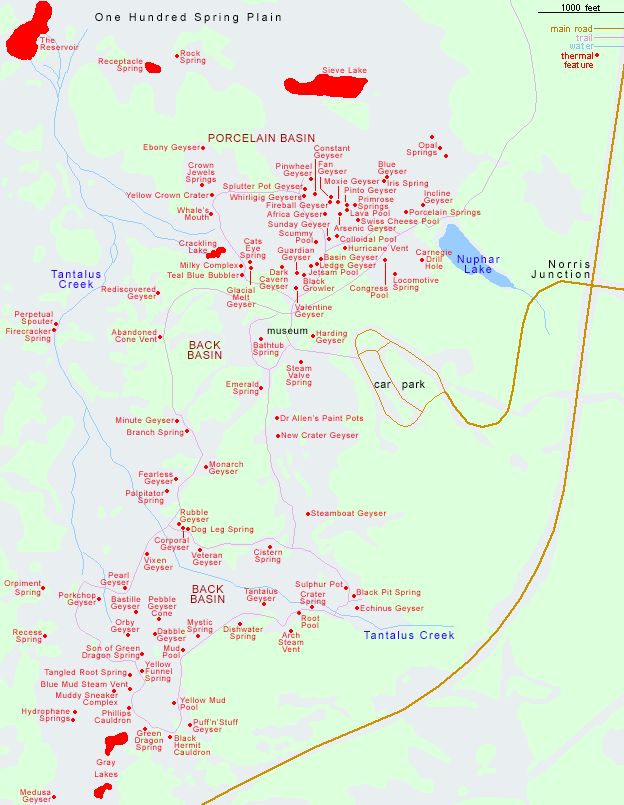
This map shows the location of approximately 100 thermal features in Norris Geyser Basin that have an official name, divided into the Porcelain Basin Group in the north and the larger but more dispersed Back Basin Group in the south. Both are bordered by Tantalus Creek to the west, while many more geysers and pools and found to the north, in One Hundred Spring Plain.
All Contents © Copyright The American Southwest | Comments and Questions | Contribute | Affiliate Marketing Disclosure | Site Map