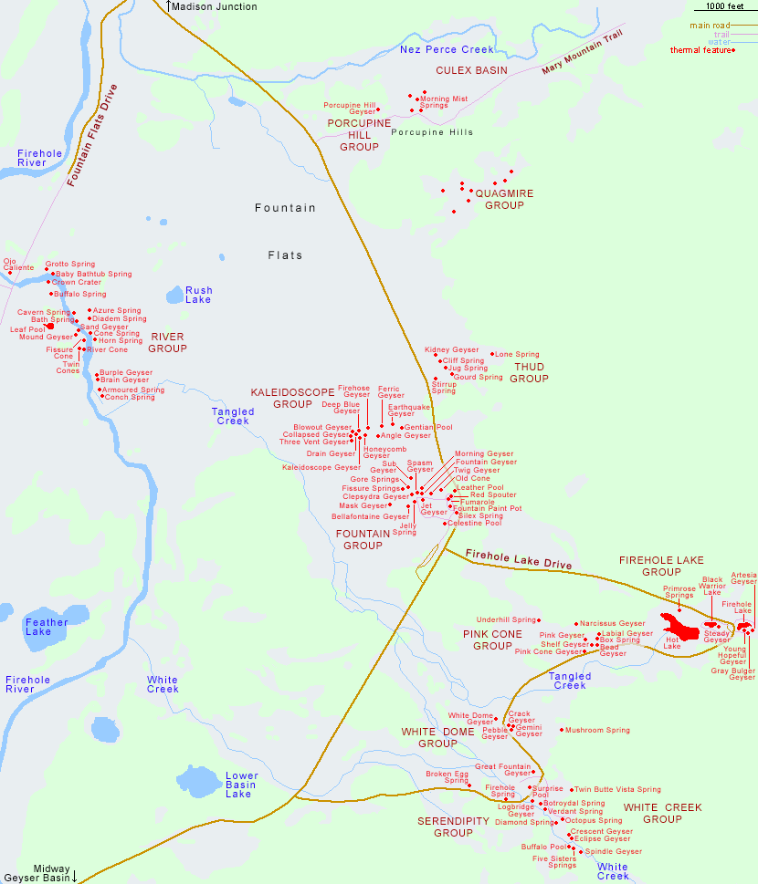
Map of Lower Geyser Basin, Yellowstone National Park
Wyoming > Yellowstone National Park > The Southwest > Lower Geyser Basin > Map
Main Yellowstone National Park Map
Other maps: Midway Geyser Basin, Norris Geyser Basin, Upper Geyser Basin
This map shows the location of over 100 named thermal features in Yellowstone National Park's Lower Geyser Basin, which contains many hundreds more pools and springs that are unnamed. Major collections are the River, Fountain, Kaleidoscope, Thud, Firehole Lake, Pink Cone, White Dome, White Creek and Serendipity groups, reached by either the main road, Firehole Lake Drive, or Fountain Flats Drive.
All Contents © Copyright The American Southwest | Comments and Questions | Contribute | Affiliate Marketing Disclosure | Site Map