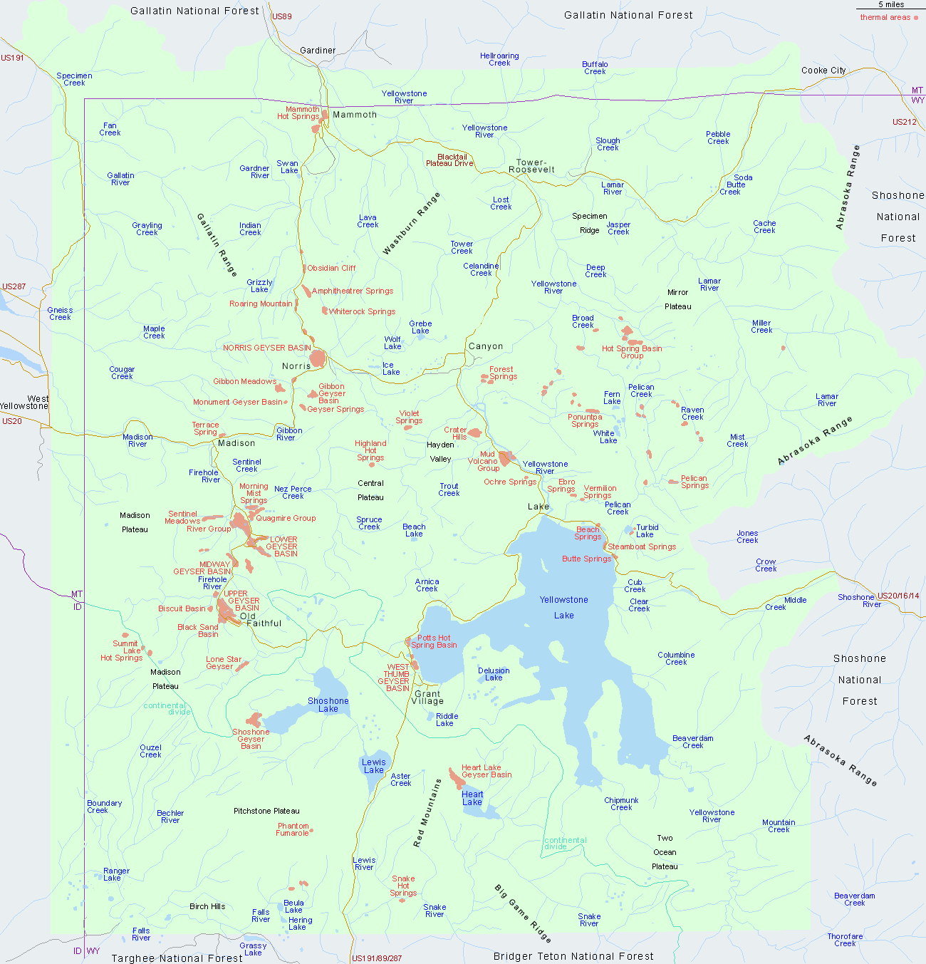
Other Yellowstone Maps
- Grand Canyon of the Yellowstone
- Heart Lake Geyser Basin
- Lower, Midway and Upper Geyser Basins
- Lower Geyser Basin
- Midway Geyser Basin
- Mud Volcano Region
- Mystic Falls Trail
- Norris Geyser Basin
- Upper Geyser Basin
- West Thumb Geyser Basin
Yellowstone Driving Distances
| 1 | 2 | 3 | 4 | 5 | 6 | 7 | 8 | 9 | 10 | 11 | 12 | 13 | 14 | 15 | ||
| Canyon | 1 | 93 | 68 | 38 | 36 | 115 | 16 | 25 | 33 | 12 | 47 | 41 | 57 | 18 | 37 | |
| Cody | 2 | 24 | 132 | 98 | 177 | 78 | 118 | 126 | 105 | 80 | 117 | 120 | 109 | 132 | ||
| East Entrance | 3 | 107 | 73 | 153 | 53 | 93 | 101 | 80 | 105 | 91 | 94 | 86 | 107 | |||
| Gardiner | 4 | 73 | 152 | 53 | 40 | 6 | 26 | 52 | 56 | 94 | 24 | 54 | ||||
| Grant Village | 5 | 79 | 20 | 33 | 68 | 47 | 82 | 18 | 21 | 54 | 47 | |||||
| Jackson | 6 | 99 | 81 | 146 | 126 | 161 | 96 | 57 | 133 | 126 | ||||||
| Lake | 7 | 40 | 48 | 27 | 62 | 39 | 41 | 33 | 54 | |||||||
| Madison | 8 | 34 | 13 | 71 | 16 | 54 | 43 | 14 | ||||||||
| Mammoth | 9 | 21 | 47 | 50 | 89 | 18 | 48 | |||||||||
| Norris | 10 | 58 | 29 | 68 | 29 | 27 | ||||||||||
| Northeast Entrance | 11 | 97 | 103 | 29 | 86 | |||||||||||
| Old Faithful | 12 | 39 | 59 | 30 | ||||||||||||
| South Entrance | 13 | 75 | 69 | |||||||||||||
| Tower | 14 | 57 | ||||||||||||||
| West Yellowstone | 15 |
All Contents © Copyright The American Southwest | Comments and Questions | Contribute | Affiliate Marketing Disclosure | Site Map