Purple Mountain Trail, Yellowstone National Park
Wyoming > Yellowstone National Park > The Northwest > Hiking > Purple Mountain Trail
Purple Mountain
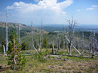
The path to the top of 8,433 foot Purple Mountain crosses a meadow then climbs steeply the south-facing slopes, which bear dense lodgepole pine woodland. Trees partly obscure the summit views, but much can still be seen, to the south
Length: 2.5 miles
Elevation change: 1,560 feet
Difficulty: Moderate
Type: One way
Usage: Low
Season: Summer, fall
Trailhead: North side of the highway, just east of Madison Junction, opposite a small parking area
Rating (1-5): ★★★★★
Elevation change: 1,560 feet
Difficulty: Moderate
Type: One way
Usage: Low
Season: Summer, fall
Trailhead: North side of the highway, just east of Madison Junction, opposite a small parking area
Rating (1-5): ★★★★★

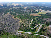
After the Yellowstone National Park entrance at West Yellowstone, the highway heads eastwards beside the Madison River, over wooded land that is flat and quite open for a few miles but soon becomes hilly, as the river enters a deep canyon, bordered to the south by Mount Haynes and the edge of Madison Plateau, and to the north by Purple Mountain, a flat-topped ridge 6 miles across.
The wide valley floor is good habitat for wildlife, viewable from many roadside overlooks, but along the 13 miles to Madison Junction there are only three hiking paths; the long Gneiss Creek Trail, a short route to Harlequin Lake and the 2.5 mile Purple Mountain Trail, which climbs steeply by 1,560 feet, ascending the north side of the valley to a viewpoint at the edge of the forest, overlooking the junction of the Madison, Gibbon and Firehole rivers.
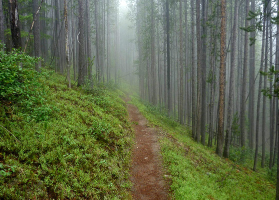
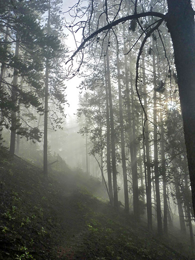
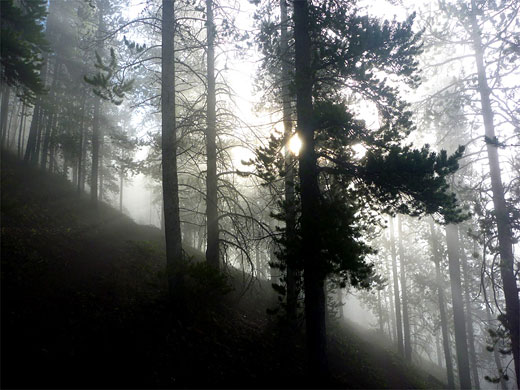
Most of the route is through thick woodland, with frequent if fleeting glimpses of the land below, yet the trip is atmospheric, and not often traveled. The mountain was named for the patches of colorful volcanic ash scattered across its upper slopes, though none are visible along the trail.
Trail map for Yellowstone National Park.
11 views along the Purple Mountain Trail.
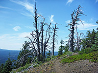
The trailhead for the hike to Purple Mountain is 0.2 miles east of Madison Junction, at a turnout on the south side of the highway, opposite an employee residence area. Guests at the nearby Madison Campground can reach the trail via a short connecting path behind the residence, joining the main route which starts next to a small meadow and leads northeast into dense woodland, remaining tree-bound all the way to the summit. The surroundings are overgrown, and undamaged by fire, so provide good cover for bears and other creatures of the forest. The narrow trail has a consistent uphill gradient without ever being particularly steep, climbing an undulating hillside crossed by many small gullies, some containing transient streams, until reaching a larger ravine filled with fallen tree trunks. The trail then turns back west and is quite straight for a while, enclosed by taller trees, until, about 2/3 of the way to the top, starts a series of long switchbacks, which finish as the route moves away from the edge of the mountain, up a valley to the plateau.
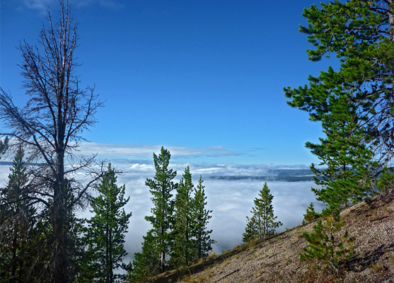
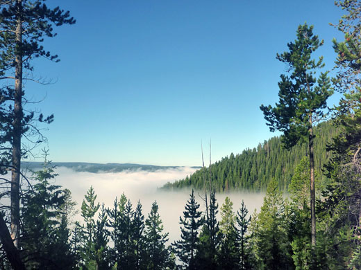
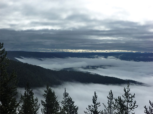
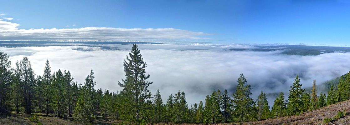
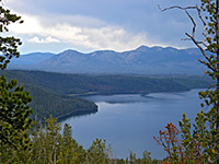
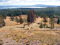
The Purple Mountain Trail ends with a level section back south to the edge of a promontory projecting out a little and giving a 180 degree view over the valleys 1,500 feet below; the best perspective is from a treeless area a short distance down the slope. On a clear day the panorama extends south across Madison Plateau towards the Tetons (50 miles), east to the Central Plateau and west to the mountains of the continental divide, in Idaho.
The wide valley floor is good habitat for wildlife, viewable from many roadside overlooks, but along the 13 miles to Madison Junction there are only three hiking paths; the long Gneiss Creek Trail, a short route to Harlequin Lake and the 2.5 mile Purple Mountain Trail, which climbs steeply by 1,560 feet, ascending the north side of the valley to a viewpoint at the edge of the forest, overlooking the junction of the Madison, Gibbon and Firehole rivers.
Most of the route is through thick woodland, with frequent if fleeting glimpses of the land below, yet the trip is atmospheric, and not often traveled. The mountain was named for the patches of colorful volcanic ash scattered across its upper slopes, though none are visible along the trail.
Location
Trail map for Yellowstone National Park.
Photographs
11 views along the Purple Mountain Trail.
The Trail
The trailhead for the hike to Purple Mountain is 0.2 miles east of Madison Junction, at a turnout on the south side of the highway, opposite an employee residence area. Guests at the nearby Madison Campground can reach the trail via a short connecting path behind the residence, joining the main route which starts next to a small meadow and leads northeast into dense woodland, remaining tree-bound all the way to the summit. The surroundings are overgrown, and undamaged by fire, so provide good cover for bears and other creatures of the forest. The narrow trail has a consistent uphill gradient without ever being particularly steep, climbing an undulating hillside crossed by many small gullies, some containing transient streams, until reaching a larger ravine filled with fallen tree trunks. The trail then turns back west and is quite straight for a while, enclosed by taller trees, until, about 2/3 of the way to the top, starts a series of long switchbacks, which finish as the route moves away from the edge of the mountain, up a valley to the plateau.
The Viewpoint
The Purple Mountain Trail ends with a level section back south to the edge of a promontory projecting out a little and giving a 180 degree view over the valleys 1,500 feet below; the best perspective is from a treeless area a short distance down the slope. On a clear day the panorama extends south across Madison Plateau towards the Tetons (50 miles), east to the Central Plateau and west to the mountains of the continental divide, in Idaho.
Purple Mountain Trail - Similar Hikes
All Contents © Copyright The American Southwest | Comments and Questions | Contribute | Affiliate Marketing Disclosure | Site Map