Divide Lookout Trail, Yellowstone National Park
Wyoming > Yellowstone National Park > The Southwest > Hiking > Divide Lookout Trail
Divide Lookout
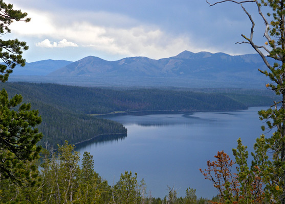
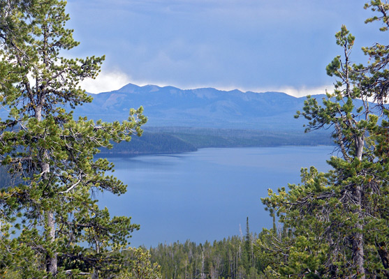
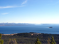
This short, unmarked trail climbs up a steep, wooded ravine to a forested summit on the continental divide, at 8,779 feet, for views over Shoshone Lake and Mount Sheridan
Length: 1.5 miles
Elevation change: 740 feet
Difficulty: Easy to moderate
Type: One way
Usage: Low
Season: Summer, fall
Trailhead: South side of US 20/191/287, one mile west of the continental divide
Rating (1-5): ★★★★★
Elevation change: 740 feet
Difficulty: Easy to moderate
Type: One way
Usage: Low
Season: Summer, fall
Trailhead: South side of US 20/191/287, one mile west of the continental divide
Rating (1-5): ★★★★★

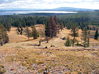
Two attractions of the Divide Lookout Trail are the chance to walk along the continental divide, at 8,700 feet, and the good views of Shoshone Lake and Mount Sheridan, since although most of the 1.5 mile route is through dense forest, gaps in the trees allow glimpses of the expansive, mountainous land to the southeast.
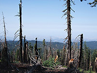
The trail ends, somewhat anticlimactically, in a clearing in the woods, on a low flattish summit completely enclosed by trees and so without any views. This was the site of the Divide Lookout fire watchtower, in operation until the 1980s and dismantled in 1991, after which usage of the trail has decreased; apart from the restricted but still quite impressive viewpoint of Shoshone Lake (better than from Shoshone Point along the highway), there is not much else of interest along the way.
Trail map for Yellowstone National Park.
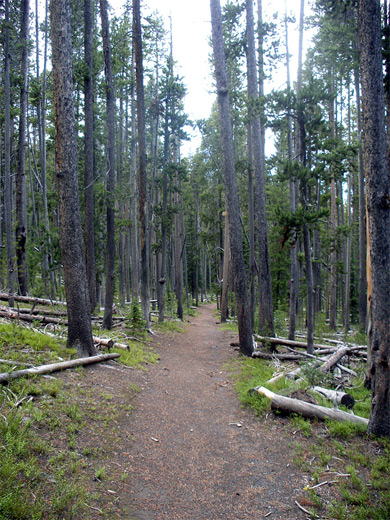
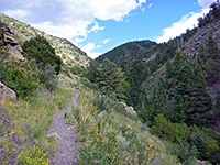
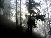
The rather inconspicuous start point for the Divide Lookout Trail is beside a large pullout along the Grand Loop Road, one mile west of the westernmost of the two crossings of the continental divide (Craig Pass/Isa Lake). Thick, dark, moist woodland borders the highway, and the path is soon winding its way between large trees and bushy undergrowth, over a small stream and up the slope beyond to a junction with the little traveled Spring Creek Trail; this follows the stream westwards for 3.5 miles to an intersection with the Lone Star Geyser Trail, and is primarily used as a cross-country ski route during winter. The Divide Lookout Trail continues southeast, becoming quite straight, past a small meadow and then through forest for the rest of the way, the trees still large and old but now quite well separated and lacking much undergrowth so the surroundings are light and airy. Rocks underfoot are mostly black obsidian, either gravel or solid outcroppings, and some parts have an attractive shiny surface, speckled with white intrusions.
The path climbs steadily up a ravine alongside a minor drainage to a saddle, where the ground drops off steeply ahead, allowing views of Shoshone Lake and the Red Mountains beyond. The best overlook is a little way off trail to the east, but even here the pine and fir trees obscure parts of the scene. The path next follows the ridge a little way, the lake no longer visible, then turns due west, up a gentle slope to the 8,779 foot summit, where there is now no trace of the old fire lookout tower, and nothing to see apart from the enclosing trees.
The trail ends, somewhat anticlimactically, in a clearing in the woods, on a low flattish summit completely enclosed by trees and so without any views. This was the site of the Divide Lookout fire watchtower, in operation until the 1980s and dismantled in 1991, after which usage of the trail has decreased; apart from the restricted but still quite impressive viewpoint of Shoshone Lake (better than from Shoshone Point along the highway), there is not much else of interest along the way.
Location
Trail map for Yellowstone National Park.
The Divide Lookout Trail
The rather inconspicuous start point for the Divide Lookout Trail is beside a large pullout along the Grand Loop Road, one mile west of the westernmost of the two crossings of the continental divide (Craig Pass/Isa Lake). Thick, dark, moist woodland borders the highway, and the path is soon winding its way between large trees and bushy undergrowth, over a small stream and up the slope beyond to a junction with the little traveled Spring Creek Trail; this follows the stream westwards for 3.5 miles to an intersection with the Lone Star Geyser Trail, and is primarily used as a cross-country ski route during winter. The Divide Lookout Trail continues southeast, becoming quite straight, past a small meadow and then through forest for the rest of the way, the trees still large and old but now quite well separated and lacking much undergrowth so the surroundings are light and airy. Rocks underfoot are mostly black obsidian, either gravel or solid outcroppings, and some parts have an attractive shiny surface, speckled with white intrusions.
The Viewpoint
The path climbs steadily up a ravine alongside a minor drainage to a saddle, where the ground drops off steeply ahead, allowing views of Shoshone Lake and the Red Mountains beyond. The best overlook is a little way off trail to the east, but even here the pine and fir trees obscure parts of the scene. The path next follows the ridge a little way, the lake no longer visible, then turns due west, up a gentle slope to the 8,779 foot summit, where there is now no trace of the old fire lookout tower, and nothing to see apart from the enclosing trees.
Divide Lookout Trail - Similar Hikes
All Contents © Copyright The American Southwest | Comments and Questions | Contribute | Affiliate Marketing Disclosure | Site Map