Yellowstone Lake Overlook Trail, Yellowstone National Park
Wyoming > Yellowstone National Park > The Southeast > Hiking > Yellowstone Lake Overlook Trail
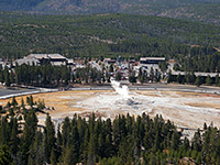
Yellowstone Lake Overlook
Quite popular route that climbs through forest and grassland, past a few small pools and gas vents, to a vantage point at the edge of a wildflower-filled meadow up in the mountains
Length: 1 mile
Elevation change: 500 feet
Difficulty: Easy
Type: One way
Usage: Medium
Season: Spring, summer, fall
Trailhead: West Thumb Geyser Basin
Rating (1-5): ★★★★★
Elevation change: 500 feet
Difficulty: Easy
Type: One way
Usage: Medium
Season: Spring, summer, fall
Trailhead: West Thumb Geyser Basin
Rating (1-5): ★★★★★

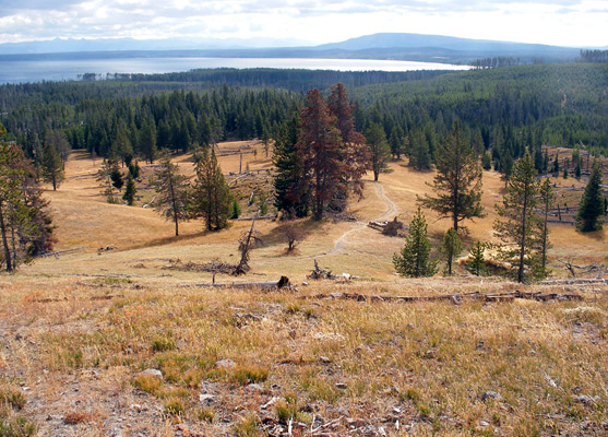
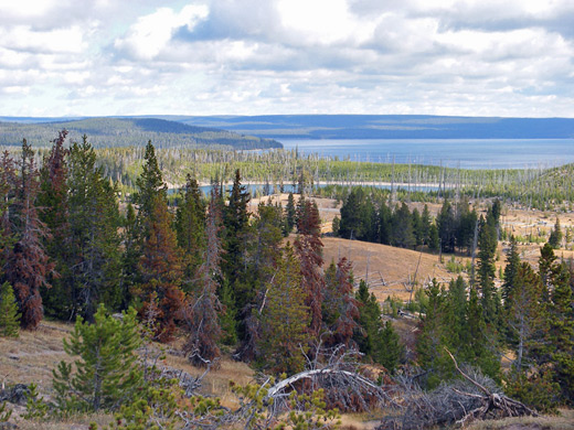
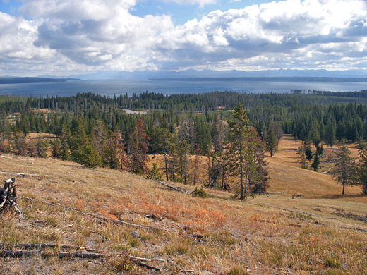
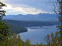
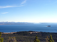
The slightly longer of two easy paths near Grant Village and West Thumb Geyser Basin, Yellowstone Lake Overlook Trail takes hikers one mile through thin pine forest to the top of a small treeless hill that gives a panoramic view over the surroundings including Yellowstone Lake and the much smaller Duck Lake to the east, the Red Mountains to the southeast and the continental divide to the west.
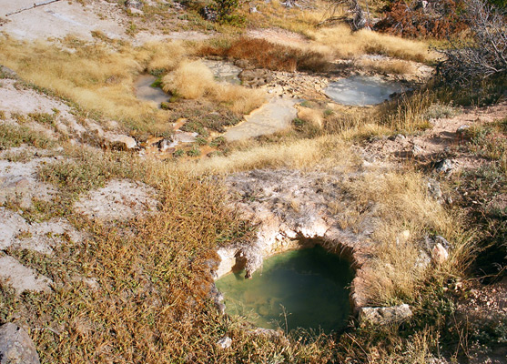
Also of interest are a few minor hot pools and vents near the summit, though the hike overall is not particularly special; a rather better elevated vista of Yellowstone Lake can be had from the Elephant Back Mountain Trail, starting 20 miles further north along the highway. Nevertheless, the proximity to the geyser basin ensures a steady stream of visitors to the overlook in summer.
Trail map for Yellowstone National Park.
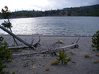
The official parking for the Yellowstone Lake Overlook hike is the main lot at West Thumb Geyser Basin, though the trail heads west and soon crosses the highway, so the walk could be shortened a little by parking here; the route is not signposted but recognizable by pedestrian crossing marks over the road. The path enters low, new growth pine forest, climbs slightly and soon emerges onto an open, grassy hillside, as the gradient starts to increase. The final section is quite steep, ascending about 400 feet and passing one cloudy, gently simmering pool before the path ends at the viewpoint on the hill top, just north of which are several other thermal vents. There are no trees on the summit so the views cover 360 degrees, over mainly mountainous, thickly forested land apart from in the east, where Yellowstone Lake stretches out towards the Absaroka Range on the horizon.
Also of interest are a few minor hot pools and vents near the summit, though the hike overall is not particularly special; a rather better elevated vista of Yellowstone Lake can be had from the Elephant Back Mountain Trail, starting 20 miles further north along the highway. Nevertheless, the proximity to the geyser basin ensures a steady stream of visitors to the overlook in summer.
Location
Trail map for Yellowstone National Park.
The Overlook Trail
The official parking for the Yellowstone Lake Overlook hike is the main lot at West Thumb Geyser Basin, though the trail heads west and soon crosses the highway, so the walk could be shortened a little by parking here; the route is not signposted but recognizable by pedestrian crossing marks over the road. The path enters low, new growth pine forest, climbs slightly and soon emerges onto an open, grassy hillside, as the gradient starts to increase. The final section is quite steep, ascending about 400 feet and passing one cloudy, gently simmering pool before the path ends at the viewpoint on the hill top, just north of which are several other thermal vents. There are no trees on the summit so the views cover 360 degrees, over mainly mountainous, thickly forested land apart from in the east, where Yellowstone Lake stretches out towards the Absaroka Range on the horizon.
Nearby Trails
Yellowstone Lake Overlook - Similar Hikes
All Contents © Copyright The American Southwest | Comments and Questions | Contribute | Affiliate Marketing Disclosure | Site Map