Beaver Ponds Trail, Yellowstone National Park
Wyoming > Yellowstone National Park > The North > Hiking > Beaver Ponds Trail
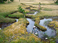
Beaver Ponds
The clockwise loop to a group of beaver-inhabited ponds north of Mammoth village starts with a steep climb beside a wooded creek then crosses more open land to the ponds, returning across a grassy plateau, a favored location for grazing elk
Length: 5 miles, round trip
Elevation change: 450 feet
Difficulty: Easy
Type: Loop
Usage: High
Season: Spring, summer, fall
Trailhead: Beside Hymen Terrace, or behind Mammoth Hot Springs Hotel
Rating (1-5): ★★★★★
Elevation change: 450 feet
Difficulty: Easy
Type: Loop
Usage: High
Season: Spring, summer, fall
Trailhead: Beside Hymen Terrace, or behind Mammoth Hot Springs Hotel
Rating (1-5): ★★★★★

The pleasant, five mile loop past a group of beaver-inhabited ponds is one of the secondary attractions of the Mammoth Hot Springs area, since it passes no thermal features apart from right at the start, and for most of the way encounters rather nondescript forest and grassland, but the surroundings are good wildlife habitat, for creatures including elk, antelope, deer and moose, and the relatively long distance ensures that not too many people make the hike, unlike the very busy boardwalk trails around the nearby thermal terraces.
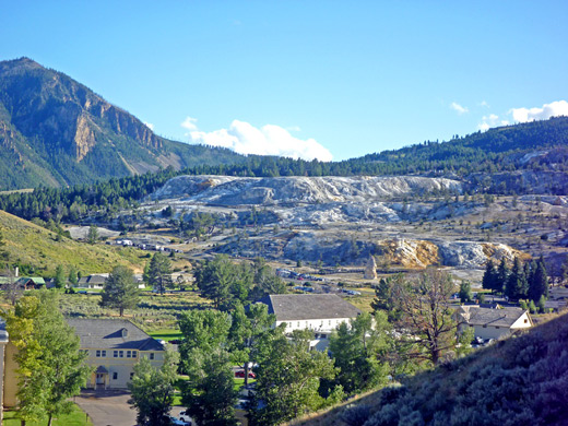
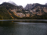
The route has two trailheads a quarter of a mile apart, from where both paths climb for a short distance and head north over sloping terrain on the eastern foothills of Sepulcher Mountain, giving good views north and east, over the deep canyon of the Gardner River and across to Mount Everts. The northern trailhead has easier parking though the south end of the trail gains most elevation at the beginning, so this is the preferred start point.
Trail map for Yellowstone National Park.
8 views along the Beaver Ponds Trail.
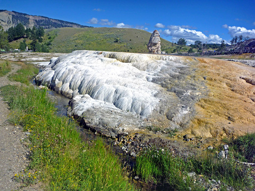
The southern Beaver Ponds trailhead is beside the north edge of the Mammoth Hot Springs terraces, near Liberty Cap and a small but pretty thermal feature known as Hymen Terrace which forms part of the south banks of Clematis Creek. There are several parking areas close by but they are often full; if so, a good place to park is at the end of a residential street on the far side of the highway, reached by driving along the main road to Tower for 700 feet then turning right at the first junction. The trail follows Clematis Creek across an open area into a narrow, wooded ravine, crosses the stream a couple of times then climbs quite sharply up the north side of the valley, gaining 450 feet overall, out into open, bushy slopes and to an intersection with a route to Snow Pass and the summit of Sepulcher Mountain. Turning right, the Beaver Ponds Trail winds through a floral meadow and across mixed forest/grassland before descending a little and reaching the first pond after 2.2 miles.
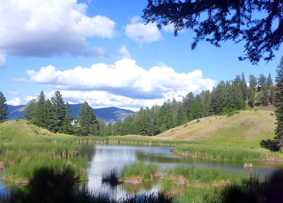
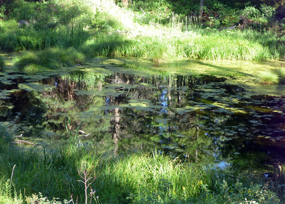
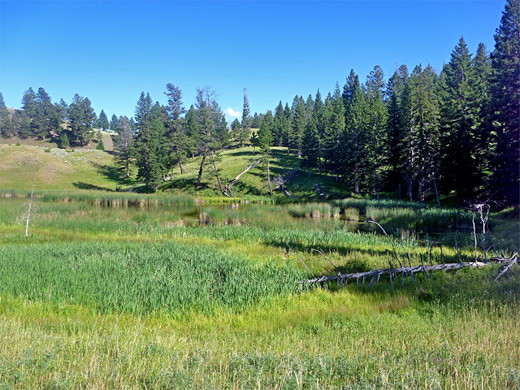
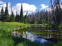
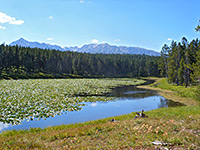
There are no obvious signs of beaver here but the scenery is nice enough - the pond is lined with tall reeds and is half enclosed by Douglas fir trees, with distant mountains visible to the east. The next few pools are entirely within the forest and are less photogenic, being smaller, shallower and covered by algae, but after these the path turns east and descends next to a stream to the main pond, where beavers have built a few dams along the east edge. The trail follows the shoreline, crosses the exit channel on a wooden footbridge, climbs the hillside opposite and has several more ascents and descents before leaving the forest and merging to Elk Plaza, the wide, flat grassland overlooking Gardner Canyon and the Grand Loop Road, 1,200 feet below. The now disused Gardiner High Road can also be seen, a much shorter distance down the hillside, and after one mile on the plateau the path descends to the start of this road, to the alternative trailhead, next to a large parking lot behind Mammoth Hot Springs Hotel. The grasslands are the most likely place on the hike to see elk, usually resident here during spring and early summer.
The route has two trailheads a quarter of a mile apart, from where both paths climb for a short distance and head north over sloping terrain on the eastern foothills of Sepulcher Mountain, giving good views north and east, over the deep canyon of the Gardner River and across to Mount Everts. The northern trailhead has easier parking though the south end of the trail gains most elevation at the beginning, so this is the preferred start point.
Location
Trail map for Yellowstone National Park.
Photographs
8 views along the Beaver Ponds Trail.
The Trail
The southern Beaver Ponds trailhead is beside the north edge of the Mammoth Hot Springs terraces, near Liberty Cap and a small but pretty thermal feature known as Hymen Terrace which forms part of the south banks of Clematis Creek. There are several parking areas close by but they are often full; if so, a good place to park is at the end of a residential street on the far side of the highway, reached by driving along the main road to Tower for 700 feet then turning right at the first junction. The trail follows Clematis Creek across an open area into a narrow, wooded ravine, crosses the stream a couple of times then climbs quite sharply up the north side of the valley, gaining 450 feet overall, out into open, bushy slopes and to an intersection with a route to Snow Pass and the summit of Sepulcher Mountain. Turning right, the Beaver Ponds Trail winds through a floral meadow and across mixed forest/grassland before descending a little and reaching the first pond after 2.2 miles.
The Beaver Ponds
There are no obvious signs of beaver here but the scenery is nice enough - the pond is lined with tall reeds and is half enclosed by Douglas fir trees, with distant mountains visible to the east. The next few pools are entirely within the forest and are less photogenic, being smaller, shallower and covered by algae, but after these the path turns east and descends next to a stream to the main pond, where beavers have built a few dams along the east edge. The trail follows the shoreline, crosses the exit channel on a wooden footbridge, climbs the hillside opposite and has several more ascents and descents before leaving the forest and merging to Elk Plaza, the wide, flat grassland overlooking Gardner Canyon and the Grand Loop Road, 1,200 feet below. The now disused Gardiner High Road can also be seen, a much shorter distance down the hillside, and after one mile on the plateau the path descends to the start of this road, to the alternative trailhead, next to a large parking lot behind Mammoth Hot Springs Hotel. The grasslands are the most likely place on the hike to see elk, usually resident here during spring and early summer.
Beaver Ponds Trail - Similar Hikes
All Contents © Copyright The American Southwest | Comments and Questions | Contribute | Affiliate Marketing Disclosure | Site Map