Spectra Point and Ramparts Overlook Trail, Cedar Breaks National Monument
Utah > Cedar Breaks National Monument > Spectra Point & Ramparts Overlook Trail
Spectra Point & Ramparts Overlook Trail
Gently descending path along the rim, past a promontory to a second viewpoint. An unofficial, off-trail continuation leads to a stream with waterfall, and another, more exposed promontory (The Bartizan), containing several arches
Length: 0.8 miles to Spectra Point, 1.8 miles to Ramparts Overlook, 2.6 miles to the Bartizan
Elevation change: 200 feet, 600 feet, 850 feet
Difficulty: Easy, moderate, moderate
Type: One way maintained path, with unofficial, off-trail continuation
Usage: High, medium, low
Season: Summer and fall
Trailhead: Parking area near the visitor center
Rating (1-5): ★★★★★
Elevation change: 200 feet, 600 feet, 850 feet
Difficulty: Easy, moderate, moderate
Type: One way maintained path, with unofficial, off-trail continuation
Usage: High, medium, low
Season: Summer and fall
Trailhead: Parking area near the visitor center
Rating (1-5): ★★★★★

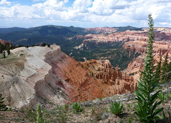
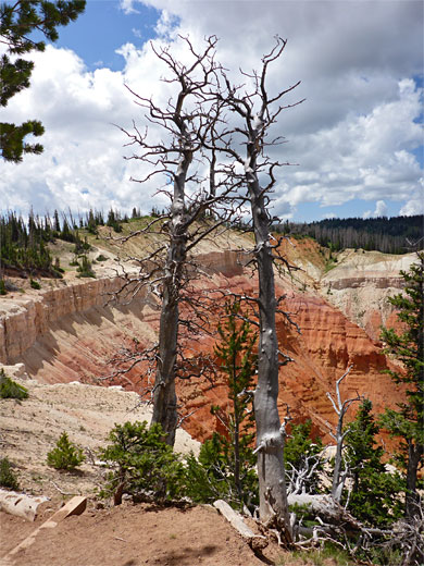
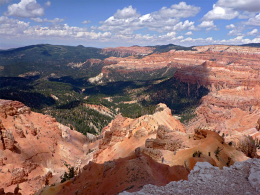
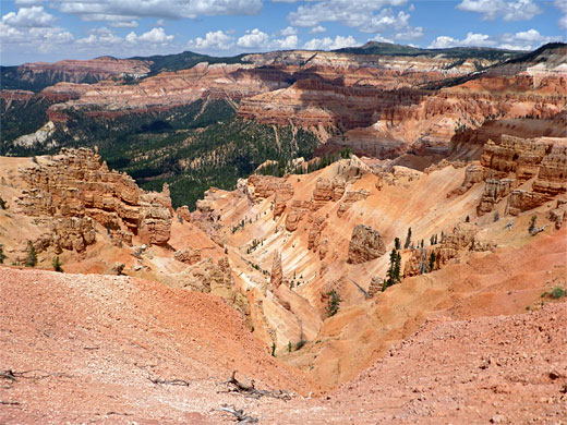
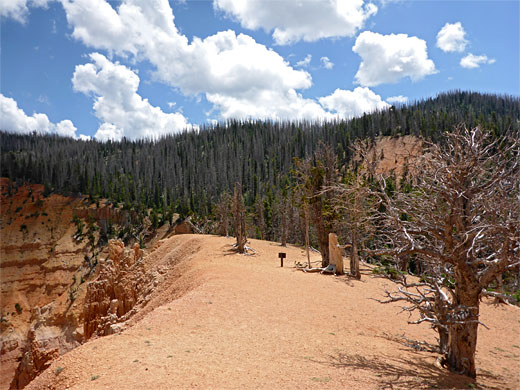
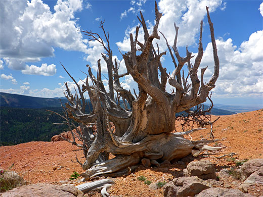
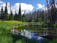
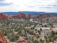
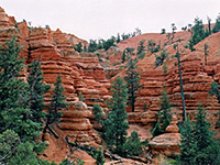
The Spectra Point and Ramparts Overlook Trail is the best of the small number of hikes in Cedar Breaks National Monument, and the most popular, since it starts right beside the visitor center, along Hwy 148 near the southern park entrance. The path follows the edge of the plateau, above the most spectacular of the red rock formations, then descends gently through light woodland to a white earth promontory, Spectra Point (after 0.8 miles), which overlooks the deep ravines of Jericho Canyon and Ashdown Creek. The next section, somewhat less used, drops down more steeply through denser, moister woodland and ends at Ramparts Overlook, a similar promontory high above two other drainages, Crescent Hollow and Slip Canyon. Both overlooks are largely unvegetated apart from a few ancient bristlecone pines.
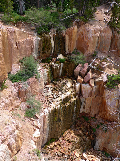
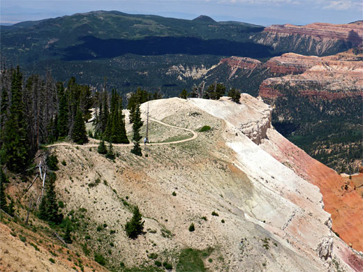
The maintained path ends here, after 1.8 miles, but an official continuation, only occasionally used, leads further west along the rim, veering away to avoid a ravine then climbing to a final, more extensive viewpoint on The Bartisan, a larger promontory, the south side of which contains several angular arches. One other point of interest nearby is a small stream, Shooting Star Creek, which at its lower end flows through a few pools and cascades then tumbles over the cliffs forming a stepped, 40 foot waterfall.
All of the hike encounters a great variety of wildflowers, including a number of rare or endemic species, some on the exposed rocky soils along the plateau edge, others close to the creek. Overall, the on-trail section of the hike is varied, relatively easy, and offers a good mix of small-scale scenery alongside the path, and spectacular views of the formations below.
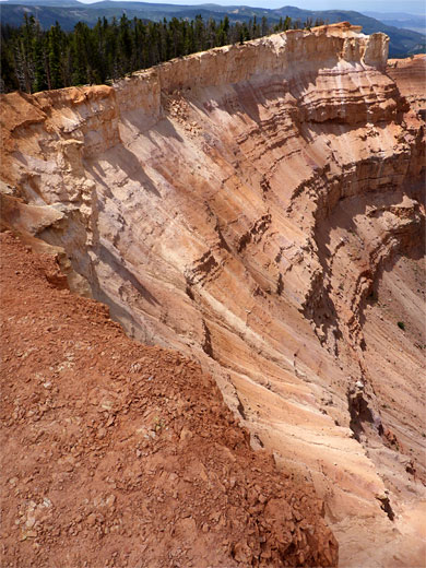
Parking for the hike is at the south end of the main lot at the visitor center, and the hike starts with a wildflower-lined flight of steps, up a short slope to the plateau edge, here facing west. The trail then heads south, right beside the plateau edge across a band of stony, white earth - part of the White Member of the Claron Formation - on which are found numerous, mostly small wildflowers including unusual species such as Cathedral Bluff dwarf gentian, Cedar Breaks gilia, dwarf townsend daisy, Panguitch buckwheat and plateau catchfly. On the other side of the trail the ground is moister and more vegetated, with larger flowers like lupine, bluebell, Colorado columbine and monument plant. A short spur leads to a historic cabin, while the main route climbs slightly to a highpoint of 10,487 feet, beside a pair of water towers. Soon after, the path swings round to the north above the upper end of Jericho Canyon, and begins a gentle descent, briefly through a patch of trees then back to white earth once more and on to the overlook at Spectra Point, which has 300 degree views over the multi-hued formations below. The stony ground is completely bare except for a few scattered flowers, and the bristlecone pines.
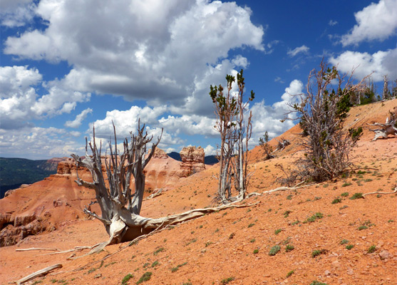
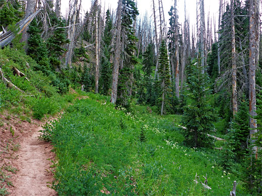
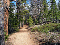
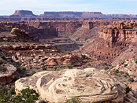
The majority of people turn back at Spectra Point, perhaps because the next section of the path is a little steeper; it re-enters wooded terrain, zig-zagging down a slope covered with scattered spruce trees, and soon comes close to Shooting Star Creek, named after the showy flowers (alpine shooting star) that grow alongside in a few places, together with much other vegetation, in contrast to the otherwise dry woodland. Two overlooks have views back towards Spectra Point, already quite high above. The trail moves further away from the rim then returns to another viewpoint which overlooks a different section of the formations, along Step Canyon, and is now crossing reddish earth, from the underlying Red Member of the Claron Formation. The path comes close the stream a second time before heading away to the final viewpoint, Ramparts Overlook, on a divide between Slip Canyon and the next ravine west, the upper end of Crescent Hollow.
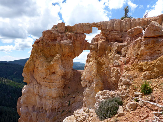
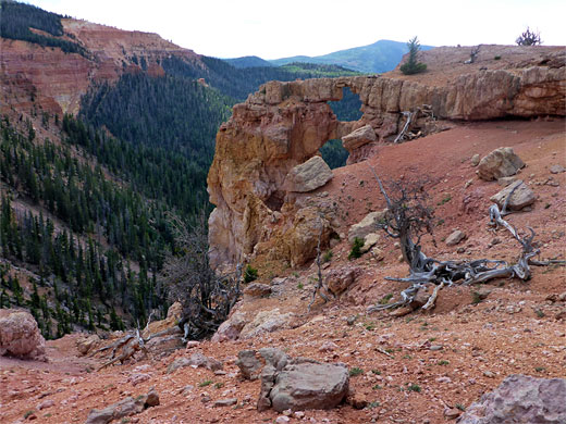
A sign marks the end of the official path though a narrower route resumes, staying close to the rim for a while before moving away to avoid a small valley, and continues through gradually thinning woodland to the much larger promontory of The Bartizan, the westernmost part of this section of the plateau - beyond, the rim bends abruptly to the south. The faint trail crosses a stony slope and rises to a flat area at the western tip of the point, on which are several more bristlecone pines. The views are now quite different to before, over mostly wooded slopes and ravines, trending down westwards towards Cedar City. On the south side of The Bartizan is a narrow, protruding cliff that has eroded to form at least three arches, not easily reachable due to unstable slopes though viewable from several directions, both above and below. At least one looks very fragile and seems unlikely to survive much longer.
The top of The Bartizan also has views of a small waterfall a short distance south, where Shooting Star Creek flows over the plateau edge, a point reachable by walking back along the path a way, into woodland, and down a slope. The cliffs at this point, although relatively short, are sheer, preventing any climb-down route, and the waterfall itself is also not properly visible from this location. The lower end of the creek has a different section of wildflowers to the upper reaches, with at least five uncommon species - alpine bistort, elephant heads, green bog orchid, green-flowered wintergreen and pink wintergreen. The stream forms little pools and is crossed by quite a few fallen tree trunks; it becomes bushier and overgrown a short distance uphill.
The maintained path ends here, after 1.8 miles, but an official continuation, only occasionally used, leads further west along the rim, veering away to avoid a ravine then climbing to a final, more extensive viewpoint on The Bartisan, a larger promontory, the south side of which contains several angular arches. One other point of interest nearby is a small stream, Shooting Star Creek, which at its lower end flows through a few pools and cascades then tumbles over the cliffs forming a stepped, 40 foot waterfall.
All of the hike encounters a great variety of wildflowers, including a number of rare or endemic species, some on the exposed rocky soils along the plateau edge, others close to the creek. Overall, the on-trail section of the hike is varied, relatively easy, and offers a good mix of small-scale scenery alongside the path, and spectacular views of the formations below.
Path to Spectra Point
Parking for the hike is at the south end of the main lot at the visitor center, and the hike starts with a wildflower-lined flight of steps, up a short slope to the plateau edge, here facing west. The trail then heads south, right beside the plateau edge across a band of stony, white earth - part of the White Member of the Claron Formation - on which are found numerous, mostly small wildflowers including unusual species such as Cathedral Bluff dwarf gentian, Cedar Breaks gilia, dwarf townsend daisy, Panguitch buckwheat and plateau catchfly. On the other side of the trail the ground is moister and more vegetated, with larger flowers like lupine, bluebell, Colorado columbine and monument plant. A short spur leads to a historic cabin, while the main route climbs slightly to a highpoint of 10,487 feet, beside a pair of water towers. Soon after, the path swings round to the north above the upper end of Jericho Canyon, and begins a gentle descent, briefly through a patch of trees then back to white earth once more and on to the overlook at Spectra Point, which has 300 degree views over the multi-hued formations below. The stony ground is completely bare except for a few scattered flowers, and the bristlecone pines.
Ramparts Overlook
The majority of people turn back at Spectra Point, perhaps because the next section of the path is a little steeper; it re-enters wooded terrain, zig-zagging down a slope covered with scattered spruce trees, and soon comes close to Shooting Star Creek, named after the showy flowers (alpine shooting star) that grow alongside in a few places, together with much other vegetation, in contrast to the otherwise dry woodland. Two overlooks have views back towards Spectra Point, already quite high above. The trail moves further away from the rim then returns to another viewpoint which overlooks a different section of the formations, along Step Canyon, and is now crossing reddish earth, from the underlying Red Member of the Claron Formation. The path comes close the stream a second time before heading away to the final viewpoint, Ramparts Overlook, on a divide between Slip Canyon and the next ravine west, the upper end of Crescent Hollow.
The Bartizan
A sign marks the end of the official path though a narrower route resumes, staying close to the rim for a while before moving away to avoid a small valley, and continues through gradually thinning woodland to the much larger promontory of The Bartizan, the westernmost part of this section of the plateau - beyond, the rim bends abruptly to the south. The faint trail crosses a stony slope and rises to a flat area at the western tip of the point, on which are several more bristlecone pines. The views are now quite different to before, over mostly wooded slopes and ravines, trending down westwards towards Cedar City. On the south side of The Bartizan is a narrow, protruding cliff that has eroded to form at least three arches, not easily reachable due to unstable slopes though viewable from several directions, both above and below. At least one looks very fragile and seems unlikely to survive much longer.
Shooting Star Creek
The top of The Bartizan also has views of a small waterfall a short distance south, where Shooting Star Creek flows over the plateau edge, a point reachable by walking back along the path a way, into woodland, and down a slope. The cliffs at this point, although relatively short, are sheer, preventing any climb-down route, and the waterfall itself is also not properly visible from this location. The lower end of the creek has a different section of wildflowers to the upper reaches, with at least five uncommon species - alpine bistort, elephant heads, green bog orchid, green-flowered wintergreen and pink wintergreen. The stream forms little pools and is crossed by quite a few fallen tree trunks; it becomes bushier and overgrown a short distance uphill.
Spectra Point Wildflowers
More flowers along the trail
 Plateau catchfly |
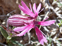
 Green bog orchid |
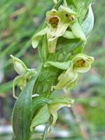
 Cathedral Bluff dwarf gentian |
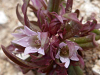
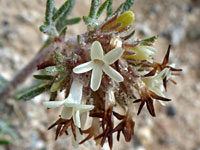 Cedar Breaks gilia |
More flowers along the trail
Spectra Point and Ramparts Overlook - Similar Hikes
All Contents © Copyright The American Southwest | Comments and Questions | Contribute | Affiliate Marketing Disclosure | Site Map