Angel's Palace Trail, Kodachrome Basin State Park
Utah > Kodachrome Basin State Park > Angel's Palace Trail
Angel's Palace Trail
Easy, popular path that climbs a short ravine and loops around the flat mesatop on the east side of the park road, giving fine views in all directions
Length: 1.4 miles
Elevation change: 120 feet
Difficulty: Easy
Type: Loop
Usage: Medium
Season: All year
Trailhead: Parking area near the state park campground
Rating (1-5): ★★★★★
Elevation change: 120 feet
Difficulty: Easy
Type: Loop
Usage: Medium
Season: All year
Trailhead: Parking area near the state park campground
Rating (1-5): ★★★★★

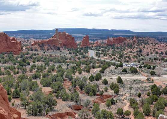
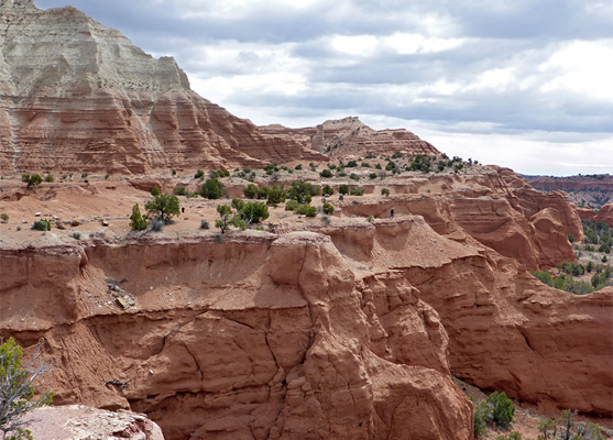
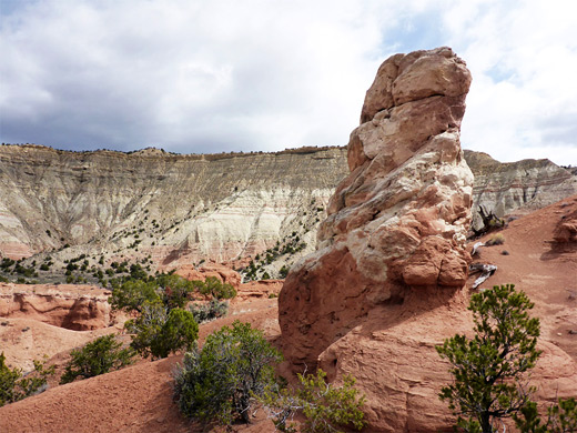
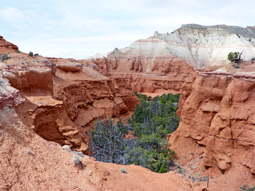
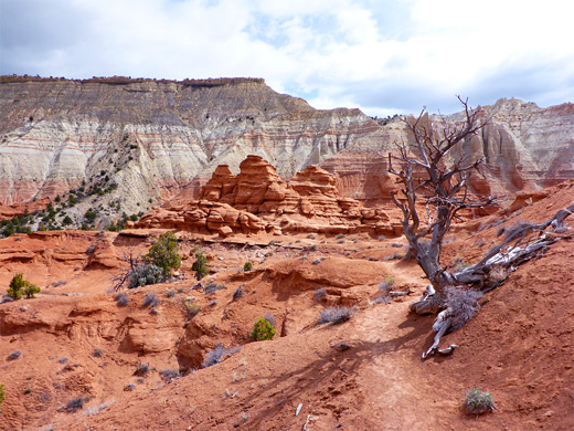
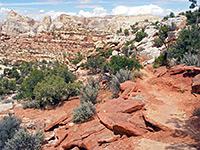
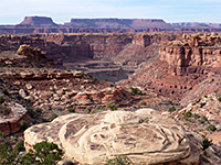
The most popular hike in Kodachrome Basin State Park is along the Angel's Palace Trail; several short, linked loops across a wide sandstone bench 100 feet above the park road, totaling 1.4 miles. Higher cliffs rise up just to the east, but there is nothing to block the views in other directions - south to the isolated line of spires near the park entrance, west across much more extensive outcrops of red sandstone, including several sand pipes, and north to a tall ridge of white sandstone, along the park boundary.
Like the nearby Nature Trail and Grand Parade Trail, the path is close enough to the campground for people staying there to reach without driving. The scenery is good at all times of day but especially in early morning, when the rising run illuminates the jagged formations to the west.
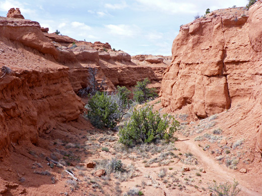
Parking for the hike is on the west side of the road next to the campground, and is also used for the short Nature Trail. The Angel's Palace Trail starts from the east side, first crossing a bushy area and a drainage that may contain flowing water, then entering a short, quite narrow ravine, framed by low, light orange cliffs of Entrada sandstone. A brief steeper section takes the path 100 feet up to the flat, sparsely vegetated plateau above the ravine, to a junction with the one mile loop section, which is all across level ground. The two sides of the loop are connected in several places, allowing for shorter hikes. Although all sections are close together, the scenery changes regularly as the path overlooks different areas. In the anticlockwise direction, the trail first heads west, out to the end of a promontory that has views of the road, the campground, the white cliffs to the north, and at least six sand pipes; it then cuts back, around a ravine and along the plateau edge to the south, above the Grand Parade area, before returning to the start close to the base of the higher cliffs on the east side.
Like the nearby Nature Trail and Grand Parade Trail, the path is close enough to the campground for people staying there to reach without driving. The scenery is good at all times of day but especially in early morning, when the rising run illuminates the jagged formations to the west.
The Trail
Parking for the hike is on the west side of the road next to the campground, and is also used for the short Nature Trail. The Angel's Palace Trail starts from the east side, first crossing a bushy area and a drainage that may contain flowing water, then entering a short, quite narrow ravine, framed by low, light orange cliffs of Entrada sandstone. A brief steeper section takes the path 100 feet up to the flat, sparsely vegetated plateau above the ravine, to a junction with the one mile loop section, which is all across level ground. The two sides of the loop are connected in several places, allowing for shorter hikes. Although all sections are close together, the scenery changes regularly as the path overlooks different areas. In the anticlockwise direction, the trail first heads west, out to the end of a promontory that has views of the road, the campground, the white cliffs to the north, and at least six sand pipes; it then cuts back, around a ravine and along the plateau edge to the south, above the Grand Parade area, before returning to the start close to the base of the higher cliffs on the east side.
Angel's Palace Trail - Similar Hikes
All Contents © Copyright The American Southwest | Comments and Questions | Contribute | Affiliate Marketing Disclosure | Site Map