Sheep Creek and Swamp Canyon Trails, Bryce Canyon National Park
Utah > Bryce Canyon National Park > Hiking > Sheep Creek and Swamp Canyon Trails
Sheep Creek and Swamp Canyon Trails
Paths down two short canyons with eroded rock formations at the top, otherwise quite thickly wooded; views of distant red cliffs. Linked by a one mile section of the Under-the-Rim Trail to form a loop
Length: 2 miles (Sheep Creek), 1.3 miles (Swamp Canyon); a 4.2 mile loop
Elevation change: 660 feet
Difficulty: Easy to moderate; steep at the upper ends of the canyons
Type: Loop
Usage: Low
Season: Late spring, summer, fall
Trailhead: Swamp Canyon viewpoint
Rating (1-5): ★★★★★
Elevation change: 660 feet
Difficulty: Easy to moderate; steep at the upper ends of the canyons
Type: Loop
Usage: Low
Season: Late spring, summer, fall
Trailhead: Swamp Canyon viewpoint
Rating (1-5): ★★★★★

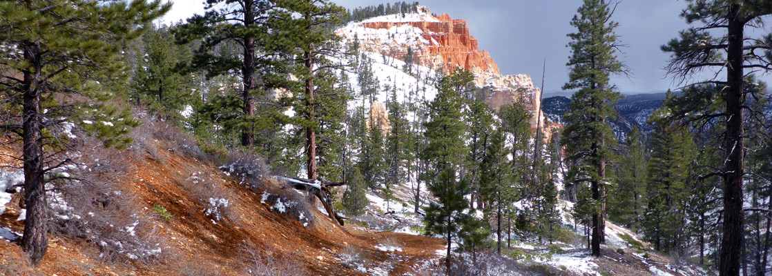
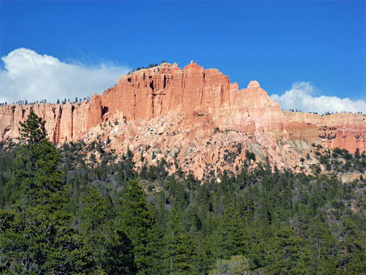
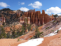
South of the popular Fairyland Point - Bryce Point area, the edge of the Paunsaugunt Plateau in Bryce Canyon National Park steepens, and the band of eroded formations becomes narrower, so the limited number of trails in this region encounter fewer hoodoos and exposed rocks, instead running mostly through wooded basins and valleys, with only distant views of the Pink Cliffs. Such is the case for the Sheep Creek and Swamp Canyon trails, which together with a short section of the Under-the-Rim Trail, form a lightly travelled loop of 4.2 miles.
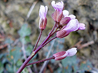
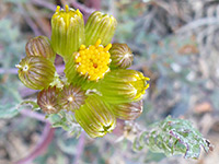
The former begins across a moist meadow on the rim, a good location for late spring wildflowers, then descends into a briefly narrow ravine that soon opens out to the flattish, thickly forested land beneath. The return part of the loop is up Swamp Canyon, a similarly wide ravine that has some photogenic, orange-red formations at its upper end. The paths are generally accessible from April onwards, once most of the winter snowfall has melted - this tends to persist the longest on the plateau top - and the hike takes about two hours.
Overview map for Bryce Canyon National Park.
Both paths start from the same point, a trailhead and overlook on the east side of the scenic drive, 5 miles south of the entrance station and just north of a tight switchback on the road as it climbs by 300 feet around the upper end of a wooded basin.
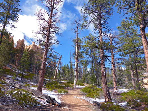
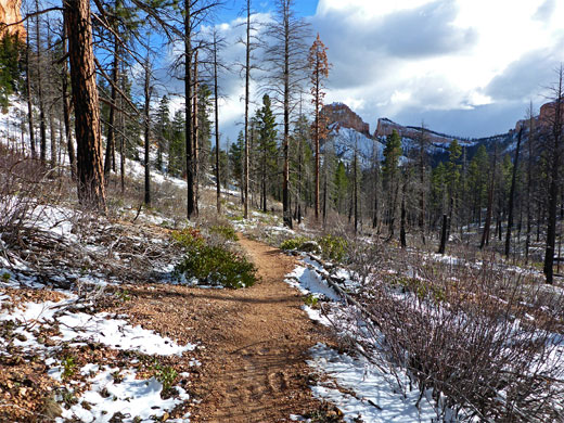
From the parking lot, a path runs downhill a little way to a junction, signed Sheep Creek left, Swamp Canyon right. The latter path begins with a steep descent so it seems best to end with the climb back up here, and hence a start along the Sheep Creek Trail is preferred. This route is level, heading north through a thin belt of trees, out of the woods and along the edge of a narrow meadow, within sight and sound of the park road on the far side. Deep snowdrifts accumulate here in winter. The trail bends to the east after 0.7 miles, passing between two rounded hillocks, and moving up a gentle incline along a very shallow ravine, as red rocks start to appear through gaps in the trees, coming fully into view at the canyon rim. A sign marks the edge of the Bryce Canyon Wilderness.
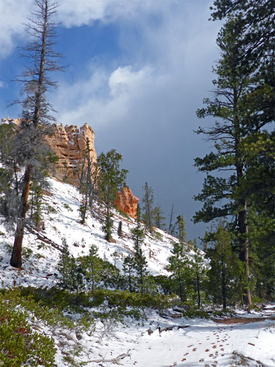
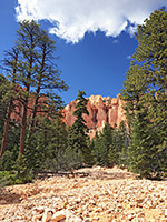
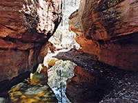
The trail descends into the ravine of Sheep Creek, past a few exposed sandstone formations, and is soon running beneath the big red cliffs at either side, though the valley quickly opens out and the cliffs become partly hidden by trees - there are now no more pinnacles close to the trail. The route continues down the drainage, which after a while becomes entrenched in a little inner gulley as it cuts through a sandy, earthen area, and reaches a four-way junction; left and right is the Under-the-Rim Trail, which to the north leads to the Hat Shop and Bryce Point (9 miles), and to the south to Yovimpa Point (14 miles). The Sheep Creek Trail continues down the drainage, eventually exiting the national park and intersecting a track that leads to the road to Kodachrome Basin State Park, but this section offers little of interest and is not often hiked.
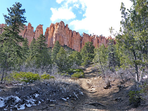
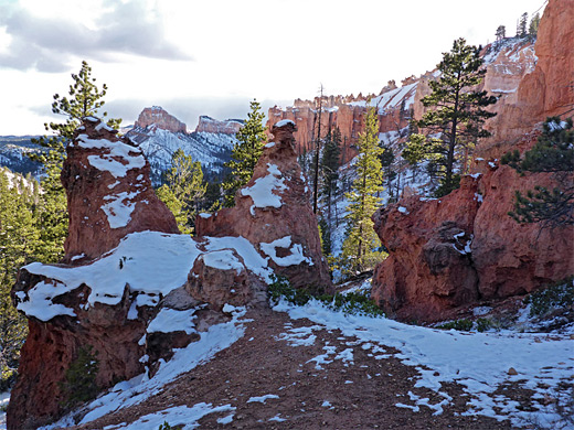
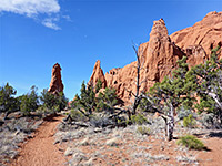
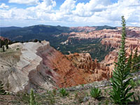
The loop continues by turning right (west) - a small climb through the woods followed by a mostly level section, passing beneath the steep face of a narrowing promontory, projecting southwards from the rim. The trail winds up to a sandy saddle and goes down the far side, across a recently burnt hillside to the flat floor of Swamp Canyon, covered by large, well separated, and mostly dead trees; a mixture of gambel oak, juniper and ponderosa pines. A sign indicates the location of the Swamp Canyon primitive campsite, and a second warns of potential bear activity. Another junction is with the 0.9 mile Swamp Canyon Trail, the return route to the rim. This is mostly straight, climbing gently then more steeply, up a ravine that stays rather wide nearly until the top, where it narrows, and the path moves beneath a few shapely red rock formations before reaching the initial junction near the trailhead.
The former begins across a moist meadow on the rim, a good location for late spring wildflowers, then descends into a briefly narrow ravine that soon opens out to the flattish, thickly forested land beneath. The return part of the loop is up Swamp Canyon, a similarly wide ravine that has some photogenic, orange-red formations at its upper end. The paths are generally accessible from April onwards, once most of the winter snowfall has melted - this tends to persist the longest on the plateau top - and the hike takes about two hours.
Location
Overview map for Bryce Canyon National Park.
Sheep Creek Trailhead
Both paths start from the same point, a trailhead and overlook on the east side of the scenic drive, 5 miles south of the entrance station and just north of a tight switchback on the road as it climbs by 300 feet around the upper end of a wooded basin.
The Plateau
From the parking lot, a path runs downhill a little way to a junction, signed Sheep Creek left, Swamp Canyon right. The latter path begins with a steep descent so it seems best to end with the climb back up here, and hence a start along the Sheep Creek Trail is preferred. This route is level, heading north through a thin belt of trees, out of the woods and along the edge of a narrow meadow, within sight and sound of the park road on the far side. Deep snowdrifts accumulate here in winter. The trail bends to the east after 0.7 miles, passing between two rounded hillocks, and moving up a gentle incline along a very shallow ravine, as red rocks start to appear through gaps in the trees, coming fully into view at the canyon rim. A sign marks the edge of the Bryce Canyon Wilderness.
Sheep Creek
The trail descends into the ravine of Sheep Creek, past a few exposed sandstone formations, and is soon running beneath the big red cliffs at either side, though the valley quickly opens out and the cliffs become partly hidden by trees - there are now no more pinnacles close to the trail. The route continues down the drainage, which after a while becomes entrenched in a little inner gulley as it cuts through a sandy, earthen area, and reaches a four-way junction; left and right is the Under-the-Rim Trail, which to the north leads to the Hat Shop and Bryce Point (9 miles), and to the south to Yovimpa Point (14 miles). The Sheep Creek Trail continues down the drainage, eventually exiting the national park and intersecting a track that leads to the road to Kodachrome Basin State Park, but this section offers little of interest and is not often hiked.
Under-the-Rim Trail and Swamp Canyon
The loop continues by turning right (west) - a small climb through the woods followed by a mostly level section, passing beneath the steep face of a narrowing promontory, projecting southwards from the rim. The trail winds up to a sandy saddle and goes down the far side, across a recently burnt hillside to the flat floor of Swamp Canyon, covered by large, well separated, and mostly dead trees; a mixture of gambel oak, juniper and ponderosa pines. A sign indicates the location of the Swamp Canyon primitive campsite, and a second warns of potential bear activity. Another junction is with the 0.9 mile Swamp Canyon Trail, the return route to the rim. This is mostly straight, climbing gently then more steeply, up a ravine that stays rather wide nearly until the top, where it narrows, and the path moves beneath a few shapely red rock formations before reaching the initial junction near the trailhead.
Sheep Creek and Swamp Canyon - Similar Hikes
All Contents © Copyright The American Southwest | Comments and Questions | Contribute | Affiliate Marketing Disclosure | Site Map