The American Southwest
Home | Parks | Trails | Plants | Canyons
Maps | Landscapes | Site Map | Whats New? |
More...
Follow americansouthwest.net on Facebook
×
General Pages
Home
Parks
Trails
Plants
Slot Canyons
Maps
Landscapes
Itineraries
Site Map
What's New?
More pages...

States
Arizona
California
Colorado
Idaho
Nevada
New Mexico
Oregon
Texas
Utah
Wyoming


ARIZONA
CALIFORNIA
COLORADO
IDAHO
NEVADA
NEW MEXICO
OREGON
TEXAS
UTAH
WYOMING
UTAH
MAPS | PARKS | TRAILS | HOTELS

Map of Bryce Canyon National Park


Utah > Bryce Canyon National Park > Map
Map of Bryce Canyon National Park


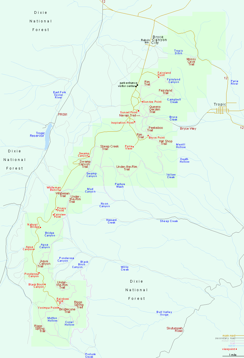
The only entrance to Bryce Canyon National Park is along UT 12, 14 miles from US 89 in the west, and 110 miles from UT 24 in the east. The approach from the east, starting from the little town of Torrey, is one of the most scenic in all of Utah, passing the high country around Boulder Mountain, the amazingly colorful rocks either side of Escalante, and scenic badlands on the approach to Henrieville, shortly before the ascent to the Paunsaugunt Plateau and Bryce Canyon.

PDFPDF format map of Bryce Canyon National Park, from the National Park Service (384 kb).

Back to Top
Arizona | California | Colorado | Idaho | Nevada | New Mexico | Oregon | Texas | Utah | Wyoming | Slot Canyons | Travelogue | SOUTHWEST

All Contents © Copyright The American Southwest | Comments and Questions | Contribute | Affiliate Marketing Disclosure | Site Map