Highlights:
Small but popular town along US 89, close to three national parks, and surrounded by much spectacular Grand Staircase scenery, across the Vermilion Cliffs and the White Cliffs, including Great Chamber, Sand Caves and Peekaboo Canyon
Nearby town:
Location:
Seasons:
All year
Rating (1-5):
★★★★★
Weather:


Featured Hotel
Hampton Inn Kanab
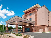 In Kanab city center along US 89, with good views of the Vermilion Cliffs just to the north. Free hot breakfast and an outdoor pool
Check Rates
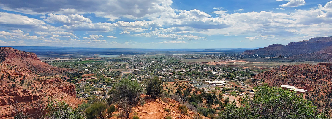
Kanab is one of the major towns serving visitors to the many and varied landscapes of southern Utah, along with such places as St George, Hanksville, Moab, and Page in Arizona; although fairly small it has a good selection of lodging, and all other necessary facilities. The name derives from a Paiute phrase meaning 'place of the willows', and this location was first settled in 1864, after construction of Fort Kanab, on the east banks of Kanab Creek; a short-lived encampment. The town itself was founded in 1870.
Kanab is within an easy day trip of three national parks, Zion, Bryce Canyon, and Grand Canyon (North Rim), plus Pipe Spring National Monument, Coral Pink Sand Dunes State Park and the western half of Grand Staircase-Escalante National Monument, while closer to town, within 20 miles, are many lesser-known sites, enough to occupy several days of hiking time.
The town, actually a city, sits at the base of the Vermilion Cliffs, one of the five main components the Grand Staircase - a long, red escarpment, composed of thin layers of the Moenave and Kayenta formations. Cliffs rise just to the north and are cut by various canyons, the largest that of Kanab Creek which provides the northwards course for US 89, the main through road.
Eight miles north are the higher, overlying White Cliffs, of Navajo Sandstone, and it is these two bands in which most of the interesting sites around Kanab are located: highlights include Great Chamber, Peekaboo Canyon (or Red Canyon) and the Sand Caves.
Kanab Table of Contents

Kanab - The North
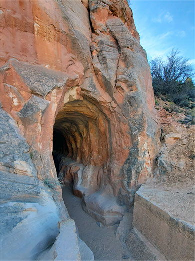
The approach to Kanab from the north is along US 89 from Zion National Park and Mt Carmel Junction; from the junction, the road climbs up the side of Long Canyon, past the 'Belly of the Dragon', a surprisingly popular attraction, since it is merely a drainage tunnel underneath the road, and past the Elkhart Cliffs slot canyon (also known as Diana's Throne), then crosses the Sand Hills, a large expanse of dunes and bushy flats, before turning south and descending into Three Lakes Canyon, which soon meets the larger Kanab Canyon. Across the hills are various side tracks, good for primitive camping; one such track, very sandy, accesses Peekaboo Canyon, or Red Canyon, the most popular slot canyon in the vicinity.
Kanab Tours
Selected excursions around Kanab; some places, in particular Great Chamber and Peekaboo Canyon, need 4WD to access, so a guided tour is often the best way to visit.
Kanab - Sites Close to Town
Closer to town, another side road continues upstream along Kanab Canyon to the Best Friends Animal Sanctuary, supposedly the largest animal refuge in the US - near here, on the walls of the canyon, are a few rock art panels, and also Hidden Lake, an unusual pool in a cave at the base of a photogenic sandstone cliff. Closer to town are Moqui Cave and the Sand Caves, a series of excavations in the cliffs. The town itself has a compact center, about ten blocks square, with most facilities along the two main roads, US 89 north and east, US 89A south. Two popular trails start right at the edge of town - Squaw Canyon and Tom's Canyon. Kanab Creek flows past the western edge, in a shallow valley, following US 89A towards Fredonia in Arizona and continuing its long journey to the Grand Canyon across the great empty plains of the Arizona Strip.
Kanab - The East
To the east, US 89 runs all along the base of the Vermilion Cliffs, which are mostly continuous for 6 miles, split by just a few canyons. Because of its archetypal Western appearance, the rolling, empty land below the cliffs has been used as the setting for a number of movies, such as the Desperadoes, Mackenna's Gold and Outlaw Josey Wales. One popular hike along this section is the Mansard Trail which climbs the escarpment and crosses a plateau, ending at an elevated alcove containing pictographs and petroglyphs. The first major break in the Vermilion Cliffs is Johnson Canyon, where a road, paved for 16 miles, heads north accessing several more remote attractions, generally requiring 4WD, including Inchworm Arch and the Great Chamber.
Featured Hikes near Kanab
Belly of the Dragon
★★★★★
★★★★★
600 feet, 15 feet
Very short hike along an artificially-constructed, 400 foot-long tunnel through orange-gray limestone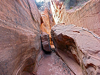
Elkheart Cliffs Canyon (Diana's Throne)
★★★★★
★★★★★
0.7 miles, 300 feet
Short slot canyon along an unnamed wash draining the south end of the Elkheart Cliffs; nice passages through stripy rocks, plus a few dryfalls, potholes and possible pools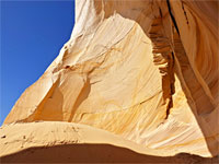
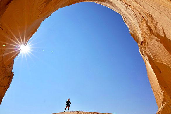
Great Chamber
★★★★★
★★★★★
0.3 miles, 200 feet
South-facing alcove eroded into the tip of a narrow promontory (Cutler Point), framed by curving, thin-layered, subtly-colored sandstone walls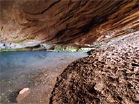
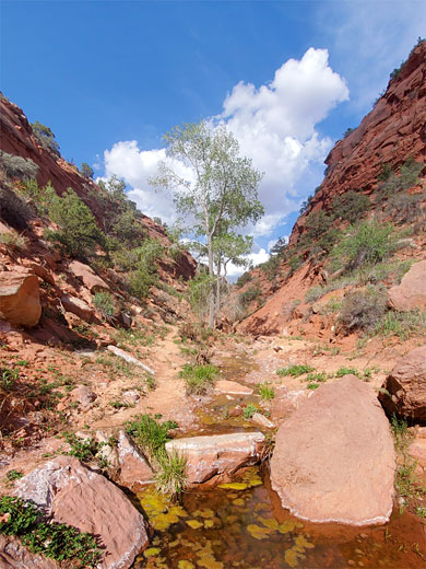
Hidden Lake
★★★★★
★★★★★
0.8 miles, 160 feet
Permanently flooded alcove at the base of a colorful cliff of stripy, orange-white Navajo sandstone, along the shallow canyon of Kanab Creek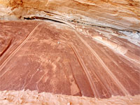
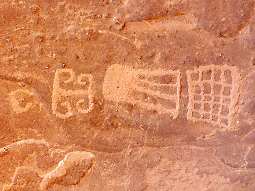
Mansard Trail
★★★★★
★★★★★
2.2 miles, 820 feet
Hike into the Vermilion Cliffs, to an alcove at the base of Mansard Mesa, where a sloping rockface is adorned with petroglyphs and pictographs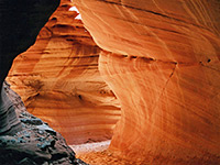
Peekaboo Canyon (Red Canyon)
★★★★★
★★★★★
4.5 miles, 450 feet
Half a mile of colorful, medium depth narrows along a minor tributary of Kanab Creek, surrounded by a rolling landscape of sand dunes and small hills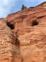
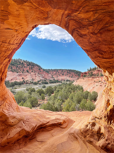
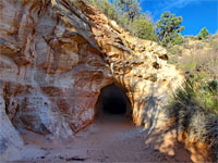
Sand Caves
★★★★★
★★★★★
0.4 miles, 80 feet
Inter-linked caverns near the top of a sandstone cliff along Three Lakes Canyon north of Kanab, formerly site of a sand mine; an easily-reached, photogenic location.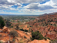
Squaw Trail
★★★★★
★★★★★
1.3 miles, 650 feet
Short but scenic hike up the Vermilion Cliffs; along a canyon then over ledges to the sandy plateau above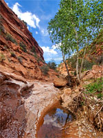
Tom's Canyon Trail
★★★★★
★★★★★
1.6 miles, 200 feet
Short route along a gradually narrowing canyon beneath the Vermilion Cliffs, ending at a secluded alcove with dripping waterfallKanab - Nearby Places
- Coral Pink Sand Dunes State Park (20 miles) - orange-pink dunes formed by erosion from the nearby Vermilion Cliffs
- Pipe Spring National Monument (20 miles) - 19th century Mormon fort
Kanab - Similar Places
- Mexican Hat, Utah - small village close to many spectacular landscapes
- Moab - major town in southeast Utah
All Contents © Copyright The American Southwest | Comments and Questions | Contribute | Affiliate Marketing Disclosure | Site Map