Squaw Trail
Short but scenic hike up the Vermilion Cliffs on the north edge of Kanab; along a canyon then over ledges to the sandy plateau above, with an optional extension to an alternative viewpoint
Length: 1.3 miles, to the plateau, or 2 miles to the final viewpoint
Elevation change: 650 feet
Difficulty: Moderate
Type: One way
Usage: Low to medium
Season: All year
Trailhead: The north end of N100E
Rating (1-5): ★★★★★
Elevation change: 650 feet
Difficulty: Moderate
Type: One way
Usage: Low to medium
Season: All year
Trailhead: The north end of N100E
Rating (1-5): ★★★★★

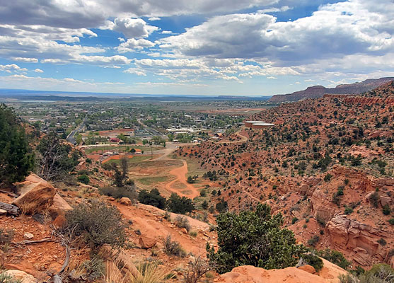
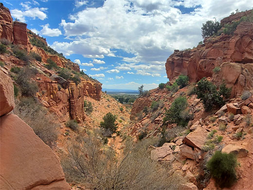
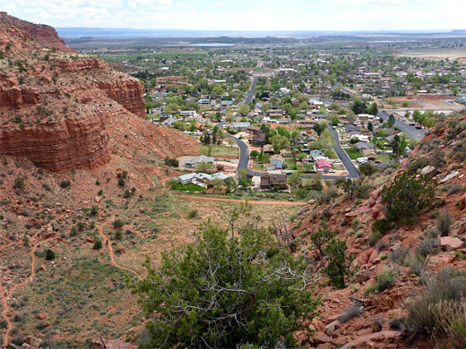
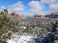
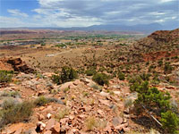
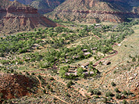
The closest hike to downtown Kanab is the Squaw Trail, which starts on the north end of N 100 E, at the foot of the Vermilion Cliffs, half a mile from US 89. The path follows a short canyon to its upper end then switchbacks up the red rock benches and ledges above, rounding a promontory, for a fine panorama over the town, and south across the Arizona Strip, before ascending further, reaching a sandy plateau after 1.3 miles and a climb of 650 feet. An optional extension, along an old vehicle track is another 0.7 miles, ending at an alternative overlook.
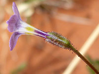
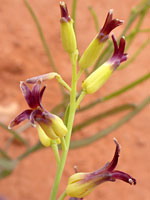
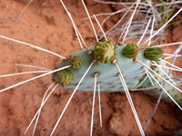
The hike then is short, not excessively steep, and it has good views, whilst passing a good selection of wildflower species including one rare cactus, opuntia pinkavae, Pinkava's pricklypear, which is found only in a narrow corridor between here and Fredonia.
The name of the route may soon be changed, to take account of modern sensitivities, to the Kanab City Trail, though the process seems yet to be finalised. Alternatively, this term may refer to a longer path, also involving the Connector, Cliff, Tom's Canyon and K-Hill trails, a total of 8 miles.
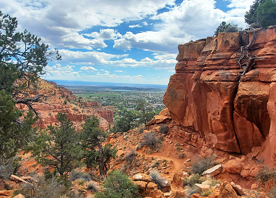
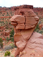
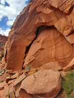
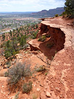
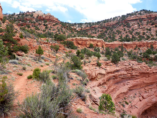
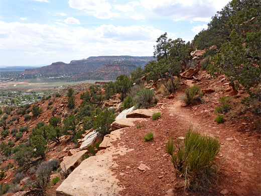
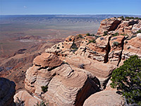
The hike starts from the Squaw Trailhead, on the north edge of Kanab next to Jacob Hamlin Park. That path crosses a grassy flat to a junction at the mouth of the canyon, next to a notice and map. One path cuts back southeast, along the base of the cliffs, while the Squaw Trail continues up the canyon a short distance to its end, and switchbacks up the east side, never climbing too steeply, running part of the way below a thicker layer of the red rock strata, which are from the Kayenta and Moenave formations. The trail becomes nearly level rounds a corner, the first good viewpoint of the town below, then traverses back above the canyon before turning south once again, out to the best viewpoint. Along this latter section is an unusual rock formation, a pinnacle resembling a bird, a chicken perhaps.
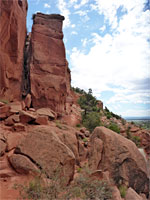
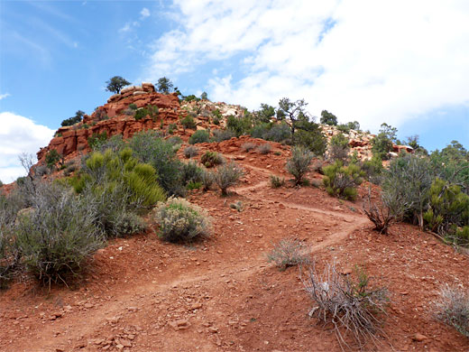
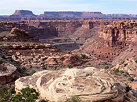
The path contours further across the cliffs, climbing gently, round almost 270 degrees before turning away from the rim, into more uneven terrain, zig-zagging up a ridge, into sandy terrain with scattered juniper and pinyon pines now nearly level, and reaches the junction with old vehicle track. This can be followed southwestwards 0.7 miles to another viewpoint on the rim of a protruding part of the cliffs, while in the other another direction the truck forms part of the Connector Trail, the next segment of the Kanab City Trail. Pinkava's pricklypear can be found in the sandy ground near the junction.
The hike then is short, not excessively steep, and it has good views, whilst passing a good selection of wildflower species including one rare cactus, opuntia pinkavae, Pinkava's pricklypear, which is found only in a narrow corridor between here and Fredonia.
The name of the route may soon be changed, to take account of modern sensitivities, to the Kanab City Trail, though the process seems yet to be finalised. Alternatively, this term may refer to a longer path, also involving the Connector, Cliff, Tom's Canyon and K-Hill trails, a total of 8 miles.
Start of the Trail
The hike starts from the Squaw Trailhead, on the north edge of Kanab next to Jacob Hamlin Park. That path crosses a grassy flat to a junction at the mouth of the canyon, next to a notice and map. One path cuts back southeast, along the base of the cliffs, while the Squaw Trail continues up the canyon a short distance to its end, and switchbacks up the east side, never climbing too steeply, running part of the way below a thicker layer of the red rock strata, which are from the Kayenta and Moenave formations. The trail becomes nearly level rounds a corner, the first good viewpoint of the town below, then traverses back above the canyon before turning south once again, out to the best viewpoint. Along this latter section is an unusual rock formation, a pinnacle resembling a bird, a chicken perhaps.
The Plateau
The path contours further across the cliffs, climbing gently, round almost 270 degrees before turning away from the rim, into more uneven terrain, zig-zagging up a ridge, into sandy terrain with scattered juniper and pinyon pines now nearly level, and reaches the junction with old vehicle track. This can be followed southwestwards 0.7 miles to another viewpoint on the rim of a protruding part of the cliffs, while in the other another direction the truck forms part of the Connector Trail, the next segment of the Kanab City Trail. Pinkava's pricklypear can be found in the sandy ground near the junction.
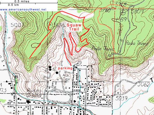
Map of the Squaw Trail
Squaw Trail - Similar Hikes
All Contents © Copyright The American Southwest | Comments and Questions | Contribute | Affiliate Marketing Disclosure | Site Map