Table of Contents
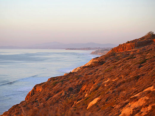
All other beaches in the western half of the US face the Pacific Ocean, and the most well-known are in California. Starting in the south, San Diego and its neighboring cities to the north have much sandy shoreline, but only two places have remained largely undeveloped and natural; these are Cabrillo National Monument at the southern tip of Point Loma and Torrey Pines State Reserve north of La Jolla, which protects several rare plant species, and has a pleasant mixture of beaches, bluffs and woodland scenery. Other stretches are still scenic, of course, despite the adjacent development, such as the La Jolla Tide Pools.
After a brief inaccessible stretch through Pendleton Marine Corps Base, the next 80 miles of the Pacific coast is within Los Angeles and its suburbs, but natural scenery returns at Santa Monica Mountains National Recreation Area, featuring grassy hillsides, woody canyons, ranches and many sandy beaches, some also part of state parks. The NRA gives way to another more inhabited stretch of coastline through such towns as Oxnard, Ventura and Santa Barbara, before the coast becomes more rugged and cliff-lined. Again part is reserved for the military but there are a number scenic destinations, mostly around the town of Morro Bay, such as Estero Bluffs, Gaviota, Harmony Headlands, Montaña de Oro and Morro Bay - all are state parks.
After a brief inaccessible stretch through Pendleton Marine Corps Base, the next 80 miles of the Pacific coast is within Los Angeles and its suburbs, but natural scenery returns at Santa Monica Mountains National Recreation Area, featuring grassy hillsides, woody canyons, ranches and many sandy beaches, some also part of state parks. The NRA gives way to another more inhabited stretch of coastline through such towns as Oxnard, Ventura and Santa Barbara, before the coast becomes more rugged and cliff-lined. Again part is reserved for the military but there are a number scenic destinations, mostly around the town of Morro Bay, such as Estero Bluffs, Gaviota, Harmony Headlands, Montaña de Oro and Morro Bay - all are state parks.
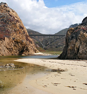
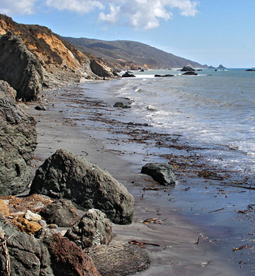
North of Morro Bay, Highway 1 encounters almost no towns for the next 120 miles, as it traverses the full length of Big Sur, the most spectacular portion of California's southern Pacific coast. The highway passes sheer cliffs, isolated rocky coves, tidepools and sandy beaches, most completely empty and undeveloped, plus grassy hillsides and inland redwood forests. Along the way are a number of state parks including (south to north):
- Julia Pfeiffer Burns State Park - wooded hills sloping down to cliffs and beautiful beaches, one with a coastal waterfall
- Andrew Molera State Park - miles of unspoilt sandy beaches, coastal redwoods, rocky bluffs, grassland and the Big Sur River
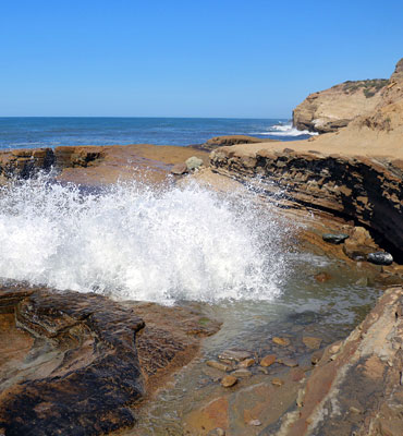
- Garrapata State Park - promontories with tidepools, beaches and eroded rock formations, plus a lagoon
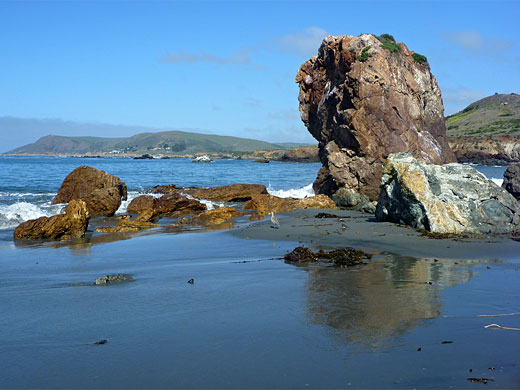
- Point Lobos State Reserve - one of the most beautiful places along the California coast; rocky headland lined by tiny beaches and coves, home to a great variety of plants, birds and marine animals
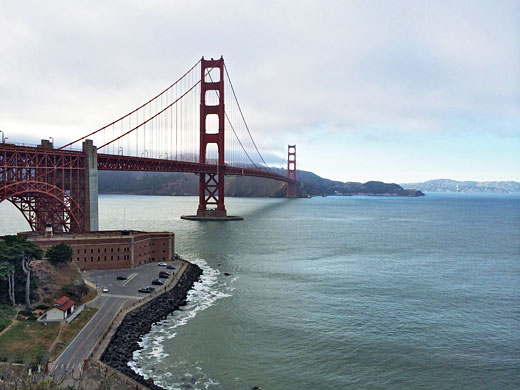
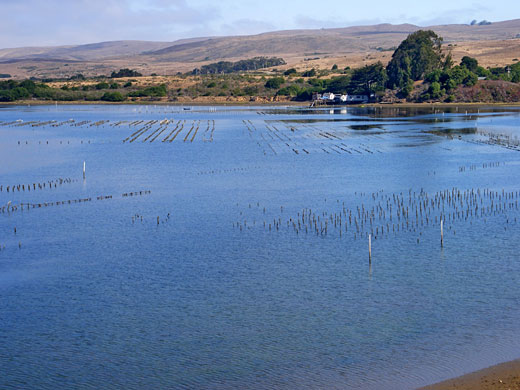
Big Sur ends at the pretty town of Carmel which leads to the larger settlements along Monterey Bay, including Monterey, Marina, Watsonville and Santa Cruz. Quieter roads extend further north along the coast to San Francisco, past more redwood forests and to the densely habited land at the tip of the peninsula, though even here the shoreline has long sandy stretches and a number of historic sites, many contained within Golden Gate National Recreation Area, which continues to Marin Peninsula on the north side of Golden Gate (the narrow entrance to San Francisco Bay). This large preserve adjoins another - Point Reyes National Seashore, an isolated, triangular peninsula bordered by miles of windswept sands backed either by cliffs or dunes. The promontory sits on the far side of the San Andreas Fault, part of which is submerged forming a long, narrow inlet (Tomales Bay).
After a short, less accessible section around Bodega Bay, the coast road stays close to the Pacific Ocean for 140 miles through Sonoma and Mendocino counties, past various smaller beach-based preserves and parks such as (from south to north):
- Sonoma Coast State Park - 15 miles of wide beaches, tall cliffs and coastal grasslands, relatively developed and quite frequently visited
- Salt Point State Park - scenic and unspoilt section of the north California coast, with the added attraction of unusual, eroded orange/grey sandstone (tafoni)
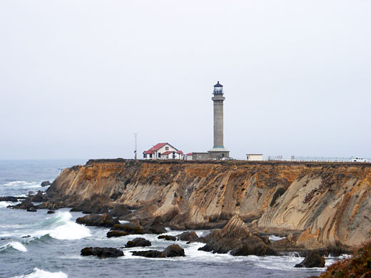
- Point Arena - headland formed by steeply-angled sandstone, eroded into striking formations, home to a historic lighthouse
- Mendocino Headlands State Park - grassy peninsula with many wildflowers, bordeed by cliffs, sea stacks and sea caves
- Point Cabrillo Light Station State Historic Park - small area of bluffs lined by low cliffs, and a 1908 lighthouse
- MacKerricher State Park - varied landscapes of forest, wetlands, sand dunes, beaches, tidepools and cliffs, bordering the north side of Fort Bragg
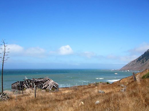
Highway 1 turns inland a little way north of Fort Bragg to avoid a long, cliff-bound section of the shoreline known as the Lost Coast, where in some places the 3,000 foot peaks of the King Range slope very steeply down to sea level in just a couple of miles. Narrow, winding roads do reach the ocean in three places (Shelter Cove, Mattole Point and Cape Mendocino) and all this area is especially scenic, if very little visited.
The main coast highway, now US 101, returns to the ocean at Eureka for the final 100 miles to Crescent City and the Oregon stateline - this stretch is known as the Redwood Coast, as just inland are the most extensive old-growth redwood forests in the state, most contained within Redwood National Park and its three associated state parks (Del Norte Coast Redwoods, Jedediah Smith Redwoods and Prairie Creek Redwoods). Besides the huge trees this area also has many fine beaches, some with resident elk. Other, smaller scenic areas along the Redwood Coast include Trinidad State Beach, Patricks Point State Park and Humboldt Lagoons State Park.
In Oregon, the southern 100 miles of the Pacific coast is predominantly rocky, characterized by sea stacks, tiny islands, coves, caves, arches and small beaches; almost all is quite unspoilt yet easy and free to access in many places. Specific locations, from south to north, include the following:
- Harris Beach State Park and Chetco Point - scenic coastline in the far south, near Brookings
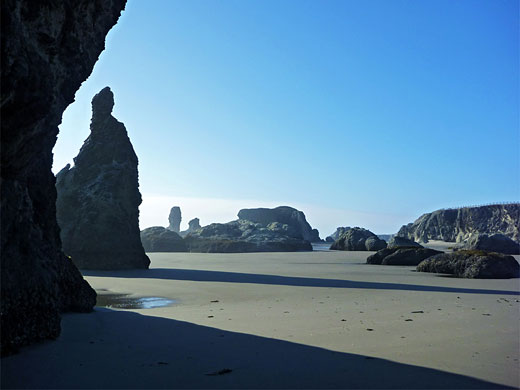
- Samuel H Boardman State Scenic Corridor - 11 miles of cliffs, beaches, stacks and arches
- Crook Point and Mack Reef - empty beaches, offshore rocks and an iconic arch
- Cape Sebastian State Scenic Corridor - high, sheer sided, wind-swept, wooded promontory
- Cape Sebastian State Scenic Corridor - high, sheer sided, wind-swept, wooded promontory
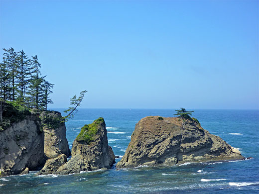
- Sisters Rocks State Park - three huge rocks, beside grey sand beaches
- Floras Lake State Park and Blacklock Point - remote, wooded stretch of the coastline
- Coquille Point and Face Rock Beach - extensive sands and large, isolated rocks, near Bandon
- Cape Arago State Park - three pretty coves, and some offshore rocks
- Shore Acres State Park - upturned sandstone layers and amazing eroded formations
- Sunset Bay State Park - secluded bays and spectacular reefs
Oregon's coast north of Sunset Bay becomes temporarily more sandy, and a 40 mile section is contained within Oregon Dunes National Recreation Area, also featuring forests, lagoons and slow-moving creeks.
View all photographs of beaches.
View all photographs of beaches.
All Contents © Copyright The American Southwest | Comments and Questions | Contribute | Affiliate Marketing Disclosure | Site Map