Highlights:
Largest protected area along the Big Sur coast - miles of unspoilt sandy beaches, coastal redwoods, rocky bluffs, grassland and the Big Sur River
Nearby town:
Carmel, 21 miles
Management:
Location:
Seasons:
All year, though winters may be cold and foggy
Rating (1-5):
★★★★★

Andrew Molera SP is part of the California South Coast itinerary
Named after a rancher who once owned the land along this part of the Pacific coast, Andrew Molera State Park is the largest Big Sur preserve but most is undeveloped, and there are few facilities. Andrew was a dairy farmer who died in 1931 at the young age of 34, when the estate passed to his sister Frances and remained in her care until being donated to the state of California following her death, in 1968.
The eight square miles contains the lower end of the Big Sur River, rolling hills either side of Highway 1, a remote section of beach, redwood groves, coastal bluffs, and the west end of Pfeiffer Ridge. This high, wooded hill slopes down very steeply on the oceanside forcing Route 101 to veer inland for a while, following the river valley, so the beaches in the state park are some of the most inaccessible on the central California coast.
The eight square miles contains the lower end of the Big Sur River, rolling hills either side of Highway 1, a remote section of beach, redwood groves, coastal bluffs, and the west end of Pfeiffer Ridge. This high, wooded hill slopes down very steeply on the oceanside forcing Route 101 to veer inland for a while, following the river valley, so the beaches in the state park are some of the most inaccessible on the central California coast.
Andrew Molera Table of Contents
- Entrance, from Hwy 1
- The beach, and shoreline trails
- Other trails, inland
- Tours of Big Sur
- Nearby places
- Similar places
Entry
The entrance to Andrew Molera State Park is on the west side of the highway - 3 miles south of the side road to Point Sur Lighthouse and 22 miles from Carmel. It is opposite the south end of the Coast Road, an unpaved, little used track that used to be the main route along this part of coast prior to completion of Highway 1 and its graceful bridges over the deep valleys of Bixby Creek and the Little Sur River. At the park, a short side road leads to a fee station, a parking area with information boards, a field center for the Ventana Wildlife Society, and a stable - base of Molera Horseback Tours, a commercial operation offering rides to the nearby hills, woods and beaches. A 24 site walk-in campsite is located nearby. As with the other parks along the coast which charge for entry, admission is free for pedestrians, so parking at one of several laybys along Highway 101 either side of the turn-off and walking 1/4 mile will save the entry charge (2024) of $10.
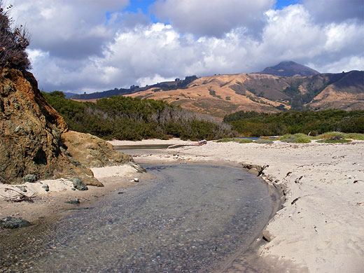
The Beach
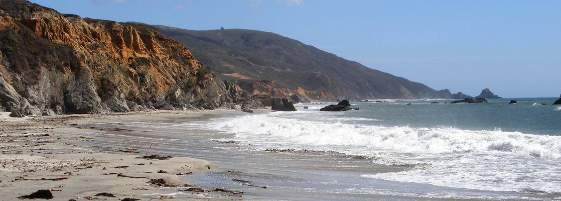
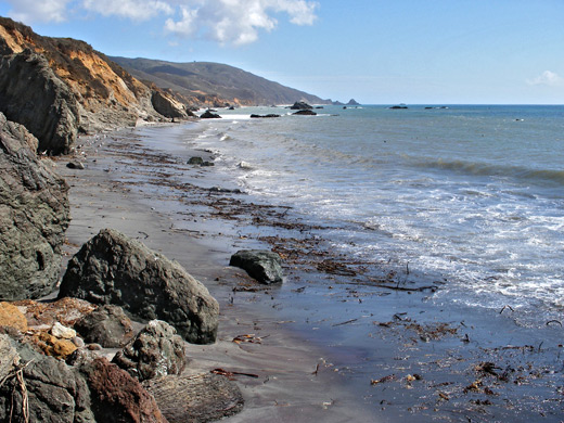
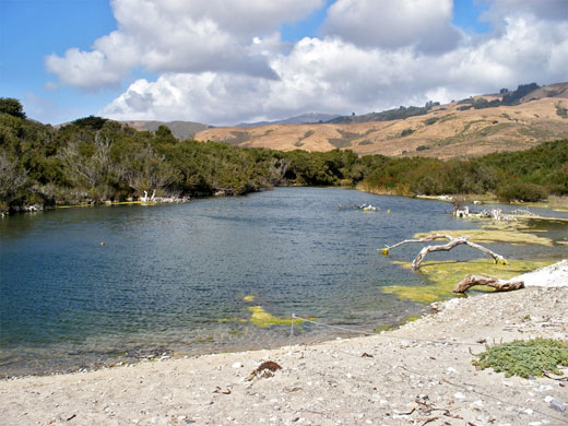
The ocean at this point is a mile away across a strip of flat, wooded land around the Big Sur River. From the carpark, two parallel footpaths lead to the coast, one following the river, the other (the Beach Trail) crossing it on a bouncy wooden bridge (removed in winter), passing through patches of trees and meadowland, then alongside some bushy sand dunes before ending at the beach. Horses and bicycles are allowed on both paths. The beach is narrowish, and quite sandy at the west end, near the river outlet, where the waters spread out forming a pretty coastal lagoon. On the far side, the cliffs rise to a sandy bluff, reachable by the other path (the Headlands Trail), or by wading across the river and climbing up the hillside. Quite a few people walk to the beach but not so many continue further south, where the sands stretch for several miles, accompanied by pebbles, driftwood and washed-up seaweed. This part of the coast is wild and scenic, though not as good for sunbathing as the area near the river since most is rather narrow, and the adjoining rocks harbor quite a few sand files. The cliffs rise gradually higher, and the coastline remains similar for 4 miles as far as Pfeiffer Beach, which is reachable by a 2 mile unpaved road starting from near Pfeiffer Big Sur State Park. Several rocky promontories prevent walking all the way to Pfeiffer Beach from the mouth of the Big Sur River.
Other Trails
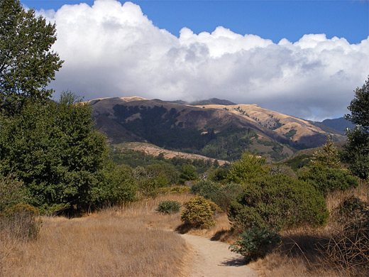
Andrew Molera State Park has around 20 miles of footpaths, mostly along the wooded valley of the Big Sur River. The best overall views are from the Ridge Trail, starting by the beach near the end of the river. This good, wide path climbs up Pfeiffer Ridge for 3 miles, gaining over 1,000 feet in elevation, to a viewpoint next to the park boundary. The return journey can be along the Panorama Trail then the Bluffs Trail, a route which descends towards the coast and follows above the cliffs back to the river. On the far side of the highway, the 1.9 mile East Molera Trail ascends even further, to a small redwood grove on a summit at 1,549 feet, from where many square miles of the hills and the ocean are visible.
Big Sur Tours
Guided tours of the coast.
Andrew Molera - Nearby Places
- Garrapata State Park (15 miles) - scenic coastline with beaches and rocks, plus part of the Santa Lucia Mountain foothills
- Julia Pfeiffer Burns State Park (15 miles) - Big Sur park that includes California's only coastal waterfall
- Point Lobos State Natural Reserve (19 miles) - famous promontory at the north end of Big Sur
Andrew Molera - Similar Places
- Lost Coast - wildest part of California's Pacific shoreline
- Point Reyes National Seashore - isolated peninsula north of San Francisco
- Torrey Pines State Reserve - bluffs and beaches near San Diego
- Trinidad State Beach - empty, sandy beach in far north California
All Contents © Copyright The American Southwest | Comments and Questions | Contribute | Affiliate Marketing Disclosure | Site Map