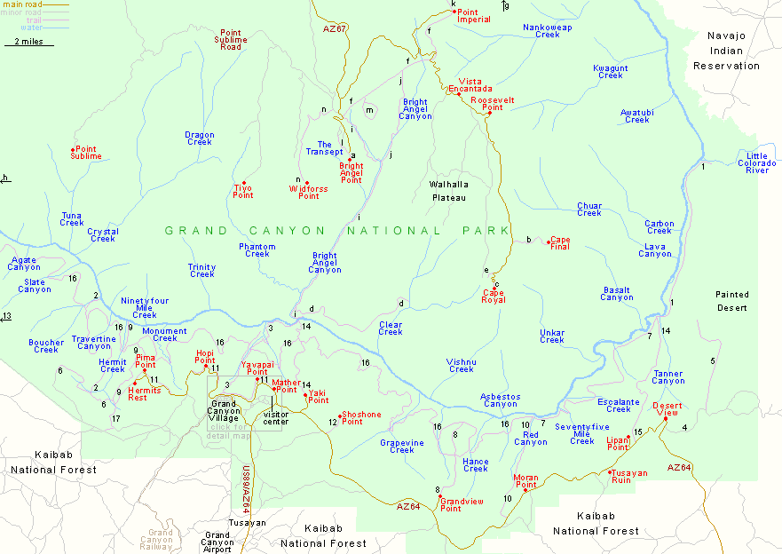
Map of North Rim and South Rim, Grand Canyon National Park
Arizona > Grand Canyon National Park > Overview Map > Detail Map
South Rim Trails
|
North Rim Trails
|
Grand Canyon overview map
Grand Canyon Village map
Grand Canyon - overview (184 kb)
Grand Canyon Village (976 kb)
North Rim (664 kb)
All Contents © Copyright The American Southwest | Comments and Questions | Contribute | Affiliate Marketing Disclosure | Site Map