Highlights:
World famous red rock buttes surrounded by sandy plains; the epitome of a Western landscape, featured in many movies and commercials. Some can be seen from overlooks along US 163 but most is part of a Navajo Tribal Park, viewed by the 17 mile Valley Drive
Nearby town:
Kayenta, 23 miles
Management:
Navajo Reservation
Location:
36.982, -110.112 (Tribal Park)
Seasons:
All year
Rating (1-5):
★★★★★
Weather:


Monument Valley is part of the Colorado River, Grand Circle and Indian Lands itineraries
Featured Hotel
Hampton Inn of Monument Valley
 The only chain hotel in Kayenta, 20 miles south of Monument Valley; a three floor, adobe-style property with outdoor pool and gardens
Check Rates
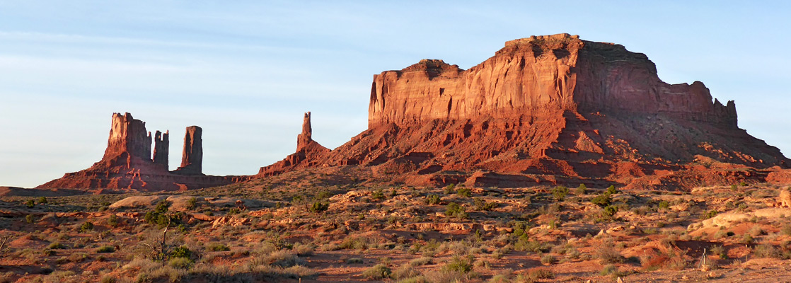
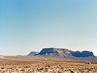
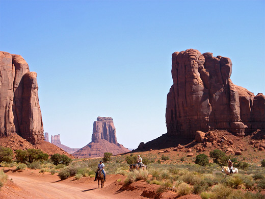
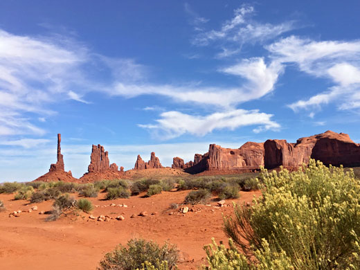
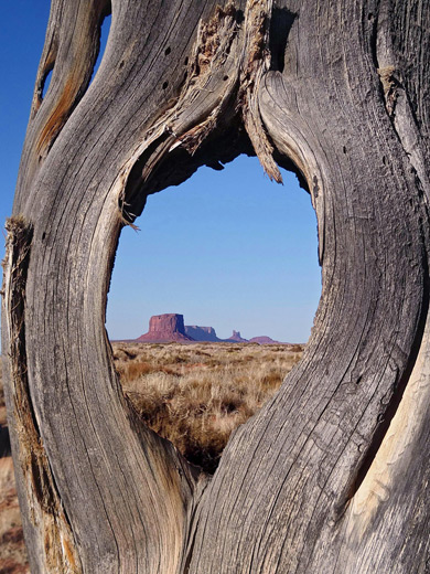
Monument Valley provides perhaps the most enduring and definitive images of the American West. The isolated red mesas and buttes surrounded by empty, sandy desert have been filmed and photographed countless times over the years for movies, adverts and holiday brochures.
Because of this, the area may seem quite familiar, even on a first visit, but it is soon evident that the natural colors really are as bright and deep as those in all the pictures.
The valley is not a valley in the conventional sense, but rather a wide flat, sometimes desolate landscape, interrupted by the crumbling formations rising hundreds of feet into the air, the last remnants of the sandstone layers that once covered the entire region.
Monument Valley Table of Contents
- Maps of the valley
- Photographs
- Tours of Monument Valley
- Scenic drives
- Goulding; Navajo village providing visitor facilities
- Approach to the valley, aling US 163
- Monument Valley Navajo Tribal Park
- Monument Valley Drive; main road through the formations
- Hotels
- Hiking in Monument Valley, including the 3 mile Wildcat Trail
- Nearby places
- Similar places
Location
Monument Valley Maps: Overview, Valley Drive.
Photographs
Monument Valley, Valley Drive.
Monument Valley Tours
Explore the valley with Navajo guides; the main formations, and the backcountry. Roads are often rough, so for some, a guided tour is the best way to experience the scenery.
Monument Valley Scenic Drives
17 mile dirt road past the best formations, within the Navajo Tribal Park, with 11 major overlooks. Usually accessible to regular vehicles, including small RVs
Access to a rarely-visited region on the north side of the valley, where the land slopes down gently towards Lake Powell
Goulding
The area lies entirely within the Navajo Indian Reservation on the Utah/Arizona border; the state line passes through the most famous landmarks, which are concentrated around the border near the small settlement of Goulding - this was established in 1923 as a trading post, and provides basic visitor services. A paved side road heads past the village to the northwest beneath Oljeto Mesa and has views of other less-visited parts of the valley, then another route (the unpaved Piute Farms Road) continues all the way to the shores of the San Juan branch of Lake Powell.
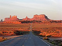
Approach to Monument Valley
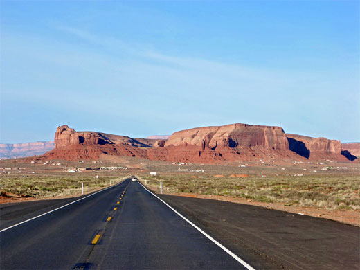
There is only one main road through Monument Valley, US 163, which links Kayenta, AZ with US 191 in Utah. The stretch approaching the AZ/UT border from the north gives the most famous image of the valley, and possibly of the whole Southwest - a long straight empty road leads across flat desert towards the 1,000 foot high stark red cliffs on the horizon, curving away just in front. The highway cuts through the mesas at Monument Pass, near which several dirt tracks leave both east and west and criss-cross the red sandy landscape, offering a more close up appreciation of the rock formations, although these roads lead to Navajo residences so some discretion is necessary when visiting. This is also a good area for hiking, though there are no official trails. One possible route is around the group of formations on the southeast side of Monument Pass - a cross country trip of about 4 miles that involves traversing various small washes, cliffs and mesas.
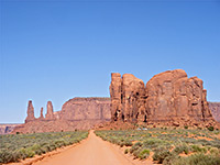
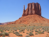
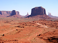
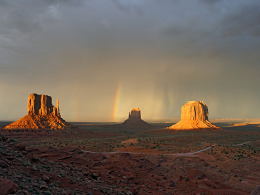
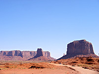
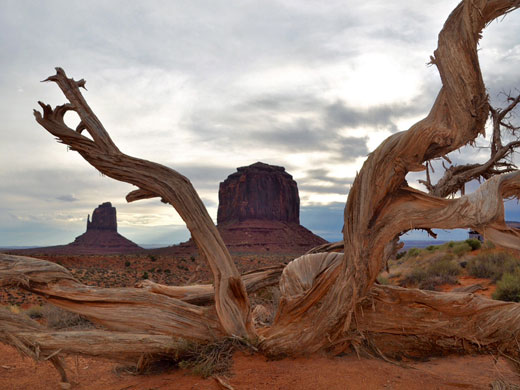
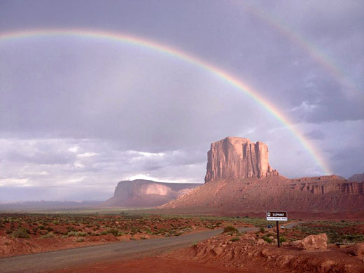
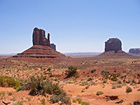
Monument Valley Navajo Tribal Park
Although much can be appreciated from the main road, a lot more of the landscape is hidden from view behind long straight cliffs (the Mitchell and Wetherill Mesas), east of the road on the Arizona side (see overview map). This is contained within the Monument Valley Navajo Tribal Park (entrance fees $8 per person in 2023), reached along a short side road directly opposite the turn-off to Goulding. From the visitor center at Lookout Point there are good views across three of the valley's most photographed peaks - East and West Mitten Buttes, and Merrick Butte. The park has only one hiking path, the 3.2 mile Wildcat Trail which starts just south of the visitor center and loops around West Mitten Butte. Away from the park are other scenic backcountry areas, including Mystery Valley, on the opposite (west) side of Wetherill Mesa. This may be visited on half-day tours starting at Gouldings Lodge; highlighs are arches (Skull, Honeymoon and Pine Tree), pictographs, petroglyphs and Anasazi ruins.
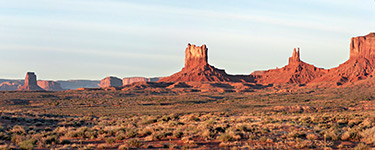
Monument Valley Drive
The view from Lookout Point is spectacular enough, but most of the Navajo Tribal Park can only be seen from the Valley Drive, a 17 mile dirt road which starts at the visitor center and heads southeast amongst the towering cliffs and mesas, one of the most famous being Totem Pole, an oft-photographed spire of rock 450 feet high but only a few meters wide. The road is dusty, steep in a couple of places and rather uneven, but does not need 4WD - unless after recent heavy rain, the journey is suitable for the majority of family cars, and small to medium sized RVs, though the surface is perhaps not improved too much in order to increase business for the many Navajo guides and 4WD jeep rental outfits, which wait expectantly by the visitor center - typical prices are around $75 for a 2 hour trip (though cheaper tours are available from Gouldings Lodge). As well as eroded rocks, this area also has ancient cave and cliff dwellings, natural arches and petroglyphs, all generally away from the Valley Drive at more isolated locations and viewable only as part of guided tours.
The Valley Drive passes 11 numbered stops at the most scenic places, and a typical journey around the loop takes at least 2 hours. Tourists are not allowed to hike away from the road closer towards any of the formations, but even so the trip is very enjoyable.
Monument Valley Hotels
Accommodation in the center of Monument Valley is limited to Gouldings Lodge and the View Hotel in the tribal park - both rather expensive - so most people prefer to stay 23 miles south in Kayenta, AZ, a town with only one chain hotel, Hampton Inn, following the closure of Holiday Inn Kayenta and Best Western Wetherill Inn.
Monument Valley Hiking
Wildcat Trail
★★★★★
★★★★★
3.2 miles, 350 feet
The only official trail in the valley; a loop all around West Mitten Butte, across sand dunes and along dry washesMonument Valley - Nearby Places
- Canyon de Chelly National Monument (116 miles) - deep canyon containing many ancient cliff dwellings
- Mexican Hat (21 miles) - small town near many spectacular landscapes
Monument Valley - Similar Places
- Island in the Sky, Canyonlands National Park - buttes and mesas around a high plateau
- Valley of the Gods, near Mexican Hat - similar landscape of stark red rock formations
All Contents © Copyright The American Southwest | Comments and Questions | Contribute | Affiliate Marketing Disclosure | Site Map