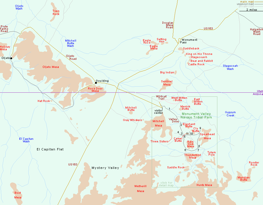
Map of the main formations in Monument Valley, most of which are within the Navajo Tribal Park, east of US 163 and hidden from it by the Mitchell and Wetherill Mesas. All of the tribal park is in Arizona, though there are many other formations in Utah, including the famous straight road with buttes on the horizon (Monument Pass).
Valley Drive detail map
Numbers indicate the main stops along the Valley Drive - the scenic road through Monument Valley Navajo Tribal Park:
Valley Drive detail map
Numbers indicate the main stops along the Valley Drive - the scenic road through Monument Valley Navajo Tribal Park:
- The Mittens and Merrick Butte
- Elephant Butte
- Three Sisters
- John Ford's Point
- Camel Butte
- The Hub
- Totem Pole and Yei Bi Chei
- Totem Pole and Sand Springs
- Artist's Point
- North Window
- The Thumb
All Contents © Copyright The American Southwest | Comments and Questions | Contribute | Affiliate Marketing Disclosure | Site Map