Highlights:
Very remote and spectacular wilderness area alongside the Rio Grande, subject to extreme heat most of the year. A mix of desert, canyon and mountain landscapes, with many and varied desert plants and wildlife. Park is crossed by a few roads and many trails; main regions are Chisos Mountains and the north, the southeast and the southwest
Nearby town:
Alpine, 98 miles
Management:
Location:
29.328, -103.205 (Panther Junction)
Seasons:
All year, though temperatures are very hot in summer
Rating (1-5):
★★★★★

Big Bend is part of the West and Central Texas itinerary
Big Bend National Park - Regions
Dramatic mountain range at the center of the park; cooler conditions in summer, and many trails
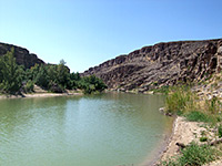
Arid region of low desert, and two large canyons along the Rio Grande (Boquillas and Marsical), plus the visitor center of Rio Grande Village
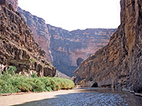
Colorful badlands, desert plains, small ravines, the most scenic river canyon (Santa Elena), and the 30 mile Ross Maxwell Scenic Drive
Few US national parks are as remote as Big Bend - the two main northern entrances are both over an hour's drive from any mainstream town, and the nearest major city is El Paso, 300 miles west. Yet despite the isolation, visitation has been steadily increasing in recent years as more people learn about the fantastic mixture of desert, mountain and river canyon scenery within and around the park.
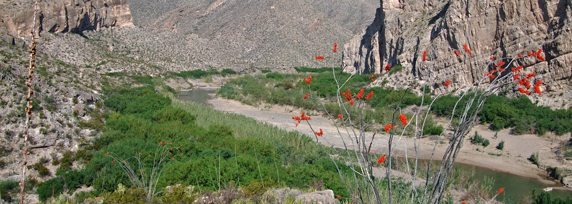
The dominant feature of Big Bend National Park is the Rio Grande, the course of which runs generally northwest from the Gulf of Mexico but takes a long diversion south of several mountain ranges before turning back north towards New Mexico; the national park sits in the lower part of this 'big bend', adjacent to the international border. Three major canyons fall within the park boundary; Santa Elena, Marsical and Boquillas, between which the river flows through desert land that is wild and largely unreachable.
North of the Rio Grande the park is mostly arid and rocky with only limited access by paved roads, a part of the great Chihuahuan Desert that extends across much of north Mexico into the southwest corner of Texas. Plant life is particularly varied and plentiful, with over 60 species of cacti plus many other spiky plants. Landscape features include narrow canyons, colorful badlands, eroded rock formations, sand dunes, desert plains, dry washes and oases. Two major roads cross the desert areas of the park, one heading southwest, the other southeast.
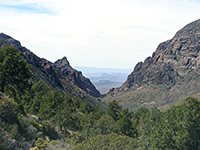
One prominent exception to the arid desert, and for some people the main reason to visit Big Bend National Park, are the Chisos Mountains, a huge, angular range of cliffs and rocky peaks rising to 7,825 feet. In these tree-covered slopes the hot desert lowlands are far away and many trails give access to a cool, sheltered world, inhabitants of which include black bears and mountain lions. Facilities are concentrated in Chisos Basin, sheltered on all sides by high cliffs, and include a lodge, restaurant, gift shop and campground.
The dominant feature of Big Bend National Park is the Rio Grande, the course of which runs generally northwest from the Gulf of Mexico but takes a long diversion south of several mountain ranges before turning back north towards New Mexico; the national park sits in the lower part of this 'big bend', adjacent to the international border. Three major canyons fall within the park boundary; Santa Elena, Marsical and Boquillas, between which the river flows through desert land that is wild and largely unreachable.
North of the Rio Grande the park is mostly arid and rocky with only limited access by paved roads, a part of the great Chihuahuan Desert that extends across much of north Mexico into the southwest corner of Texas. Plant life is particularly varied and plentiful, with over 60 species of cacti plus many other spiky plants. Landscape features include narrow canyons, colorful badlands, eroded rock formations, sand dunes, desert plains, dry washes and oases. Two major roads cross the desert areas of the park, one heading southwest, the other southeast.
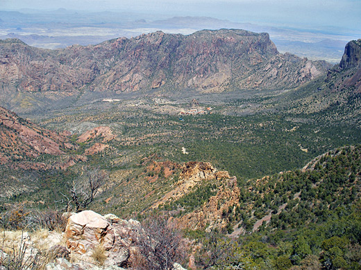
One prominent exception to the arid desert, and for some people the main reason to visit Big Bend National Park, are the Chisos Mountains, a huge, angular range of cliffs and rocky peaks rising to 7,825 feet. In these tree-covered slopes the hot desert lowlands are far away and many trails give access to a cool, sheltered world, inhabitants of which include black bears and mountain lions. Facilities are concentrated in Chisos Basin, sheltered on all sides by high cliffs, and include a lodge, restaurant, gift shop and campground.
Big Bend Table of Contents
- Regions; north, southeast, southwest
- Map of the park
- Photographs
- Hiking in Big Bend NP
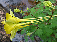
- Wildflowers of Big Bend NP
- Big Bend rafting
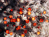
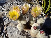
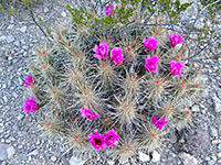
- Cacti in Big Bend NP
- Big Bend Hotels
Location
Map of Big Bend National Park.
Photographs
Blue Creek Canyon, Chisos Mountains, Dog Canyon and Devil's Den, Emory Peak, Marufo Vega Trail, the Southeast, the Southwest.
All Big Bend photographs.
Big Bend Trails
All trails in Big Bend NP
Featured Big Bend Trails
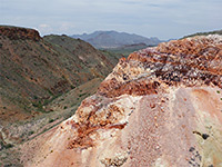
Apache Canyon
★★★★★
★★★★★
3.8 miles, 230 feet
Rarely traveled path across open terrain to an old corral, a ruined cabin and a spectacular outcrop of colorful rocks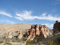
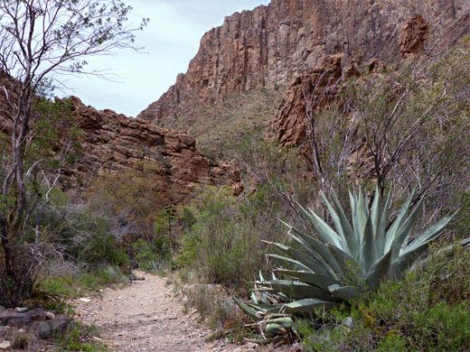
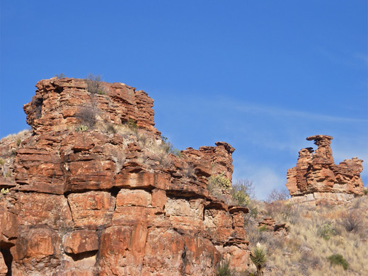
Blue Creek Canyon
★★★★★
★★★★★
1.5 miles, 240 feet
A disused but well preserved ranch building and a group of pointed red rock formations are the two attractions lower section of the trail along Blue Creek Canyon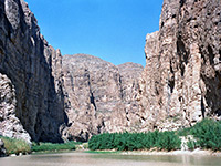
Boquillas Canyon
★★★★★
★★★★★
0.7 miles, 40 feet
The entrance to Boquillas Canyon, one of the three great river gorges within Big Bend National Park, can be reached by a short trail that climbs over a ridge then passes through a riparian area close to the Rio Grande, ending at a pebbly beach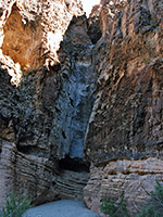
Burro Mesa Pouroff
★★★★★
★★★★★
0.5 miles, 50 feet
This well used path to a narrow pouroff crosses sandy ground then follows a dry wash to the base of the cliffs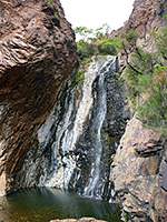
Cattail Falls
★★★★★
★★★★★
1.5 miles, 360 feet
Beautiful, hidden waterfall above a series of pools, in a wooded canyon on the west side of the Chisos Mountains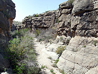
Dog Canyon and Devil's Den
★★★★★
★★★★★
8 miles, 300 feet (loop)
Paths across flat, bushy desert to two contrasting ravines, one a narrow gorge through white limestone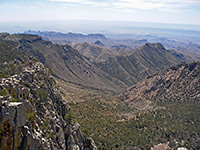
Emory Peak
★★★★★
★★★★★
4.5 miles, 2450 feet
The highest mountain in the national park, reached by well used trails beginning in Chisos Basin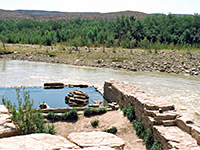
Hot Springs
★★★★★
★★★★★
3 miles, 250 feet
The Hot Springs alongside the Rio Grande can be reached either by a gravel track (not for RVs), leaving Hwy 118 a few miles from Rio Grande Village, or by a pleasant 3 mile trail, crossing desert land with many and varied cacti, and frequent views of the river gorge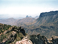
Lost Mine
★★★★★
★★★★★
2.4 miles, 1200 feet
From a pull-out along the Chisos Basin Road near Panther Pass, this often busy trail climbs a tree-covered hillside and a bushy ravine to a narrow ridge separating the upper ends of Juniper Canyon and Pine Canyon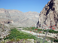
Marufo Vega
★★★★★
★★★★★
14 miles, 1000 feet
Perhaps the most difficult day hike in Big Bend, the Marufo Vega loop trail crosses hostile, mountainous terrain, exceedingly hot and dry during the summer months, and descends steeply down a canyon to the banks of the Rio Grande
Mule Ears
★★★★★
★★★★★
1.9 miles, 100 feet
The Mule Ears Spring trail winds over typical Chihuahaun Desert land of small peaks, sandy flats and dry washes, to a cottonwood tree-lined oasis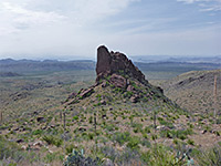
Oak Spring
★★★★★
★★★★★
2.3 miles, 950 feet
Connecting path between the Window at the edge of the Chisos Mountains, and the desert lowlands to the westSanta Elena Canyon
★★★★★
★★★★★
0.8 miles, 40 feet
Santa Elena is most spectacular canyon in the national park, formed as the Rio Grande cuts through the 1,200 foot cliffs of Sierra Ponce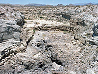
Tuff Canyon
★★★★★
★★★★★
0.5 miles, level
Short, narrow, cliff-lined ravine through pyroclastic tuff, viewed from three overlooks along paths on the rim, or from below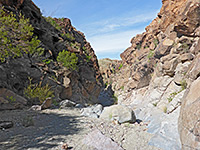
Upper Burro Mesa Pouroff
★★★★★
★★★★★
1.8 miles, 200 feet
Route along a shallow valley, and later an enclosed and rocky canyon, to the brink of a high dryfall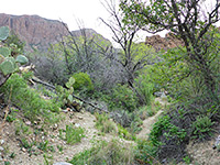
Ward Spring
★★★★★
★★★★★
1.6 miles, 450 feet
Lightly used trail, mostly across open terrain, to an overgrown spring in a shallow ravine. Many types of cacti and wildflowers along the way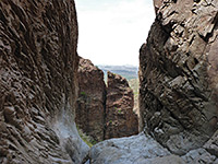
Window
★★★★★
★★★★★
2.2 miles, 560 feet
Popular path in the Chisos Mountains, down an increasingly deep and overgrown ravine to a narrow rocky section with small pools, preceding a big pour-offBig Bend Rafting
Explore the Rio Grande canyons! By raft, canoe or kayak
Big Bend Wildflowers
Big Bend Cacti
Photos and descriptions of desert plants
Big Bend Hotels
Hotels in the Big Bend region are few and far between. Small places like Presidio and Lajitas have a few motels, but better standard chain hotels are found only in towns much further away: Alpine (98 miles), Fort Stockton (125 miles), Pecos (177 miles) and Van Horn (198 miles) - distances are to Panther Junction.
All Contents © Copyright The American Southwest | Comments and Questions | Contribute | Affiliate Marketing Disclosure | Site Map