Chisos Mountains and the North, Big Bend National Park
Texas > Big Bend National Park > Chisos Mountains and the North
Highlights:
Dramatic mountain range at the center of Big Bend National Park, with significantly cooler conditions compared to the desert lowlands. Crossed by many trails. Reached from the north by US 385, which passes other features of interest including the narrow canyons of Dog Canyon and Devil's Den

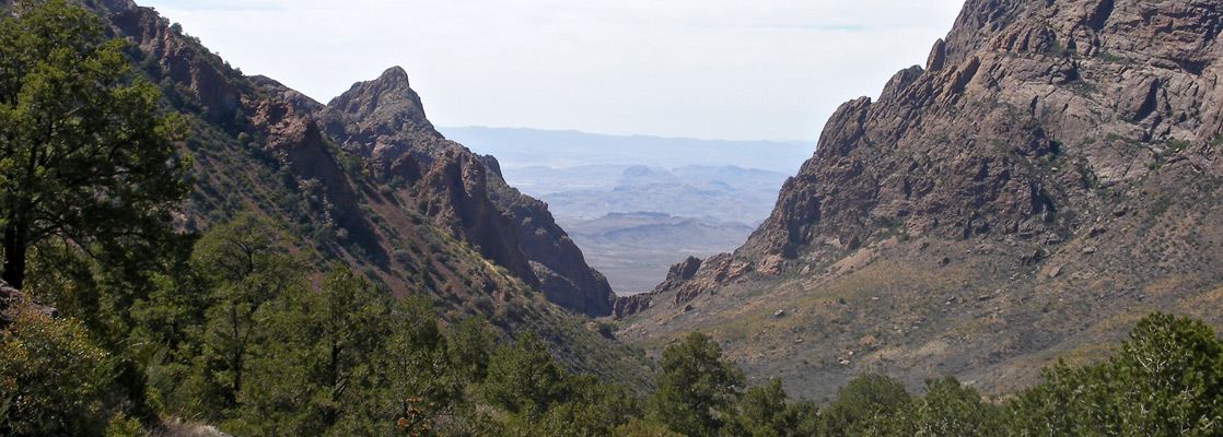
The hazy peaks of the Chisos Mountains in the center of Big Bend National Park first come into view once through the northern entrance along US 385 at Persimmon Gap - the one breach in the high Santiago Mountains that form a natural barrier across the desert.
A ranger station, visitor center and picnic area are located next to the road in the Santiago mountain foothills, still high enough to overlook several miles of the highway to the south, as it crosses a wide desert plain flanked by distant hills, past three main points of interest; first is the trailhead for the easy 2 mile walk to the deep ravine of Dog Canyon and the more strenuous but also more interesting 3 mile hike to Devil's Den, a narrow vertical-walled limestone gorge.
A ranger station, visitor center and picnic area are located next to the road in the Santiago mountain foothills, still high enough to overlook several miles of the highway to the south, as it crosses a wide desert plain flanked by distant hills, past three main points of interest; first is the trailhead for the easy 2 mile walk to the deep ravine of Dog Canyon and the more strenuous but also more interesting 3 mile hike to Devil's Den, a narrow vertical-walled limestone gorge.
Chisos Mountains Table of Contents
Photographs
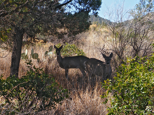
Chisos Mountains, Dog Canyon and Devil's Den, Emory Peak.
Introduction
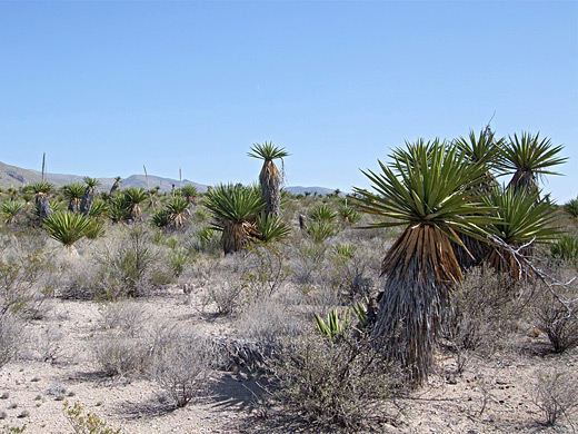
Ten miles south, the road reaches the turn-off for the Dagger Flat Auto Trail, a 7 mile gravel track leading to a grove of giant yucca plants. Although maintained and generally suitable for all vehicles except large RVs, this route is narrow, bumpy and steep in places, so care is needed when driving. The road crosses bushy flats for a few miles then climbs through a range of low hills, descending the far side and veering to the north, alongside a dry wash to the wide valley containing a forest of yucca faxoniana, the giant dagger yucca.
The third location is the Grapevine Hills, a colorful region of eroded rocks and mud dunes which can be visited by walking cross country from US 385, though the usual approach is via a separate track branching north off TX 118 (see park map).
Panther Junction
US 385 ends at Panther Junction, site of the park headquarters, a visitor center, post office and gas station. A left turn along TX 118 eventually reaches Boquillas Canyon in the southeast, while the road to the right (also TX 118) leads past the Chisos Mountains and on to the more-visited southwestern section of the park; another junction soon after is with the road into the mountains.
Chisos Mountains Road
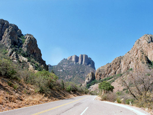
The road into the Chisos Mountains is 6 miles long, quite steep at one point and with some hairpin bends that reduce speeds to 15 mph and make the route not recommended for vehicles over 24 feet long. The vegetation changes markedly over a short distance - from cacti and other Chihuahuan Desert plants through a transition zone with bushes and grassland, to fir and pine woodland at the upper elevations. From a highpoint of 5,679 feet at Panther Pass the road descends a little into the sheltered Chisos Basin which has quite extensive development including a lodge (offering free wi-fi), shops, restaurants and a campsite; this is generally the most popular location to visit and camp in the park as other areas tend to be very hot for much of the year. Indeed many people seem to come here just for the facilities rather than hike the trails further into the mountains, or explore the lower elevation regions of the park.
The Window
Chisos Basin is circled by high volcanic peaks and vertical, weathered cliffs, the one exception being due west where the desert is visible through a V-shaped gap known as The Window - orientated just right to watch the sun set below the horizon. A short loop path leads to a good vantage point and a 2.2 mile trail follows the valley (Oak Creek Canyon) to the window itself, from where much more of the lands to the west can be seen.
Hiking in the Chisos Mountains
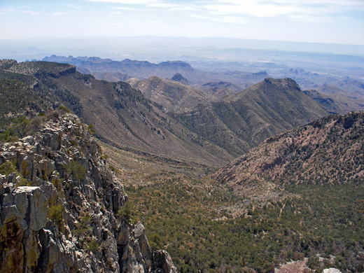
Apart from the various facilities and services, hiking is the main reason to visit the Chisos Mountains - a variety of long foot paths cross the hills and valleys, mostly south of the basin. Besides the Window Trail, the other popular half day trip is the Lost Mine Trail which climbs to a high ridge overlooking the desert to the southeast. The majority of the other options require an overnight stay in a primitive campsite, or a more strenuous all day hike. They include a climb up Emory Peak, the highest summit in Big Bend National Park (4.5 miles one way, elevation gain 2,450 feet), or the South Rim Trail (several routes, with a round trip of at least 14 miles).
Emory Peak and Chisos Mountains topographic map.
Trails of the Chisos Mountains
All trails in the Chisos Mountains and the north
Featured Chisos Mountains Trails
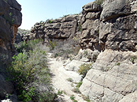
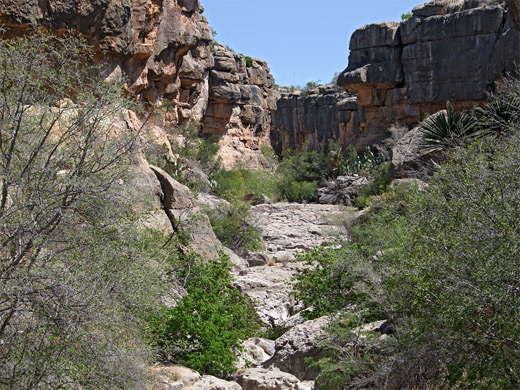
Dog Canyon and Devil's Den
★★★★★
★★★★★
8 miles, 300 feet (loop)
Paths across flat, bushy desert to two contrasting ravines, one a narrow gorge through white limestone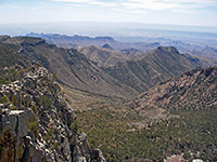
Emory Peak
★★★★★
★★★★★
4.5 miles, 2450 feet
The highest mountain in the national park, reached by well used trails beginning in Chisos Basin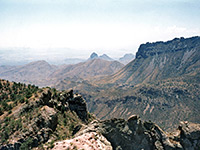
Lost Mine
★★★★★
★★★★★
2.4 miles, 1200 feet
From a pull-out along the Chisos Basin Road near Panther Pass, this often busy trail climbs a tree-covered hillside and a bushy ravine to a narrow ridge separating the upper ends of Juniper Canyon and Pine Canyon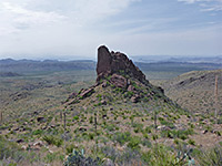
Oak Spring
★★★★★
★★★★★
2.3 miles, 950 feet
Connecting path between the Window at the edge of the Chisos Mountains, and the desert lowlands to the west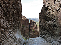
Window
★★★★★
★★★★★
2.2 miles, 560 feet
Popular path that follows an increasingly deep and overgrown ravine to a narrow rocky section with small pools, preceding a big pour-offAll Contents © Copyright The American Southwest | Comments and Questions | Contribute | Affiliate Marketing Disclosure | Site Map