Highlights:
Arid Big Bend region of low desert plains and washes, and two large canyons along the Rio Grande (Boquillas and Marsical). Includes one of the two main centers for recreation activities in the park, Rio Grande Village

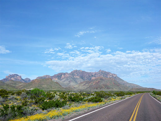
It is 24 miles from Panther Junction near the main Big Bend National Park visitor center to Boquillas Canyon in the southeast. The road (TX 118) crosses the eastern foothills of the Chisos Mountains then follows a sandy wash towards the Rio Grande, descending steadily over a vast desert plain.
Most of the land is rather featureless; there is a picnic spot and a short nature trail at Dugout Wells, and several side tracks to primitive campsites but no notable landmarks, although out of sight in the wide basin to the east is Ernst Tinaja, a natural circular waterhole in a short eroded canyon that features often in Big Bend photograph books. This may be reached by driving five miles along a rough 4WD track (Old Ore Road), followed by a 1.4 mile hike.
Most of the land is rather featureless; there is a picnic spot and a short nature trail at Dugout Wells, and several side tracks to primitive campsites but no notable landmarks, although out of sight in the wide basin to the east is Ernst Tinaja, a natural circular waterhole in a short eroded canyon that features often in Big Bend photograph books. This may be reached by driving five miles along a rough 4WD track (Old Ore Road), followed by a 1.4 mile hike.
Big Bend Southeast Table of Contents
- Photographs
- Rio Grande Village
- Boquillas Canyon
- Along the Rio Grande
- Big Bend rafting
- Trails of the southeast
Photographs
General views, Marufo Vega Trail.
Rio Grande Village
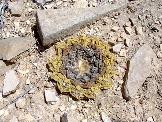
The road approaches the river at Rio Grande Village, which includes a spacious campground, an RV site with full hookups, a gas station and a general store, all surrounded by tall cottonwood trees and dense thickets of bushes. Because of this riparian environment, sustained by the nearby waters, the land hereabouts is good for wildlife, including semi-tame roadrunners and herds of javelinas that often wander through the campsite. The village tends to be busiest during the mild winter months, as in summer the weather is very hot, and rather humid. In spring the village is often the hottest place in the whole US. To the south, on the far side of the river, is the Mexican town of Boquillas del Carmen, which has a pretty setting with a few hundred pastel-colored houses scattered over a hillside beneath the imposing 6,000 foot high cliffs of Sierra del Carmen. A side road past the RV site leads to a picnic area next to the Rio Grande at the remains of Daniels Ranch, also the start point for a 3 mile hike across desert slopes to the Hot Springs. This natural warm water source is contained within a stone enclosure right beside the river, close to an abandoned settlement, and is reachable more easily by a gravel track (not for RVs), that forks off TX 118 shortly before Rio Grande Village. The limestone terraces just west of the road junction are a particularly good cactus location, and several dozen different species may be found here, including the rare ariocarpus fissuratus.
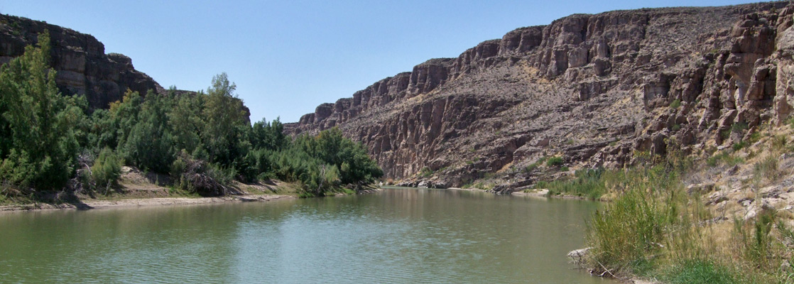
Boquillas Canyon
East of Rio Grande Village, the highway continues a few miles across more uneven terrain, first passing the trailhead for the Marufo Vega and Ore Terminal paths - the first a testing 14 mile loop across remote, mountainous country, the second a slightly easier 4 mile trail to the remains of an ore processing station. One other junction along the road is with a short a side track to an elevated viewpoint of the river and Boquillas del Carmen, before it ends at a parking area for the short hike to the mouth of Boquillas Canyon, the longest gorge along the Rio Grande.
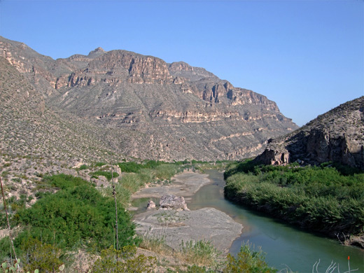
Along the Rio Grande
Upstream (west) of Rio Grande Village, the water supports a narrow band of greenery as it flows through quite empty land with only limited access by a few rough tracks. Twenty five miles from the village at the southernmost tip of its Big Bend, the river emerges from Marsical Canyon, the middle of the three large ravines in the park. It is very inaccessible and isolated, and is usually only visited during rafting excursions down river. In the other direction from the village, the Rio Grande soon disappears into Boquillas Canyon and the cliffs do not fully subside until Black Gap Wildlife Management Area 18 miles east; a boat trip through here can last for several days.
Big Bend Rafting
Explore the Rio Grande canyons! By raft, canoe or kayak
Trails of the Southeast, Big Bend
All trails in the southeast
Featured Southeast Trails
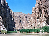
Boquillas Canyon
★★★★★
★★★★★
0.7 miles, 40 feet
The entrance to Boquillas Canyon, one of the three great river gorges within Big Bend National Park, can be reached by a short trail that climbs over a ridge then passes through a riparian area close to the Rio Grande, ending at a pebbly beach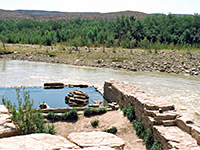
Hot Springs
★★★★★
★★★★★
3 miles, 250 feet
The Hot Springs alongside the Rio Grande can be reached either by a gravel track (not for RVs), leaving Hwy 118 a few miles from Rio Grande Village, or by a pleasant 3 mile trail, crossing desert land with many and varied cacti, and frequent views of the river gorge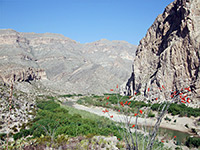
Marufo Vega
★★★★★
★★★★★
14 miles, 1000 feet
Perhaps the most difficult day hike in Big Bend, the Marufo Vega loop trail crosses hostile, mountainous terrain, exceedingly hot and dry during the summer months, and descends steeply down a canyon to the banks of the Rio GrandeAll Contents © Copyright The American Southwest | Comments and Questions | Contribute | Affiliate Marketing Disclosure | Site Map