TEXAS


Map of Big Bend National Park

Sites in Texas

NPS Units
Alibates Flint Quarries
Amistad
Big Bend
Fort Davis
Guadalupe Mountains
Lake Meredith
Padre Island
San Antonio Missions

Other Places
Big Bend Ranch
Black Gap
Caprock Canyons
Davis Mountains
Dinosaur Valley
Enchanted Rock
Fort Leaton
Franklin Mountains
Hueco Tanks
Langtry
Lost Maples
Monahans Sandhills
Odessa Meteor Crater
Palmetto
Palo Duro Canyon
Pedernales Falls

Texas Site Map

Follow americansouthwest.net on Facebook
Site Search

Photograph Search


Big Bend National Park > Map

Map of Big Bend National Park
Trails are identified by a number, corresponding to the description on the trail listings page.

Emory Peak and Chisos Mountains topographic map.

PDF format maps of Big Bend National Park from the National Park Service:
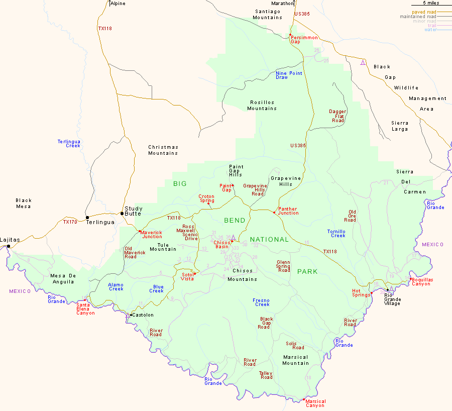
PDFArea map (40 kb)
Park map (584 kb)

Back to Top

All Contents © Copyright John Crossley | Comments and Questions | Site Map

Arizona California Colorado Nevada New Mexico Oregon Texas Utah Wyoming Slot Canyons Travelogue