Highlights:
Colorful badlands, desert plains, small ravines and the most scenic river canyon (Santa Elena) in Big Bend; most sites are along the 30 mile Ross Maxwell Scenic Drive, the best road in the park

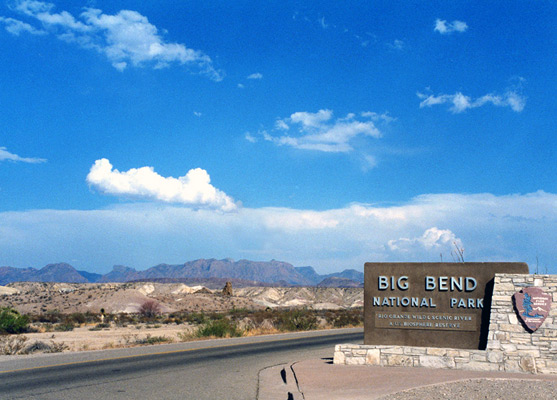
The scenery in the west of Big Bend National Park is more varied than the east, and many of the interesting sites are close to the 30 mile Ross Maxwell Scenic Drive, which links Santa Elena Canyon with TX 118 north of the Chisos Mountains, and is definitely the best road in the park; from the undulating foothills west of the mountains the route offers several good viewpoints of the desert below, then descends quite steeply into a region of small canyons, colorful mounds and eroded rock, before arriving at the banks of the Rio Grande.
The drive forks off Highway 118 about half way between the western Big Bend entrance near Study Butte and the park headquarters at Panther Junction, a fairly level road across open, gently sloping land with small, isolated summits that passes several primitive campsites such as Croton Spring, Paint Gap and Grapevine Hills, but no features of special interest.
The drive forks off Highway 118 about half way between the western Big Bend entrance near Study Butte and the park headquarters at Panther Junction, a fairly level road across open, gently sloping land with small, isolated summits that passes several primitive campsites such as Croton Spring, Paint Gap and Grapevine Hills, but no features of special interest.
Big Bend Southwest Table of Contents
Photographs
General views, Apache Canyon, Blue Creek Canyon, Burro Mesa Pouroff.
Ross Maxwell Scenic Drive
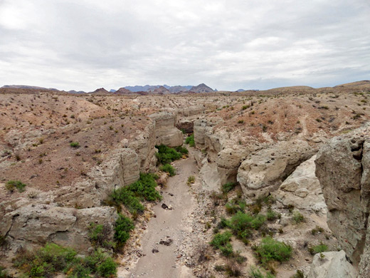
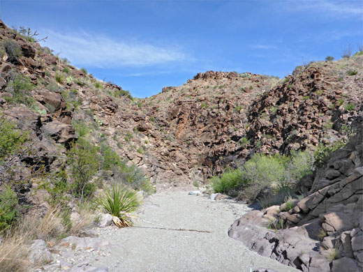
Highlights along the first half of Ross Maxwell Scenic Drive include the disused homestead of Sam Nail Ranch, eroded red rocks and another old ranch building in Blue Creek Canyon, a fine view of the desert at Sotol Vista Overlook, the water carved formations of Burro Mesa Pouroff, and Mule Ears Spring, a sheltered oasis reached by a 1.9 mile trail. A little further along the road, a much shorter trail leads to Tuff Canyon, a narrow but deep ravine in the desert. The enclosing rocks are volcanic tuff, quite resistant to erosion so the canyon has developed high walls; most watercourses flow across sand or mudstone and form shallow valleys with sloping sides. Another path descends to the mouth of the canyon and allows for upstream exploration.
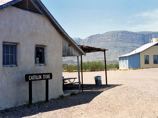
Castolon
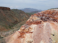
The land south of Tuff Canyon is low in elevation (under 2,400 feet) and especially colorful, with contrasting white, black and red rocks. Five miles beyond and close to the Rio Grande is the historic settlement of Castolon, which has scattered old adobe dwellings and farm machinery plus a small general store still in operation. Nearby, the Cottonwood Campground contains 31 sites in a quiet, scenic setting with the river banks on one side and a high rocky hill (Cerro Castellan) to the other.
The End of the Road
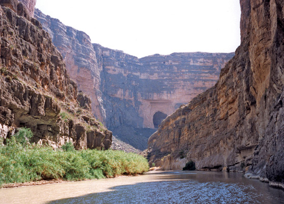
The main reason to drive this far is to visit beautiful Santa Elena Canyon along the Rio Grande - the start of the path into this 1,500 foot deep gorge is 8 miles beyond the campsite, right at the end of the paved road. After visiting the canyon (a hike which might involve wading a stream), most people drive back the same way, but there is an alternative route to the west entrance station; the unpaved Old Maverick Road. This is maintained so usually fine for all vehicles, starting close to the Santa Elena trailhead and reaching TX 118 just inside the park boundary after 14 miles across generally flat, desert terrain. The only problems may be occasional streambed crossings, as these may be rocky and/or muddy after recent rainfall. The surroundings are rugged and unspoilt, and there is an interesting old cabin en route (Luna's Jacal), home of a lone resident early this century.
Trails of the Southwest, Big Bend
All trails in the southwest
Featured Southwest Trails
Apache Canyon
★★★★★
★★★★★
3.8 miles, 230 feet
Rarely traveled path across open terrain to an old corral, a ruined cabin and a spectacular outcrop of colorful rocks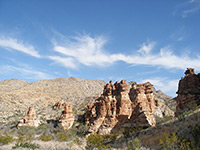
Blue Creek Canyon
★★★★★
★★★★★
1.5 miles, 240 feet
A disused but well preserved ranch building and a group of pointed red rock formations are the two attractions lower section of the trail along Blue Creek Canyon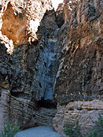
Burro Mesa Pouroff
★★★★★
★★★★★
0.5 miles, 50 feet
This well used path to a narrow pouroff crosses sandy ground then follows a dry wash to the base of the cliffs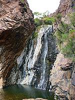
Cattail Falls
★★★★★
★★★★★
1.5 miles, 360 feet
Beautiful, hidden waterfall above a series of pools, in a wooded canyon on the west side of the Chisos Mountains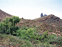
Mule Ears
★★★★★
★★★★★
1.9 miles, 100 feet
The Mule Ears Spring trail winds over typical Chihuahaun Desert land of small peaks, sandy flats and dry washes, to a cottonwood tree-lined oasis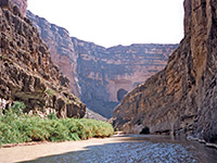
Santa Elena Canyon
★★★★★
★★★★★
0.8 miles, 40 feet
Santa Elena is most spectacular canyon in the national park, formed as the Rio Grande cuts through the 1,200 foot cliffs of Sierra Ponce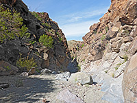
Upper Burro Mesa Pouroff
★★★★★
★★★★★
1.8 miles, 200 feet
Route along a shallow valley, and later an enclosed and rocky canyon, to the brink of a high dryfall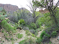
Ward Spring
★★★★★
★★★★★
1.6 miles, 450 feet
Lightly used trail, mostly across open terrain, to an overgrown spring in a shallow ravine. Many types of cacti and wildflowers along the wayAll Contents © Copyright The American Southwest | Comments and Questions | Contribute | Affiliate Marketing Disclosure | Site Map