Phipps Wash, Grand Staircase-Escalante National Monument
Utah > Grand Staircase-Escalante National Monument > Phipps Wash

Phipps Wash
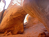
Large sandstone arch, reached by hiking across sand and slickrock then down the deepening drainage of Phipps Wash, which eventually meets the Escalante River after also passing a small natural bridge
Length: 5 miles, to the Escalante River
Elevation change: 800 feet
Difficulty: Moderate
Type: One way, cross country route
Usage: Low
Season: All year
Trailhead: Start of Old Sheffied Road
Rating (1-5): ★★★★★
Elevation change: 800 feet
Difficulty: Moderate
Type: One way, cross country route
Usage: Low
Season: All year
Trailhead: Start of Old Sheffied Road
Rating (1-5): ★★★★★

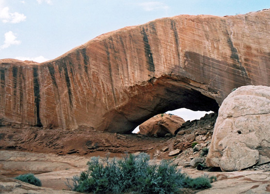
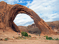
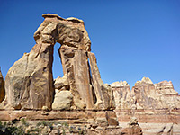
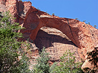
Most Escalante canyons are a long way from paved roads and need some effort to reach, but not Phipps Wash, as this is never more than two miles from UT 12, though still far enough away to escape completely from any traffic noise. It is not the most spectacular canyon in the area and has no especially narrow parts yet is very popular owing to the relatively easy access, and illustrates the different character of canyons in this region, changing from a sandy drainage winding through slickrock, to a sheer red-walled gorge, then to an overgrown, bushy ravine where a stream begins to flow. One added feature of interest is 100 foot wide Phipps Arch, located high in the cliffs above a side valley.
The lower end of Phipps Wash meets the Escalante River 2 miles downstream from the UT 12 crossing and can be accessed from the highway via an easy trail. The upper end begins at the edge of Little Spencer Flat, a plateau crossed by the Old Sheffield Road - a route that leaves UT 12 between mileposts 70 and 71 and is also used to reach Big Horn Canyon and other nearby drainages, though it becomes increasingly sandy further east. There are various places to camp along here, including one area just off the main road, so handy for overnight stops when traveling cross country. The highway is very little used at night. The beginning of Phipps Wash is about 2 miles along the track, nearly opposite the start of Big Horn Canyon, but the hike can begin anywhere before this, just by walking east to the first side drainage then following this downstream.
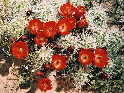
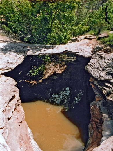
The parking/camping area close to UT 12 is as good a place as any to start, and from here the route is southeast, towards a gap in the steepish cliffs that form a barrier to the slickrock beneath, this being 0.3 miles from UT 12. The slope relents here allowing for a descent to a sandy area then further down into a side drainage of the main canyon. The surrounding land is dotted with cacti, bushes and wildflowers, especially Indian Paintbrush, but is mostly bare of vegetation. This side canyon has a few short dryfalls and seasonal pools then a big drop off, passed on the right side, shortly before the junction with the main channel of Phipps Wash. Large cliffs streaked by desert varnish soon rise on the east side then, after a wide area, the left side also becomes enclosed and a stream beings to flow, causing the canyon to be quite overgrown by cottonwood trees and bushes. Eventually the walls open out as Phipps meets the Escalante River flood plain, though the actual river is another third of a mile more, flowing swiftly though a corridor of reeds and trees.
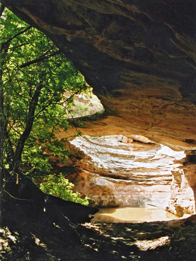
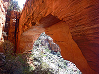
Although large, Phipps Arch is well hidden at the top of the cliffs to the east of the wash, and is not visible from the main drainage. There is no obvious clue to its whereabouts, except perhaps for a trail of footprints, but it is situated along the only significant east-side tributary joining in the enclosed part of the main canyon, approximately half way to the Escalante River. The arch is reached by a 10 minute walk from the wash, climbing quite steeply up the sloping slickrock on the left of the side canyon heading for a small gap between the highest parts of the sandstone peaks - the span is about 0.3 miles from the Phipps Wash streamway, and perpendicular to it. Also quite well hidden, though easier to reach, is Maverick Natural Bridge, a little way up a side drainage on the other side of the main wash. This has a span of about 20 feet, often with a pool underneath, and is quite shaded by trees and bushes.
Location
The lower end of Phipps Wash meets the Escalante River 2 miles downstream from the UT 12 crossing and can be accessed from the highway via an easy trail. The upper end begins at the edge of Little Spencer Flat, a plateau crossed by the Old Sheffield Road - a route that leaves UT 12 between mileposts 70 and 71 and is also used to reach Big Horn Canyon and other nearby drainages, though it becomes increasingly sandy further east. There are various places to camp along here, including one area just off the main road, so handy for overnight stops when traveling cross country. The highway is very little used at night. The beginning of Phipps Wash is about 2 miles along the track, nearly opposite the start of Big Horn Canyon, but the hike can begin anywhere before this, just by walking east to the first side drainage then following this downstream.

Phipps Wash Hike
The parking/camping area close to UT 12 is as good a place as any to start, and from here the route is southeast, towards a gap in the steepish cliffs that form a barrier to the slickrock beneath, this being 0.3 miles from UT 12. The slope relents here allowing for a descent to a sandy area then further down into a side drainage of the main canyon. The surrounding land is dotted with cacti, bushes and wildflowers, especially Indian Paintbrush, but is mostly bare of vegetation. This side canyon has a few short dryfalls and seasonal pools then a big drop off, passed on the right side, shortly before the junction with the main channel of Phipps Wash. Large cliffs streaked by desert varnish soon rise on the east side then, after a wide area, the left side also becomes enclosed and a stream beings to flow, causing the canyon to be quite overgrown by cottonwood trees and bushes. Eventually the walls open out as Phipps meets the Escalante River flood plain, though the actual river is another third of a mile more, flowing swiftly though a corridor of reeds and trees.
An Arch and a Natural Bridge
Although large, Phipps Arch is well hidden at the top of the cliffs to the east of the wash, and is not visible from the main drainage. There is no obvious clue to its whereabouts, except perhaps for a trail of footprints, but it is situated along the only significant east-side tributary joining in the enclosed part of the main canyon, approximately half way to the Escalante River. The arch is reached by a 10 minute walk from the wash, climbing quite steeply up the sloping slickrock on the left of the side canyon heading for a small gap between the highest parts of the sandstone peaks - the span is about 0.3 miles from the Phipps Wash streamway, and perpendicular to it. Also quite well hidden, though easier to reach, is Maverick Natural Bridge, a little way up a side drainage on the other side of the main wash. This has a span of about 20 feet, often with a pool underneath, and is quite shaded by trees and bushes.
Phipps Wash - Similar Hikes
All Contents © Copyright The American Southwest | Comments and Questions | Contribute | Affiliate Marketing Disclosure | Site Map