Upper Calf Creek Falls, Grand Staircase-Escalante National Monument
Utah > Grand Staircase-Escalante National Monument > Upper Calf Creek Falls
Upper Calf Creek Falls
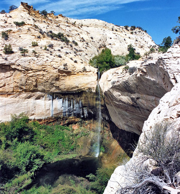
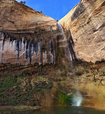
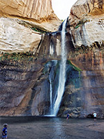
88 foot waterfall close to UT 12, reached by a steep descent down a white slickrock slope. The pool drops into an enclosed, bushy chamber and is preceded by a nice series of pools across smooth sandstone
Length: 1.1 miles
Elevation change: 560 feet
Difficulty: Moderate - steep slickrock
Type: One way
Usage: Medium
Season: All year
Trailhead: End of a short track off UT 12
Rating (1-5): ★★★★★
Elevation change: 560 feet
Difficulty: Moderate - steep slickrock
Type: One way
Usage: Medium
Season: All year
Trailhead: End of a short track off UT 12
Rating (1-5): ★★★★★

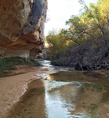
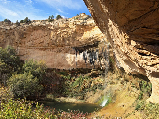
A spring provides the water source for the year-round flow of Calf Creek, which meanders along a shallow valley with several deep, clear pools before the upper falls, where the creek drops 88 feet over a cliff face at the head of Calf Creek Canyon. This deepens gradually for 2.5 miles south then doubles in size below the 126 foot lower falls. The upper cascade is not quite as spectacular and receives fewer visitors although it is quicker to reach and still well worth a look.
11 views along the Upper Calf Creek Falls Trail.
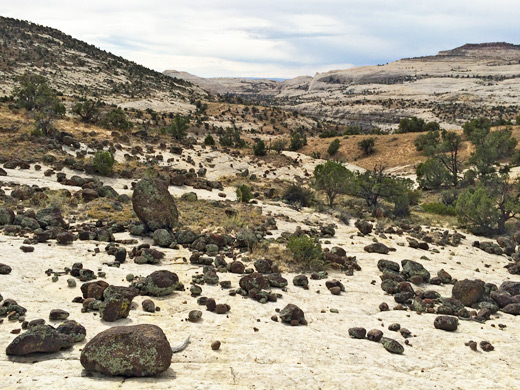
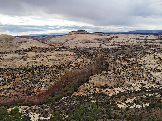
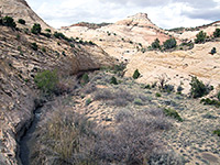
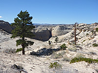
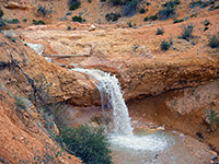
The Upper Falls trailhead is at the end of a short bumpy track off the west side of UT 12, near milepost 81, and is not signposted. It is reasonably popular though, presumably known by word of mouth or from guidebooks. The path to the falls is at first down a steepish slope of white slickrock marked by cairns of dark, volcanic pebbles then across flatter sandy ground to the canyon edge, with a total elevation loss of almost 600 feet. There is an easy route down a slope to the base of the falls though the main trail stays at rim level and ends at a group of clear pools just above the cliff edge. The distance is just over 1 mile, and a round trip can take less than one hour.
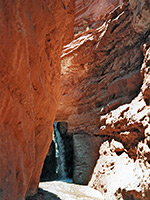
At the base of the falls is a large pool often deep enough for swimming, plus a second pool nearby beneath the junction of a (usually dry) tributary canyon that joins from the north. Most of the canyon floor from here downstream is quite overgrown with reeds, long green grass and bushes though hiking down the creek right to the top of the upper falls is possible - a combination of wading, boulder hopping and walking through the undergrowth. The best views of the upper waterfall are from beneath, or from the west side - it is easy to hop over the creek then climb up a slope and round the edge a little way.
Photographs
11 views along the Upper Calf Creek Falls Trail.
The Trail
The Upper Falls trailhead is at the end of a short bumpy track off the west side of UT 12, near milepost 81, and is not signposted. It is reasonably popular though, presumably known by word of mouth or from guidebooks. The path to the falls is at first down a steepish slope of white slickrock marked by cairns of dark, volcanic pebbles then across flatter sandy ground to the canyon edge, with a total elevation loss of almost 600 feet. There is an easy route down a slope to the base of the falls though the main trail stays at rim level and ends at a group of clear pools just above the cliff edge. The distance is just over 1 mile, and a round trip can take less than one hour.
The Canyon
At the base of the falls is a large pool often deep enough for swimming, plus a second pool nearby beneath the junction of a (usually dry) tributary canyon that joins from the north. Most of the canyon floor from here downstream is quite overgrown with reeds, long green grass and bushes though hiking down the creek right to the top of the upper falls is possible - a combination of wading, boulder hopping and walking through the undergrowth. The best views of the upper waterfall are from beneath, or from the west side - it is easy to hop over the creek then climb up a slope and round the edge a little way.
Upper Calf Creek Falls - Similar Hikes
All Contents © Copyright The American Southwest | Comments and Questions | Contribute | Affiliate Marketing Disclosure | Site Map