Rattlesnake Creek Trail, Cedar Breaks National Monument
Utah > Cedar Breaks National Monument > Rattlesnake Creek Trail

Rattlesnake Creek Trail
Lightly-used trail past two viewpoints on the rim of Cedar Breaks then steeply down through meadows and pine/aspen forest into a thickly wooded canyon containing a permanent stream, within the Ashdown Gorge Wilderness
Length: 3.8 miles, to the canyon floor; the path continues downstream
Elevation change: 2,400 feet
Difficulty: Moderate
Type: One way
Usage: Low
Season: Summer and fall
Trailhead: Parking area along Hwy 143
Rating (1-5): ★★★★★
Elevation change: 2,400 feet
Difficulty: Moderate
Type: One way
Usage: Low
Season: Summer and fall
Trailhead: Parking area along Hwy 143
Rating (1-5): ★★★★★

The Rattlesnake Creek Trail starts just outside the northern boundary of Cedar Breaks National Monument, soon entering the park briefly and passing a couple of fine overlooks of the red rock formations before descending steadily through forests of pine, spruce and aspen interrupted with a few small meadows, then out to a treeless ridge, Stud Flat, which has a greater wildflower selection and affords grand views of the surrounding landscape, a mix of red cliffs and wooded peaks. After here the path descends steeply once again, into the wooded canyon of Rattlesnake Creek, reaching the floor after 3.8 miles, descending 2,400 feet, a point which makes a good destination for a there-and-back day hike.
The path though does continue downstream, linking with other trails that explore the canyons of upper Ashdown Creek and its tributaries, while another option is to follow the main canyon, with much wading, down to its intersection with Hwy 14; a total distance of 9.5 miles. The more spectacular lower section of the gorge is best explored on a shorter hike starting from the road, however, but the upper 3.8 miles of the trail, down to the creek, passes a good variety of scenery, and is rarely visited. This hike takes five hours or more, round trip. Most of the trail, apart from the first half mile and two short sections that enter the monument, is within the Ashdown Gorge Wilderness.
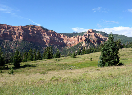
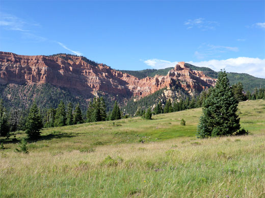
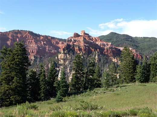
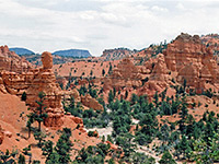
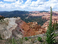
The Rattlesnake Creek hike begins from a sizeable pullout just north of the national monument boundary fence along Hwy 148, at elevation 10,456 feet, a short distance south of Mammoth Summit. The path rises slightly, crosses a meadow with many summer-blooming wildflowers and enters sparse woodland, where it becomes quite straight for a while, running alongside the fence, which bends by 90 degrees near the rim of the Cedar Breaks amphitheater, and a short spur leads to the first of two viewpoints, right on the plateau edge; high above Adams Canyon, the slopes of which display the familiar assortment of orange, red and white rocks. The second overlook, a little way further, has slightly better views, and is framed by several ancient or dead trees on the rim.
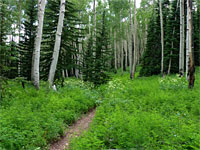
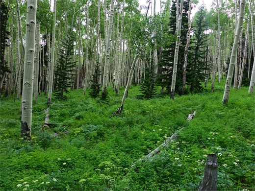
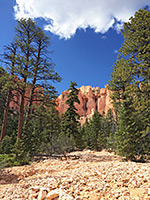
The trail, now within the monument, starts a steeper descent, down a stony slope through a darker patch of trees and into an aspen grove with tall green understory, sprinkled with the white flowers of aspen pea. Lower down are many of the larger blooms of the sego lily. The trail steepens once more, crosses a small flat meadow and emerges from the trees to a much more extensive open area, on a grassy slope above a tributary of the creek, with the main gorge visible far below. After a few short switchbacks, the path re-enters the forest, levels out briefly before dropping down again through an area of fallen trunks and contours down to the floor of the tributary creek, dry for much of the year. Next is more traversing and descending, through darker woods that shelter many small orchids (green-leaf rattlesnake-plantain).
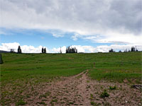
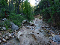
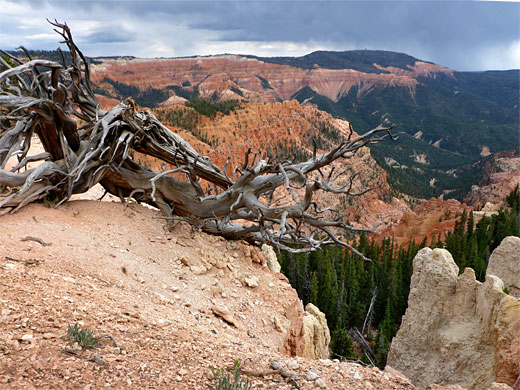
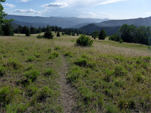
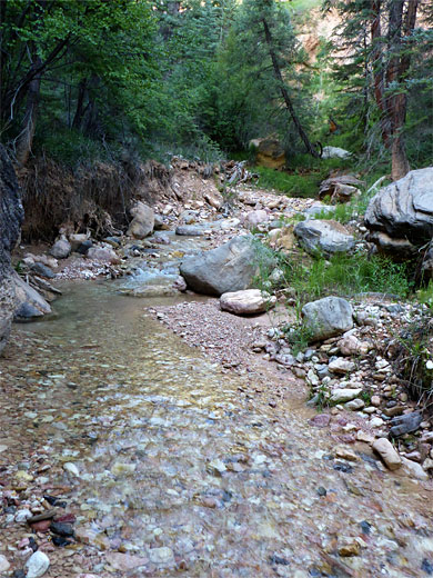
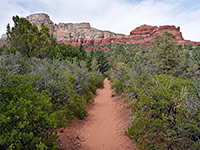
The gradient gradually lessens and the forest is interrupted by a few clearings, sometimes with fallen trees lying across, until an abrupt exit from the woods at the east end of Stud Flat, a broad ridgetop free of trees for over half a mile, covered instead by long grass and many wildflowers. The most conspicuous feature in view is a line of vertical red cliffs to the north, below the rounded summit of Navajo Point. The path approaches the far end of the flat and turns north into woodland, for the 700 foot descent to Rattlesnake Creek, initially via a series of switchbacks then a long straight, approaching the creek only gradually. This section of the canyon is not so scenic since it is enclosed, thickly wooded, shady so generally lacking wildflowers, and without much exposed rock, just lots of boulders, tree branches and undergrowth; it remains similar for a mile downstream until the trees recede and the gorge starts to deepen more sharply and become partially cliff-bound, approaching the junction with Lake Creek from the north.
The path though does continue downstream, linking with other trails that explore the canyons of upper Ashdown Creek and its tributaries, while another option is to follow the main canyon, with much wading, down to its intersection with Hwy 14; a total distance of 9.5 miles. The more spectacular lower section of the gorge is best explored on a shorter hike starting from the road, however, but the upper 3.8 miles of the trail, down to the creek, passes a good variety of scenery, and is rarely visited. This hike takes five hours or more, round trip. Most of the trail, apart from the first half mile and two short sections that enter the monument, is within the Ashdown Gorge Wilderness.
Cedar Breaks Viewpoints
The Rattlesnake Creek hike begins from a sizeable pullout just north of the national monument boundary fence along Hwy 148, at elevation 10,456 feet, a short distance south of Mammoth Summit. The path rises slightly, crosses a meadow with many summer-blooming wildflowers and enters sparse woodland, where it becomes quite straight for a while, running alongside the fence, which bends by 90 degrees near the rim of the Cedar Breaks amphitheater, and a short spur leads to the first of two viewpoints, right on the plateau edge; high above Adams Canyon, the slopes of which display the familiar assortment of orange, red and white rocks. The second overlook, a little way further, has slightly better views, and is framed by several ancient or dead trees on the rim.
Descent through the Forest
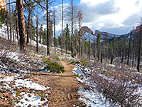
The trail, now within the monument, starts a steeper descent, down a stony slope through a darker patch of trees and into an aspen grove with tall green understory, sprinkled with the white flowers of aspen pea. Lower down are many of the larger blooms of the sego lily. The trail steepens once more, crosses a small flat meadow and emerges from the trees to a much more extensive open area, on a grassy slope above a tributary of the creek, with the main gorge visible far below. After a few short switchbacks, the path re-enters the forest, levels out briefly before dropping down again through an area of fallen trunks and contours down to the floor of the tributary creek, dry for much of the year. Next is more traversing and descending, through darker woods that shelter many small orchids (green-leaf rattlesnake-plantain).
Stud Flat to Rattlesnake Creek
The gradient gradually lessens and the forest is interrupted by a few clearings, sometimes with fallen trees lying across, until an abrupt exit from the woods at the east end of Stud Flat, a broad ridgetop free of trees for over half a mile, covered instead by long grass and many wildflowers. The most conspicuous feature in view is a line of vertical red cliffs to the north, below the rounded summit of Navajo Point. The path approaches the far end of the flat and turns north into woodland, for the 700 foot descent to Rattlesnake Creek, initially via a series of switchbacks then a long straight, approaching the creek only gradually. This section of the canyon is not so scenic since it is enclosed, thickly wooded, shady so generally lacking wildflowers, and without much exposed rock, just lots of boulders, tree branches and undergrowth; it remains similar for a mile downstream until the trees recede and the gorge starts to deepen more sharply and become partially cliff-bound, approaching the junction with Lake Creek from the north.
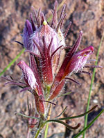
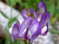
Rattlesnake Creek Wildflowers
More flowers along the trail
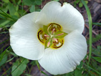 Sego lily |
 Heller's bird's beak |
 Timber milkvetch |
More flowers along the trail
Rattlesnake Creek Trail - Similar Hikes
All Contents © Copyright The American Southwest | Comments and Questions | Contribute | Affiliate Marketing Disclosure | Site Map