Week 2 - Gallup to Corpus Christi; Santa Fe
Thursday 30 June 1994: Awoke to a scorching clear morning and had
breakfast in the sun. Only one other vehicle stopped at our lay-by before 11.30.
Circling above us there were numerous examples of what we had come to recognise
as turkey vultures. We left them to themselves and drove to Los Alamos (the atomic
town) which seemed rather unremarkable and then down some rather steep roads to
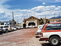
Santa Fe, first having lunch in a dusty carpark at the
railway station. One end of the carpark was actually a road, but without any markings,
hence we were advised to move away from this by a friendly local; "the people are
crazy", he said (meaning other car drivers). I was expecting some grand historic
building, since I thought that all Southwest trains came through Santa Fe, but in fact
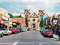
the station was rather small and unimportant-looking. After lunch we walked for 10
minutes into the city centre - a great place; lots of curious second-hand shops and
jewellery places, with dried chillies hanging everywhere. All of the buildings were
various shades of brown and pink, with blue artwork. Bought a Raven Image map of
Arizona, much to the disgust of the shop assistant - "Arizona? Just a big desert" was the
dismissive response. After this we stopped in the central square and watched the world go by,
including a cool policeman on a mountain bike, and lots of young hippie types. It
would probably have been good in the sixties too. This is one place I would like to
live, but not today - we had to move on.
Leaving Santa Fe at about 5 pm we drove south along the very scenic Turquois Trail (NM 37), crossed
I-40 and continued along road 337, through Chilili amongst other places. The almost
totally deserted (apart from several dogs) town of
Mountainair provided a gas stop just in time, after which
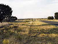
we headed into complete emptiness down road 55. One part of the route was marked
on the AAA map as a gravel road, but this was not so. Despite the barrenness of the
landscape, there is actually a National Monument here - ruins of a 17th century
Spanish mission - but this didn't seem exciting enough to stop. Fences alongside the
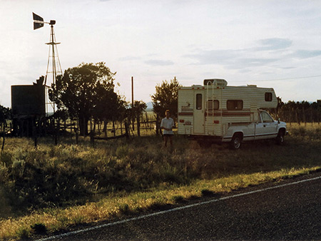
road made finding a stopping place rather difficult and it was getting dark when we
pulled up next to an abandoned ranch a little north of the town of Claunch
(population
about 20). To our surprise, six other cars went past in the next four hours. In the
evening we cooked Chilili and looked at the stars overhead. The place we stopped at
was rather eerie as the sun went down, with an old water tower creaking in the wind,
rusting cars and machinery scattered about, and the remains of a cattle stockade, all
gradually crumbling away in the deserted landscape.
|