Hot Springs Trail, Big Bend National Park
Texas > Big Bend National Park > The Southeast > Hiking > Hot Springs Trail
Hot Springs
Lesser used trail that crosses a plateau on the north side of the Rio Grande, winds around several shallow ravines then descends to some hot springs adjacent to the river, near which are the ruins of a small village. Both may also be reached via a gravel vehicle track, and a much shorter hike
Length: 3 miles
Elevation change: 250 feet
Difficulty: Moderate; strenuous in summer
Type: One way
Usage: Low
Season: Fall, winter and spring are the usual seasons
Trailhead: End of a spur road west of Rio Grande Village
Rating (1-5): ★★★★★
Elevation change: 250 feet
Difficulty: Moderate; strenuous in summer
Type: One way
Usage: Low
Season: Fall, winter and spring are the usual seasons
Trailhead: End of a spur road west of Rio Grande Village
Rating (1-5): ★★★★★

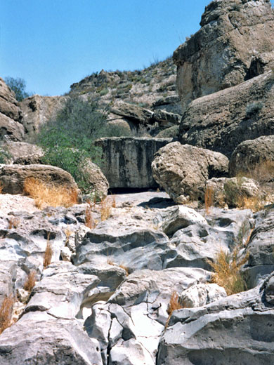
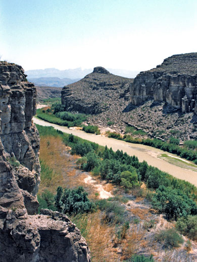
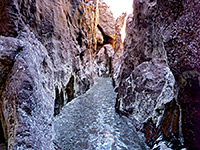
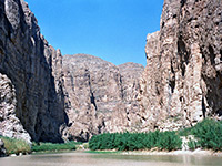
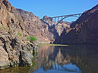
The Hot Springs Trail along the Rio Grande in the southeast corner of Big Bend National Park is an excellent desert hike although sometimes rather an ordeal in summer when the heat and sunlight reflected off the whitish earth can become intense. The 3 mile path passes especially abundant desert plant life, at first crossing a plateau above the river which flows through a short, deep canyon below, traversing several side ravines before descending to the waters edge at the hot springs themselves, then continuing on to the remains of a small village founded in 1909. This can also be reached by car via a gravel track that branches off the park road (not accessible to RVs), in which case a much shorter walk is needed to visit the springs.
Map of Big Bend National Park.
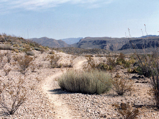
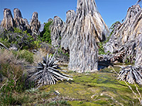
The trail starts near the Rio Grande campsite at the end of a spur road leading to the picnic area - a grassy, cottonwood tree-lined location that is also popular for bird watching. At first the route climbs up the side of a steep hill, round the top of cliffs above the river then heads across the empty plateau beyond. After a while the land rises to the summit of a low ridge and offers wide views over a vast area of desert and canyons to the west, with the Chisos Mountains looming in the distance. The path tracks down, across and up several tributary canyons then along the river for about half a mile to the springs. At least 15 different types of cacti are found en route, plus other desert plants, including species of opuntia, mammillaria, echinocactus, echinocereus, ariocarpus and coryphantha.
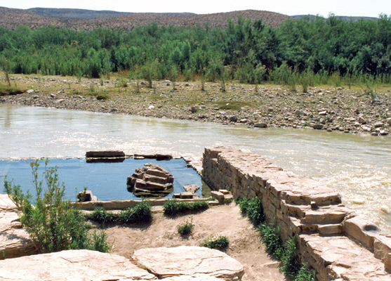
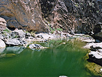
The springs are a few yards from the rivers edge and were enclosed in a brick wall early this century, creating a small bathing pool for the benefit of guests at nearby Hot Springs Village. This has long been abandoned but the pool still receives quite a few visitors who enjoy relaxing in the clear 105° waters, whilst the Rio Grande rushes noisily past. The setting is remote and unusual, and well worth a visit.
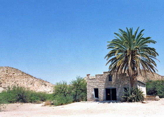
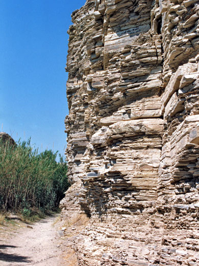
The old village is not much further; the path is along the riverside beneath a layered, crumbling cliff face with Indian petroglyphs in some places. The remaining buildings include a general store and several living quarters; another relic is a circle of huge palm trees, planted to provide shelter from the sun - the temperature beneath feels at least 20°F lower.
Location
Map of Big Bend National Park.
The Trail
The trail starts near the Rio Grande campsite at the end of a spur road leading to the picnic area - a grassy, cottonwood tree-lined location that is also popular for bird watching. At first the route climbs up the side of a steep hill, round the top of cliffs above the river then heads across the empty plateau beyond. After a while the land rises to the summit of a low ridge and offers wide views over a vast area of desert and canyons to the west, with the Chisos Mountains looming in the distance. The path tracks down, across and up several tributary canyons then along the river for about half a mile to the springs. At least 15 different types of cacti are found en route, plus other desert plants, including species of opuntia, mammillaria, echinocactus, echinocereus, ariocarpus and coryphantha.
The Springs
The springs are a few yards from the rivers edge and were enclosed in a brick wall early this century, creating a small bathing pool for the benefit of guests at nearby Hot Springs Village. This has long been abandoned but the pool still receives quite a few visitors who enjoy relaxing in the clear 105° waters, whilst the Rio Grande rushes noisily past. The setting is remote and unusual, and well worth a visit.
Hot Springs Village
The old village is not much further; the path is along the riverside beneath a layered, crumbling cliff face with Indian petroglyphs in some places. The remaining buildings include a general store and several living quarters; another relic is a circle of huge palm trees, planted to provide shelter from the sun - the temperature beneath feels at least 20°F lower.
Hot Springs Trail - Similar Hikes
All Contents © Copyright The American Southwest | Comments and Questions | Contribute | Affiliate Marketing Disclosure | Site Map