

Mule Ears Trail, Big Bend National Park
Texas > Big Bend National Park > The Southwest > Hiking > Mule Ears Trail
Mule Ears Trail
After crossing typical Chihuahuan Desert land of dry washes, cactus flats and small ridges, this trail arrives at a cool, cottonwood tree-lined oasis
Length: 1.9 miles, to Mule Ears Spring
Elevation change: 100 feet
Difficulty: Easy
Type: One way. Path continues another 1.9 miles to a junction with the Smoky Creek Trail
Usage: Low to medium
Season: Fall, winter, spring
Trailhead: End of a spur road off Ross Maxwell Scenic Drive
Rating (1-5): ★★★★★
Elevation change: 100 feet
Difficulty: Easy
Type: One way. Path continues another 1.9 miles to a junction with the Smoky Creek Trail
Usage: Low to medium
Season: Fall, winter, spring
Trailhead: End of a spur road off Ross Maxwell Scenic Drive
Rating (1-5): ★★★★★


For a close-up view of the Chihuahuan Desert in Big Bend National Park, the 3.8 mile (round trip) Mule Ears Trail is a good choice. It does not pass any 'spectacular geology', as promised by the NPS park brochure but the scenery is interesting enough. The usual destination is the spring of the title, a year round water source at the centre of an oasis of cottonwood trees and bushes - quite a contrast to the hot, arid surroundings - although the path does continue, meeting a much longer trail that connects the Chisos Mountains with the Rio Grande.
The land in this part of Big Bend National Park is low in elevation, with no shade and temperatures likely to rise above 100°F most of the time from May to September so the trail is best avoided during the middle of the day in summer.
Map of Big Bend National Park.
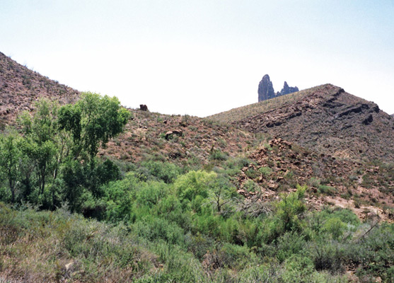
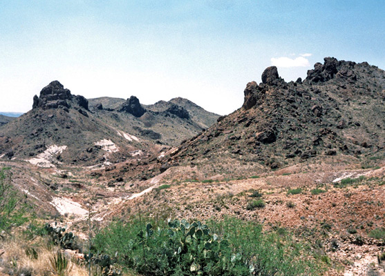
The Mule Ears Trail starts at Mule Ears Overlook, a short spur road on the Ross Maxwell Scenic Drive, 8 miles north of Castolon - the ears are twin pillars of black igneous rock, once part of the core of a volcano, that now rise above the desert several miles to the east. Most of the land hereabouts is undulating, stony hills with sandy ravines, all covered by well-separated desert plants - at least a dozen species of cacti plus the usual sotol, lechuguilla and yucca. The route is across the side of a shallow hillside, along a more level section and down into a wide watercourse, then up the far side, along a flat ridge and across a second dry canyon.
The spring is at the far side of the second canyon, at the centre of a large area of greenery. Nearby is the remains of a stone dwelling, with old pipework leading to the stream. Clear, drinkable water always flows, but the volume is reduced to a trickle in dry weather, with a pool a few inches deep. The stream usually sinks below ground after a short distance.
The land in this part of Big Bend National Park is low in elevation, with no shade and temperatures likely to rise above 100°F most of the time from May to September so the trail is best avoided during the middle of the day in summer.
Location
Map of Big Bend National Park.
The Desert
The Mule Ears Trail starts at Mule Ears Overlook, a short spur road on the Ross Maxwell Scenic Drive, 8 miles north of Castolon - the ears are twin pillars of black igneous rock, once part of the core of a volcano, that now rise above the desert several miles to the east. Most of the land hereabouts is undulating, stony hills with sandy ravines, all covered by well-separated desert plants - at least a dozen species of cacti plus the usual sotol, lechuguilla and yucca. The route is across the side of a shallow hillside, along a more level section and down into a wide watercourse, then up the far side, along a flat ridge and across a second dry canyon.
The Spring
The spring is at the far side of the second canyon, at the centre of a large area of greenery. Nearby is the remains of a stone dwelling, with old pipework leading to the stream. Clear, drinkable water always flows, but the volume is reduced to a trickle in dry weather, with a pool a few inches deep. The stream usually sinks below ground after a short distance.
Mule Ears Trail - Similar Hikes
All Contents © Copyright The American Southwest | Comments and Questions | Contribute | Affiliate Marketing Disclosure | Site Map