Frijolito Loop Trail, Bandelier National Monument
New Mexico > Bandelier National Monument > Hiking > Frijolito Loop Trail
Frijolito Loop Trail
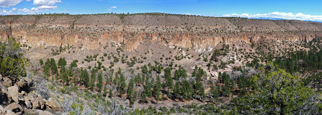
Frijolito is an unexcavated mesatop ruin on the southwest side of Frijoles Canyon, not especially interesting to look at, but reached by an enjoyable trail that climbs steeply to the canyon rim, giving good views of Tyuonyi and the valley floor
Length: 2.5 miles (loop)
Elevation change: 520 feet
Difficulty: Moderate
Type: Loop
Usage: Low
Season: All year, unless snow-covered in winter
Trailhead: Cottonwood picnic area
Rating (1-5): ★★★★★
Elevation change: 520 feet
Difficulty: Moderate
Type: Loop
Usage: Low
Season: All year, unless snow-covered in winter
Trailhead: Cottonwood picnic area
Rating (1-5): ★★★★★

Frijolito is an overgrown, unexcavated mesatop pueblo from the mid 1400s, close to the rim on the southwest side of Frijoles Canyon, not especially interesting to look at and probably not recognizable were it not for an NPS notice, but the trail past this site is enjoyable, offering fantastic views up and down the canyon. The ruins are visited along a 2.5 mile hike, the Frijolito Loop Trail, which combines two separate routes, the Long Trail and part of the Burro Trail; the former climbs slowly to the mesa via a lengthy straight, while the latter is much steeper, rising through many switchbacks then heading north along the rim.
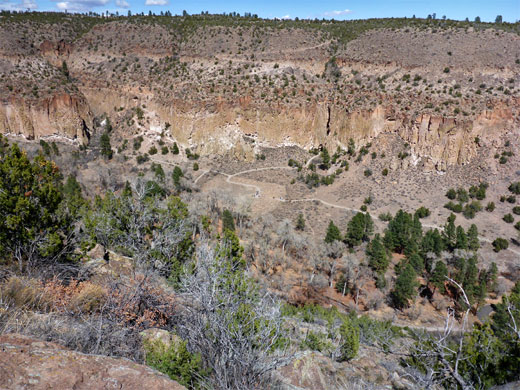
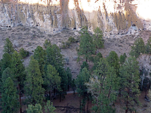
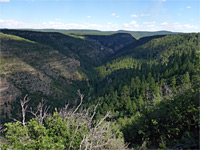
Besides the long distance views of the canyon and the Jemez Mountains to the north, the mesatop section of the path also affords a good view of Tyuonyi Pueblo below, and of the north-side cliff dwellings - a better perspective in fact than the Tyuonyi Overlook Trail, on the opposite canyon rim. The Frijolito Loop, which seems not often hiked, can be completed in little more than one hour.
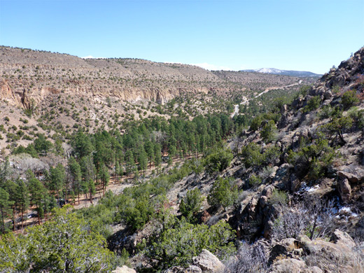
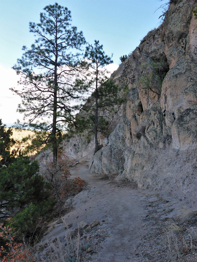
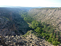
The Frijolito trailhead is along the side road to the extended Cottonwood picnic area, on the southwest side of Frijoles Creek. Just past the trail map and information board is a three-way junction; right is the Long Trail, signed to Yapashi (a larger, much more remote backcountry pueblo) amongst other places, left is the Falls Trail, while Frijolito is straight on, a path which climbs steeply right away, gaining height via many short switchbacks and several flights of rock-cut steps, up 400 feet to the canyon rim, when it divides. One branch heads southeast towards lower Alamo Canyon and the other, the most used route, follows the rim northwestwards and soon reaches the Frijolito pueblo site - a group of grass-covered blocks where about the only sign of former habitation are a few scattered pot fragments.
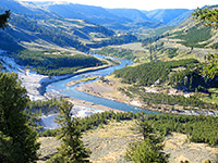
The path comes very close to the rim only briefly, above the Tyuonyi ruins, then moves away, staying generally out of sight of the valley floor while crossing sparse, pinyon-juniper woodland. The next junction is signed Yapashi 4.6 miles (left), Frijoles Canyon 0.7 miles (right), this latter being the Long Trail, the return route to the trailhead. Another notice warns of the danger of rock falls. The path is straight and rather narrow, descending gradually, so quite different to the ascent, with just one gentle switchback, near the lower end. A few light-colored rock formations are passed about half way along, but otherwise the surroundings are unremarkable. Both paths up the canyon sides are in shadow from mid morning onwards.
Besides the long distance views of the canyon and the Jemez Mountains to the north, the mesatop section of the path also affords a good view of Tyuonyi Pueblo below, and of the north-side cliff dwellings - a better perspective in fact than the Tyuonyi Overlook Trail, on the opposite canyon rim. The Frijolito Loop, which seems not often hiked, can be completed in little more than one hour.
Start of the Frijolito Trail
The Frijolito trailhead is along the side road to the extended Cottonwood picnic area, on the southwest side of Frijoles Creek. Just past the trail map and information board is a three-way junction; right is the Long Trail, signed to Yapashi (a larger, much more remote backcountry pueblo) amongst other places, left is the Falls Trail, while Frijolito is straight on, a path which climbs steeply right away, gaining height via many short switchbacks and several flights of rock-cut steps, up 400 feet to the canyon rim, when it divides. One branch heads southeast towards lower Alamo Canyon and the other, the most used route, follows the rim northwestwards and soon reaches the Frijolito pueblo site - a group of grass-covered blocks where about the only sign of former habitation are a few scattered pot fragments.
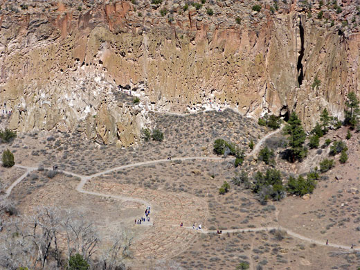
Frijoles Canyon Rim
The path comes very close to the rim only briefly, above the Tyuonyi ruins, then moves away, staying generally out of sight of the valley floor while crossing sparse, pinyon-juniper woodland. The next junction is signed Yapashi 4.6 miles (left), Frijoles Canyon 0.7 miles (right), this latter being the Long Trail, the return route to the trailhead. Another notice warns of the danger of rock falls. The path is straight and rather narrow, descending gradually, so quite different to the ascent, with just one gentle switchback, near the lower end. A few light-colored rock formations are passed about half way along, but otherwise the surroundings are unremarkable. Both paths up the canyon sides are in shadow from mid morning onwards.
Frijolito Loop - Similar Hikes
All Contents © Copyright The American Southwest | Comments and Questions | Contribute | Affiliate Marketing Disclosure | Site Map