The American Southwest
Home | Parks | Trails | Plants | Canyons
Maps | Landscapes | Site Map | Whats New? |
More...
Follow americansouthwest.net on Facebook
×
General Pages
Home
Parks
Trails
Plants
Slot Canyons
Maps
Landscapes
Itineraries
Site Map
What's New?
More pages...

States
Arizona
California
Colorado
Idaho
Nevada
New Mexico
Oregon
Texas
Utah
Wyoming


ARIZONA
CALIFORNIA
COLORADO
IDAHO
NEVADA
NEW MEXICO
OREGON
TEXAS
UTAH
WYOMING
NEW MEXICO
MAPS | PARKS | TRAILS | HOTELS

Map of Bandelier National Monument


New Mexico > Bandelier National Monument > Map
Map of Bandelier National Monument

Bandelier National Monument is accessed by Hwy 4, which starts in the west at an intersection with US 550, 24 miles from Bernalilo, and ends in the east at a junction with Hwy 502 near Los Alamos. The entrance to the monument is 40 miles from Santa Fe and 95 miles from Albuquerque.

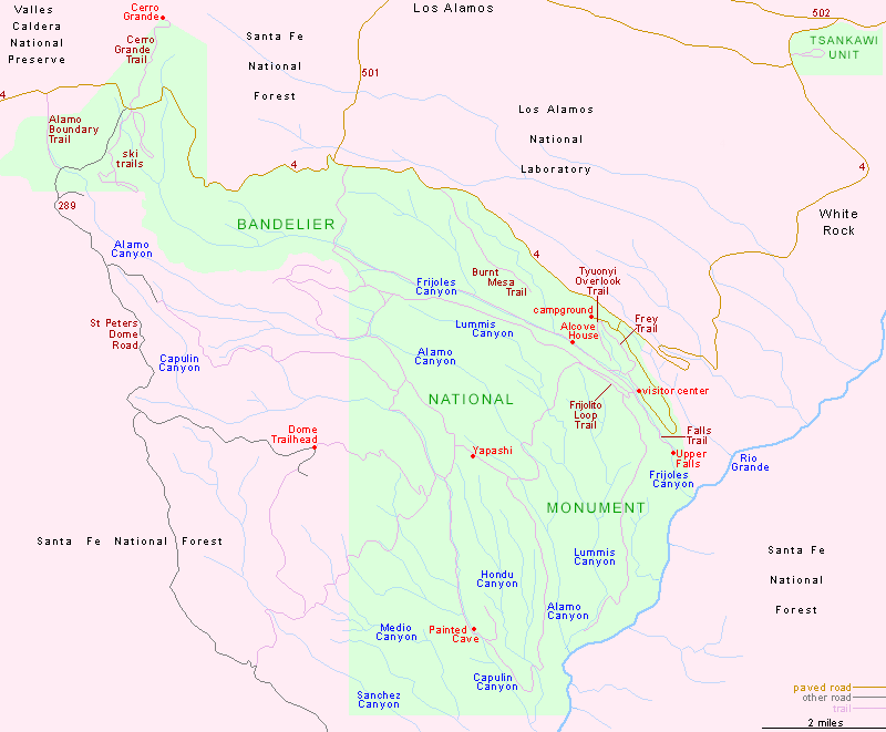
PDF format maps of Bandelier National Monument, from the National Park Service:

PDFOverview area map (3 mb)
Visitor Center area map (900 kb)

Back to Top
Arizona | California | Colorado | Idaho | Nevada | New Mexico | Oregon | Texas | Utah | Wyoming | Slot Canyons | Travelogue | SOUTHWEST

All Contents © Copyright The American Southwest | Comments and Questions | Contribute | Affiliate Marketing Disclosure | Site Map