Cerro Grande Trail, Bandelier National Monument
New Mexico > Bandelier National Monument > Hiking > Cerro Grande Trail
Cerro Grande Trail
Lightly traveled route through open, wildflower-filled woodland, up to a rounded volcanic summit, which is the highest point in the national monument, and gives expansive views west across Jemez Caldera and east towards the Rio Grande valley
Length: 2 miles
Elevation change: 1,250 feet
Difficulty: Easy to moderate; some parts are steep
Type: One way
Usage: Low
Season: Spring, summer, fall
Trailhead: Parking area along Hwy 4
Rating (1-5): ★★★★★
Elevation change: 1,250 feet
Difficulty: Easy to moderate; some parts are steep
Type: One way
Usage: Low
Season: Spring, summer, fall
Trailhead: Parking area along Hwy 4
Rating (1-5): ★★★★★

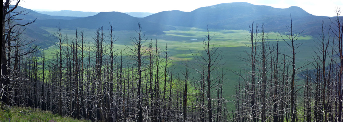
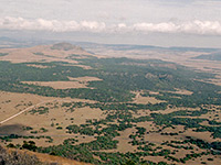
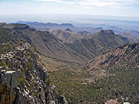
Land within Bandelier National Monument is wide ranging in elevation, from the desert-like Rio Grande corridor (5,300 feet) along the eastern boundary, to densely forested peaks in the west; the highest is 10,200 foot Cerro Grande, one of many volcanic summits associated with Valles Caldera a little way further west. Most trails in the monument are along the lower elevation canyons, where the ancient sites are located, but a few explore the higher regions, in particular the 2 mile route to the summit of Cerro Grande.
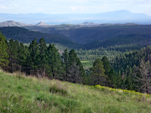
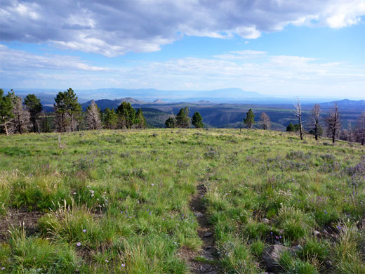
The path starts along Hwy 4, right at the northwest corner of the park, climbing through sparse ponderosa pine forest then over open slopes to the summit, where the views are partly obscured by trees but still very extensive - east towards the Rio Grande and Santa Fe, west over the caldera. The foreground is not so special, however, as all the nearby hills are rounded, wooded and similar in appearance, lacking any particular focus.
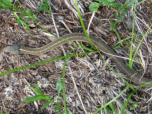
Perhaps the best aspect of the hike is just the quiet, cool woodland, which is filled with a varied array of summer wildflowers, with perhaps 50 different species found here. The trail is little-used, partly as most people enter and exit the monument from the east rather than the west; the main entrance at Frijoles Canyon is 12 miles away.
Map of Bandelier National Monument.
The Cerro Grande trailhead is at a prominent pull-out on the north side of Hwy 4, just east of the short Valle Grande Trail in the adjacent Valles Caldera National Preserve. Other paths start directly opposite on the south side of the road, mostly used in winter as cross country skiing routes.
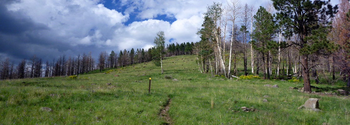
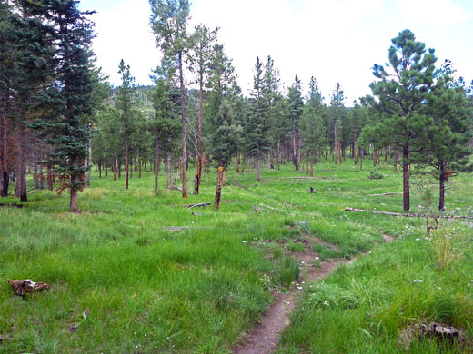
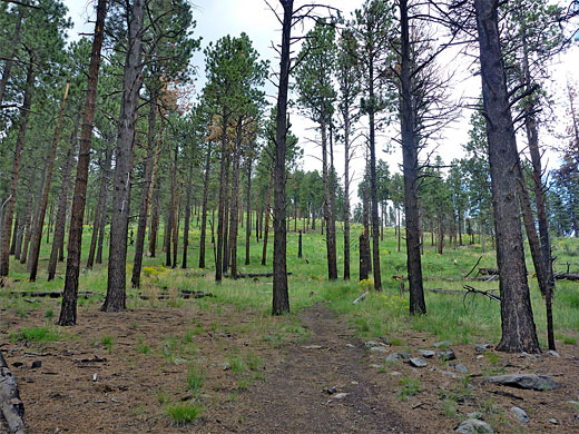
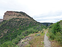
The highway is bordered to the north by open pine woods, where the tall, mature trees are quite well spaced, separated by a few grassy clearings, and with little undergrowth apart from grass and wildflowers. The path sets off through the trees up a very gentle slope, soon coming close to a fenced-off area on the right, beside a large meadow. Traffic noise remains audible for a while, as further east, the highway curves round to avoid a canyon, remaining quite close to the trail, which becomes temporally steeper, curving to the right, levelling off again and coming within sight of steeper slopes ahead. The surroundings now are a mix of moist areas, marked by longer grass and more flowers, and drier, less vegetated patches. One section is quite recently fire damaged, in 2011.
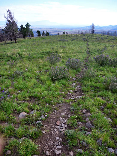
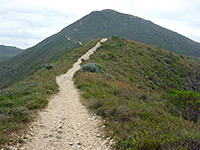
The path continues rising to an open, grassy saddle, backed by still higher slopes ahead, as the outline of the peak comes first in to view. At one time the path went straight up, but it was rerouted a few years ago, taking a longer, but less steep course - bending north, briefly back into light woodland then cutting back, up a series of shortening switchbacks, now marked with yellow arrows so as to be visible early in the season when the ground is still snow covered. The flattish summit is reached soon after, accompanied by a big cairn, and covered only by rocks and grass, though more burnt trees are close by to the north. There are still plenty of wildflowers at this high elevation; most numerous hereabouts are lupinus argenteus.
The path starts along Hwy 4, right at the northwest corner of the park, climbing through sparse ponderosa pine forest then over open slopes to the summit, where the views are partly obscured by trees but still very extensive - east towards the Rio Grande and Santa Fe, west over the caldera. The foreground is not so special, however, as all the nearby hills are rounded, wooded and similar in appearance, lacking any particular focus.
Perhaps the best aspect of the hike is just the quiet, cool woodland, which is filled with a varied array of summer wildflowers, with perhaps 50 different species found here. The trail is little-used, partly as most people enter and exit the monument from the east rather than the west; the main entrance at Frijoles Canyon is 12 miles away.
Location
Map of Bandelier National Monument.
Cerro Grande Trailhead
The Cerro Grande trailhead is at a prominent pull-out on the north side of Hwy 4, just east of the short Valle Grande Trail in the adjacent Valles Caldera National Preserve. Other paths start directly opposite on the south side of the road, mostly used in winter as cross country skiing routes.
The Trail
The highway is bordered to the north by open pine woods, where the tall, mature trees are quite well spaced, separated by a few grassy clearings, and with little undergrowth apart from grass and wildflowers. The path sets off through the trees up a very gentle slope, soon coming close to a fenced-off area on the right, beside a large meadow. Traffic noise remains audible for a while, as further east, the highway curves round to avoid a canyon, remaining quite close to the trail, which becomes temporally steeper, curving to the right, levelling off again and coming within sight of steeper slopes ahead. The surroundings now are a mix of moist areas, marked by longer grass and more flowers, and drier, less vegetated patches. One section is quite recently fire damaged, in 2011.
Cerro Grande Summit
The path continues rising to an open, grassy saddle, backed by still higher slopes ahead, as the outline of the peak comes first in to view. At one time the path went straight up, but it was rerouted a few years ago, taking a longer, but less steep course - bending north, briefly back into light woodland then cutting back, up a series of shortening switchbacks, now marked with yellow arrows so as to be visible early in the season when the ground is still snow covered. The flattish summit is reached soon after, accompanied by a big cairn, and covered only by rocks and grass, though more burnt trees are close by to the north. There are still plenty of wildflowers at this high elevation; most numerous hereabouts are lupinus argenteus.
Cerro Grande Wildflowers
More wildflowers along the trail
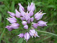 Geyer's onion |
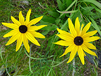 Black-eyed Susan |
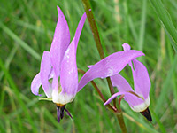 Darkthroat shootingstar |
More wildflowers along the trail
Cerro Grande Trail - Similar Hikes
All Contents © Copyright The American Southwest | Comments and Questions | Contribute | Affiliate Marketing Disclosure | Site Map