Highlights:
Cone of a long-extinct volcano, rising 1,000 feet above the surrounding featureless plains. A road climbs to the top, and a trail circles the rim. Another path explores overgrown lava deposits
Nearby town:
Raton, 32 miles
Management:
Location:
Seasons:
All year. Receives moderate snowfall in winter
Rating (1-5):
★★★★★

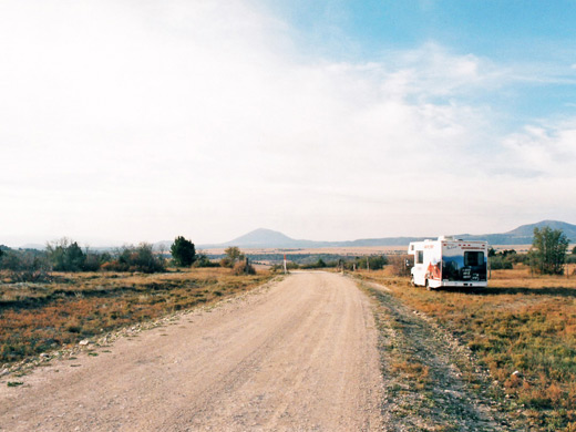
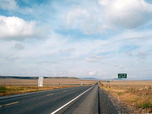
Capulin Volcano is not one of the Southwest's major attractions, partly due to its isolated location in the far northeast corner of New Mexico, well away from other popular destinations. The land hereabouts is a transition zone between the high plains of north Texas-west New Mexico and the foothills of the Rocky Mountains, containing mostly arid prairie, used for cattle rather than agriculture, and crossed by numerous small ravines and washes, with occasional hilly outcrops.
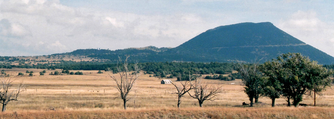
The hills and mesas become higher further west, and the region between Clayton and Raton additionally has many scattered volcanic peaks - dormant volcanoes and cinder cones, all part of a great line of vulcanism stretching from southeast Colorado into Arizona, including the El Malpais lava field and the Valley of Fires. Most of the peaks are quite small, rising just a few hundred feet above the plains, but one of the largest and best preserved is the 1,000 foot high Capulin Volcano, located between the small towns of Folsom and Capulin, and proclaimed a national monument in 1916.
The hills and mesas become higher further west, and the region between Clayton and Raton additionally has many scattered volcanic peaks - dormant volcanoes and cinder cones, all part of a great line of vulcanism stretching from southeast Colorado into Arizona, including the El Malpais lava field and the Valley of Fires. Most of the peaks are quite small, rising just a few hundred feet above the plains, but one of the largest and best preserved is the 1,000 foot high Capulin Volcano, located between the small towns of Folsom and Capulin, and proclaimed a national monument in 1916.
Capulin Volcano Table of Contents
Maps
PDF format maps of Capulin Volcano National Monument, from the National Park Service:
Park map (92 kb)
Photographs
7 views of Capulin Volcano National Monument.
Surroundings
| Capulin Volcano - one of the 20 least visited national monuments in the West |
The Volcano
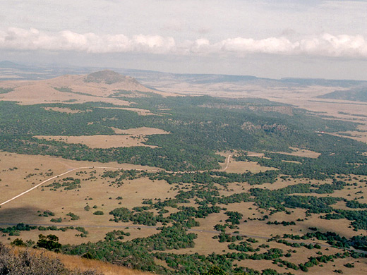
The national monument has a small visitor center that charges a relatively high $20 per vehicle for entry (2024), or $35 for an annual pass. One short path starts nearby - the Lava Flow Trail, which loops through woodland, meadows and occasional patches of overgrown lava for 2 miles, but the main activity here is to drive the road to the top of the volcano then walk along the loop path on the crater rim. The road curves 360° round the peak, ending at a parking area 600 feet above the visitor center, at the lowest point of the rim on its west side. Prevailing winds during the last eruption around 60,000 years ago pushed cinders more to the east, so the east rim is up to 300 feet higher. The sides of the volcano are quite densely covered by pinyon/ponderosa pine trees and juniper bushes, unlike most nearby volcanoes, and even the top of the rim is often overgrown though all growth is quite stunted here due to poor soil quality and lack of water. Opuntia cacti are found even at the highest point (8,182 feet).
Trails of Capulin Volcano National Monument
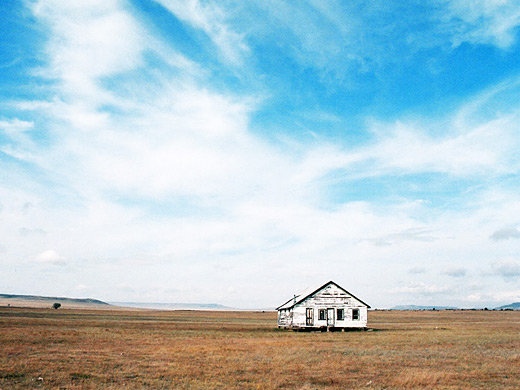
The one mile rim trail is steep in parts, though short, but often more difficult than might be expected due to frequent strong winds and the high elevation. The rim offers good views of distant lands in all directions, including various lava flows, now mostly grass-covered and difficult to identify from ground level. Another short trail descends into the shallow crater. The volcano is best photographed from a distance, such as from Capulin itself, along the main highway. This is another sleepy town, with a selection of abandoned buildings.
Capulin Volcano - Nearby Places
- Cimarron Canyon State Park (85 miles) - wooded, steep-sided canyon with unusual rocks
- Great Sand Dunes National Park, Colorado (163 miles) - the largest dunes in America
Capulin Volcano - Similar Places
- Lunar Crater, Nevada - wide volcanic crater in an isolated region
- Sunset Crater Volcano, Arizona - several volcanoes, with lava fields and cinder cones
All Contents © Copyright The American Southwest | Comments and Questions | Contribute | Affiliate Marketing Disclosure | Site Map