Cable Mountain
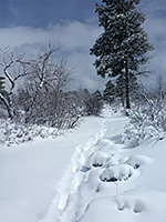
Remote, east-side viewpoint high above Zion Canyon, reached by a 2.5 mile hike across a partly wooded plateau, from a junction with the East Rim Trail. The junction can be approached from Weeping Rock in the west or Hwy 9 in the east; the latter route is longer but less strenuous, and only slightly less scenic
Length: 8.4 miles from the east entrance, or 7.1 miles from Weeping Rock
Elevation change: 1,200 feet, 2,600 feet
Difficulty: Strenuous
Type: One way; most of the route is along the East Rim Trail
Usage: Low
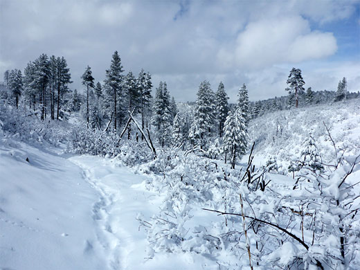
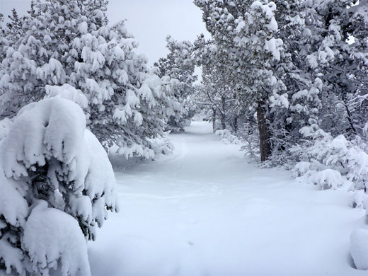
Season: Late spring, summer, fall - closed by snow at other times
Trailhead: East entrance, or Weeping Rock
Rating (1-5): ★★★★★
Elevation change: 1,200 feet, 2,600 feet
Difficulty: Strenuous
Type: One way; most of the route is along the East Rim Trail
Usage: Low
Season: Late spring, summer, fall - closed by snow at other times
Trailhead: East entrance, or Weeping Rock
Rating (1-5): ★★★★★

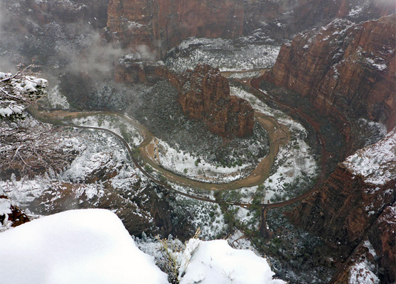
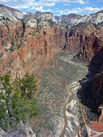
There are three spectacular viewpoints high above the Big Bend of Zion Canyon, where the Virgin River curves 270 degrees round a huge, protruding fin; Angels Landing and Observation Point, both very popular, and Cable Mountain, which is visited much less often owing to the longer hike required, either 6.9 miles starting from Weeping Rock along the canyon floor, or 8.2 miles beginning at the east park entrance along Hwy 9. Most of the walk is on the East Rim Trail, which links the two trailheads; the actual Cable Mountain Trail is only 2.5 miles long, an easy route with only minor elevation changes, crossing a partly wooded plateau to the viewpoint, on the brink of one of the tallest and steepest cliffs in the park.
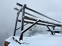
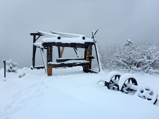
Although the land to the southeast of the viewpoint rises gently by 500 feet to a flat, indistinct summit, the name Cable Mountain seems to refer to the rocky plateau by the canyon edge, so named for the aerial tramway that was installed here between 1899 and 1901, used to transport timber and other goods, from the forested high country down to the canyon floor. The cable system operated only until 1927, soon after which the cable was removed and the lower terminal dismantled, but the upper structure remains today, and has been stabilized several times, most recently in 2011.
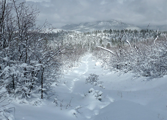
The approach along the East Rim Trail from Weeping Rock is a little shorter, significantly steeper and somewhat more scenic than the eastern route. It climbs the rocky slopes around the lower end of Echo Canyon, moves along a bench above the enclosed middle portion of the drainage to a wider, more tree-covered area where several tributaries join, then ascends further up a ridge to the southeast, into the upper reaches of a shallow, grassy valley, and meets the Cable Mountain Trail close to Stave Spring, once the site of a sawmill. The alternative approach, from the east (the generally preferred option), is initially equally as spectacular, climbing through one canyon and passing above two more, before leveling out and encountering mostly wooded surroundings en route to the junction near the spring. A third, rarely used trailhead is at the end of 1.8 miles of dirt tracks west of Zion Ponderosa Resort, accessed from the paved North Fork Road; from here, the start of the Cable Mountain route is 0.8 miles away.
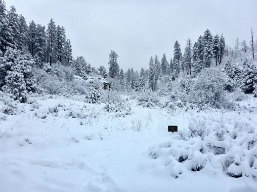
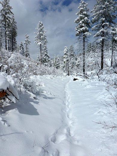
The trail junction near Stave Spring is at the edge of a meadow lined by some red rock outcrops and crossed by a small, seasonal stream. The path to Cable Mountain (and to the even more remote overlook at Deertrap Mountain) runs south up a low valley, passing a few more sandstone cliffs to the east, through sparse woodland of tall ponderosa pines, lacking much undergrowth. The route curves westwards, away from the valley floor, up a gentle hillside to a flat, less wooded area where the views open out. Another junction is soon reached, on a minor ridgetop; Deertrap Mountain is straight on while Cable Mountain is right. This path, quite narrow, rises slightly to a 6,940 foot summit, the highest point for some distance in all directions, then enters more forested land, coming close to the head of a sheer-walled ravine to the north, an inaccessible tributary of Echo Canyon.
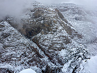
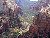
The path becomes quite straight for a while, descending gradually through the trees before veering right and traversing back left, down a briefly steeper section as the distant cliffs around the Virgin River come into view ahead. The final stretch is straight once more, to a flat area on the rim, site of the tramway relics which include a timber frame, an iron engine and other wooden items. A sign warns about getting too close to the sheer, unfenced cliff edge. The overlook is directly above Weeping Rock, 2,100 feet below, between the lower ends of Hidden and Echo canyons, and it has spectacular views across the Virgin River towards Angels Landing, Observation Point, Great White Throne and many other white sandstone summits.
Although the land to the southeast of the viewpoint rises gently by 500 feet to a flat, indistinct summit, the name Cable Mountain seems to refer to the rocky plateau by the canyon edge, so named for the aerial tramway that was installed here between 1899 and 1901, used to transport timber and other goods, from the forested high country down to the canyon floor. The cable system operated only until 1927, soon after which the cable was removed and the lower terminal dismantled, but the upper structure remains today, and has been stabilized several times, most recently in 2011.
East Rim Trail
The approach along the East Rim Trail from Weeping Rock is a little shorter, significantly steeper and somewhat more scenic than the eastern route. It climbs the rocky slopes around the lower end of Echo Canyon, moves along a bench above the enclosed middle portion of the drainage to a wider, more tree-covered area where several tributaries join, then ascends further up a ridge to the southeast, into the upper reaches of a shallow, grassy valley, and meets the Cable Mountain Trail close to Stave Spring, once the site of a sawmill. The alternative approach, from the east (the generally preferred option), is initially equally as spectacular, climbing through one canyon and passing above two more, before leveling out and encountering mostly wooded surroundings en route to the junction near the spring. A third, rarely used trailhead is at the end of 1.8 miles of dirt tracks west of Zion Ponderosa Resort, accessed from the paved North Fork Road; from here, the start of the Cable Mountain route is 0.8 miles away.
Cable Mountain Trail
The trail junction near Stave Spring is at the edge of a meadow lined by some red rock outcrops and crossed by a small, seasonal stream. The path to Cable Mountain (and to the even more remote overlook at Deertrap Mountain) runs south up a low valley, passing a few more sandstone cliffs to the east, through sparse woodland of tall ponderosa pines, lacking much undergrowth. The route curves westwards, away from the valley floor, up a gentle hillside to a flat, less wooded area where the views open out. Another junction is soon reached, on a minor ridgetop; Deertrap Mountain is straight on while Cable Mountain is right. This path, quite narrow, rises slightly to a 6,940 foot summit, the highest point for some distance in all directions, then enters more forested land, coming close to the head of a sheer-walled ravine to the north, an inaccessible tributary of Echo Canyon.
The Viewpoint
The path becomes quite straight for a while, descending gradually through the trees before veering right and traversing back left, down a briefly steeper section as the distant cliffs around the Virgin River come into view ahead. The final stretch is straight once more, to a flat area on the rim, site of the tramway relics which include a timber frame, an iron engine and other wooden items. A sign warns about getting too close to the sheer, unfenced cliff edge. The overlook is directly above Weeping Rock, 2,100 feet below, between the lower ends of Hidden and Echo canyons, and it has spectacular views across the Virgin River towards Angels Landing, Observation Point, Great White Throne and many other white sandstone summits.
Cable Mountain - Similar Hikes
All Contents © Copyright The American Southwest | Comments and Questions | Contribute | Affiliate Marketing Disclosure | Site Map