Spring Canyon, Capitol Reef National Park
Utah > Capitol Reef National Park > Hiking > Spring Canyon

Spring Canyon
Long, deep, twisting ravine that joins the north side of the Fremont River in the middle of Capitol Reef. A hike along the lowest few miles encounters tall cliffs, alcoves, pools and a seasonal stream
Length: 4 miles, or more
Elevation change: 250 feet
Difficulty: Easy, apart from fording of the Fremont River at the start
Type: One way; a route rather than a trail
Usage: Low
Season: All year, unless the Fremont River is in flood
Trailhead: Parking area along Hwy 24
Rating (1-5): ★★★★★
Elevation change: 250 feet
Difficulty: Easy, apart from fording of the Fremont River at the start
Type: One way; a route rather than a trail
Usage: Low
Season: All year, unless the Fremont River is in flood
Trailhead: Parking area along Hwy 24
Rating (1-5): ★★★★★

Spring Canyon begins on the slopes of Thousand Lakes Mountain in the Fishlake National Forest a few miles north of Torrey, and heads east towards Capitol Reef, deepening slowly but steadily while remaining relatively wide, until a short distance after the junction with Chimney Rock Canyon, where it becomes narrower and more enclosed, now cutting through the Wingate and Navajo sandstone layers in the middle of the Waterpocket Fold. It twists and turns for several more miles before meeting the Fremont River, towards the east edge of the Fold, beside Hwy 24 and four miles from the national park visitor center.
There are no significant obstacles in the canyon apart from one short slot, and all of its 18 mile length is open to hiking, though the downstream half is more interesting, and there are two main options to explore it; a one way trip, incorporating a vehicle shuttle, down Chimney Rock Canyon then along the remaining seven miles of the main canyon (a total of ten miles, starting at the Chimney Rock trailhead), or a there-and-back hike beginning at the lower end. The deepest and most enclosed section extends for four miles upstream of the Fremont River confluence, and the hike along this stretch is described below.
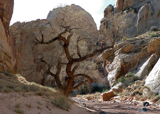
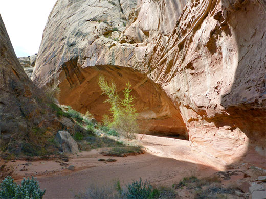
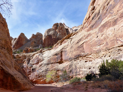
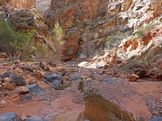
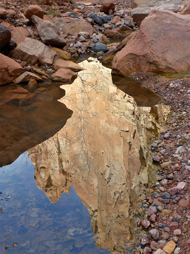
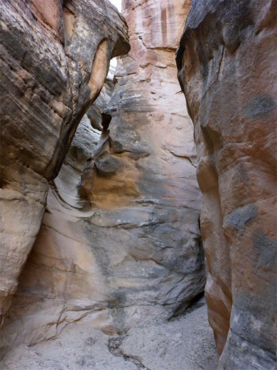
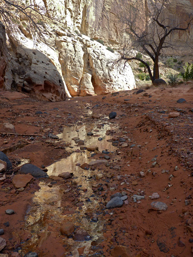
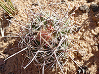
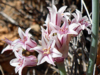
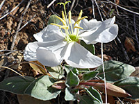
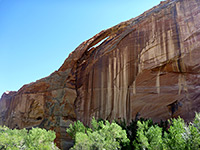
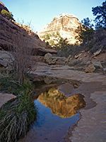
The gorge is moderately narrow in parts and contains stretches of flowing water, forming a few small cascades and long, shallow pools. Some sections of streambed border sandbanks that support trees and bushes, while in places the seasonal water covers most of the canyon floor. Other points of interest include narrow tributaries, several huge alcoves, and the usual array of colorful, eroded rock formations. Wildflowers are somewhat limited owing to the tall cliffs that prevent most sunlight from reaching the canyon floor.
Spring Canyon topographic map, trail map for Capitol Reef.
18 views of Spring Canyon.
The route through Spring Canyon is recognized by the NPS but there is no notice along Hwy 24, and no obvious sign of the canyon either, since the mouth is narrow, partly hidden by a low fin, and also because the confluence with the Fremont River is shielded by large cottonwood trees. There is plenty of parking space nearby, 800 feet southwest, at wide pull-outs either side of the highway. The river can be crossed in the vicinity of the pull-outs, but low cliffs on the far side create another obstacle, and these become sheer and run right beside the river at one point, just before reaching Spring Canyon; instead, the usual crossing point seems to be immediately west of the confluence, after a short walk through the trees on the south side of the river. The water is generally between one and two feet deep, muddy and quite fast flowing.
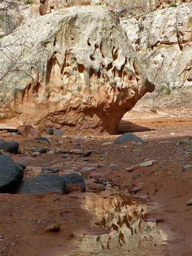
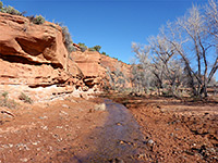
The mouth of the canyon contains residual pools and sometimes flowing water, and is enclosed by bands of trees, reeds and bushes, which extend for about half a mile, above which the drainage is usually dry, narrower, and contains much less vegetation. A path climbs over a sandbank to cut off a corner, as the canyon bends to the north and the cliffs become taller. Walking is now very easy, on gravel or firm sand. After a huge undercut, the stream bends back west and on the outside of the curve is the first minor tributary, leading to a very short slot with a pour-off above. This is followed by another tight bend, a more open stretch and then some wider curves, one opposite a broad, flat bench on the west side, about 50 feet up, this 1.6 miles from the river. After 2 miles, a second tributary joins on the right, soon reaching a high dryfall beneath an inaccessible slot.
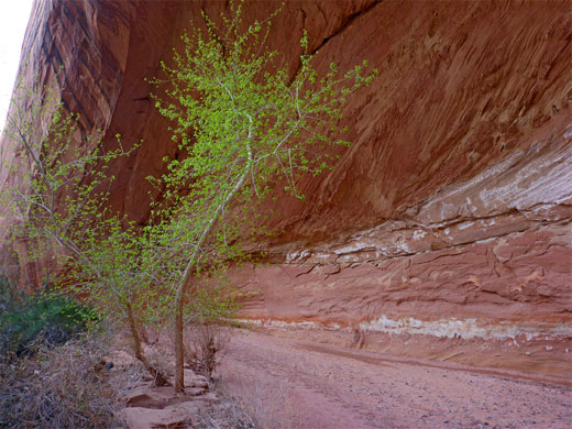
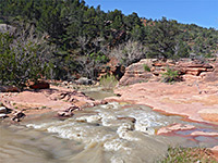
After a few more minutes walking, a shallow (seasonal) stream begins to flow, making the scenery more photogenic; the creek bed is lined with large, isolated cottonwood trees, sometimes reflected in the shallow waters below. Two tight bends are reached after 2.7 miles, either side of narrow fins, soon followed by another significant undercut and more curves, as the drainage constricts further; the stream covers all the floor for one short section, then the canyon alternates between flowing water and dry patches, as it twists and turns in either direction. The passageways are briefly filled with numerous boulders, some very large, and the stream emerges from a spring at the base of one, then, after a short climb, the canyon is much drier and soon enters a long, wide, bushy, less-interesting section, 4 miles from the river, hence this is a suitable place to stop, for shorter hikes. Ahead, the ravine is generally more open as the enclosing cliffs are significantly lower, though there is a 300 foot slot section after 6 miles that includes a couple of unclimbable falls, passable by walking on a bench and across a steep slope to the northeast. The junction with Chimney Rock Canyon is one mile further.
There are no significant obstacles in the canyon apart from one short slot, and all of its 18 mile length is open to hiking, though the downstream half is more interesting, and there are two main options to explore it; a one way trip, incorporating a vehicle shuttle, down Chimney Rock Canyon then along the remaining seven miles of the main canyon (a total of ten miles, starting at the Chimney Rock trailhead), or a there-and-back hike beginning at the lower end. The deepest and most enclosed section extends for four miles upstream of the Fremont River confluence, and the hike along this stretch is described below.
The gorge is moderately narrow in parts and contains stretches of flowing water, forming a few small cascades and long, shallow pools. Some sections of streambed border sandbanks that support trees and bushes, while in places the seasonal water covers most of the canyon floor. Other points of interest include narrow tributaries, several huge alcoves, and the usual array of colorful, eroded rock formations. Wildflowers are somewhat limited owing to the tall cliffs that prevent most sunlight from reaching the canyon floor.
Maps
Spring Canyon topographic map, trail map for Capitol Reef.
Photographs
18 views of Spring Canyon.
Access to Spring Canyon
The route through Spring Canyon is recognized by the NPS but there is no notice along Hwy 24, and no obvious sign of the canyon either, since the mouth is narrow, partly hidden by a low fin, and also because the confluence with the Fremont River is shielded by large cottonwood trees. There is plenty of parking space nearby, 800 feet southwest, at wide pull-outs either side of the highway. The river can be crossed in the vicinity of the pull-outs, but low cliffs on the far side create another obstacle, and these become sheer and run right beside the river at one point, just before reaching Spring Canyon; instead, the usual crossing point seems to be immediately west of the confluence, after a short walk through the trees on the south side of the river. The water is generally between one and two feet deep, muddy and quite fast flowing.
The First Two Miles
The mouth of the canyon contains residual pools and sometimes flowing water, and is enclosed by bands of trees, reeds and bushes, which extend for about half a mile, above which the drainage is usually dry, narrower, and contains much less vegetation. A path climbs over a sandbank to cut off a corner, as the canyon bends to the north and the cliffs become taller. Walking is now very easy, on gravel or firm sand. After a huge undercut, the stream bends back west and on the outside of the curve is the first minor tributary, leading to a very short slot with a pour-off above. This is followed by another tight bend, a more open stretch and then some wider curves, one opposite a broad, flat bench on the west side, about 50 feet up, this 1.6 miles from the river. After 2 miles, a second tributary joins on the right, soon reaching a high dryfall beneath an inaccessible slot.
Stream and Boulders
After a few more minutes walking, a shallow (seasonal) stream begins to flow, making the scenery more photogenic; the creek bed is lined with large, isolated cottonwood trees, sometimes reflected in the shallow waters below. Two tight bends are reached after 2.7 miles, either side of narrow fins, soon followed by another significant undercut and more curves, as the drainage constricts further; the stream covers all the floor for one short section, then the canyon alternates between flowing water and dry patches, as it twists and turns in either direction. The passageways are briefly filled with numerous boulders, some very large, and the stream emerges from a spring at the base of one, then, after a short climb, the canyon is much drier and soon enters a long, wide, bushy, less-interesting section, 4 miles from the river, hence this is a suitable place to stop, for shorter hikes. Ahead, the ravine is generally more open as the enclosing cliffs are significantly lower, though there is a 300 foot slot section after 6 miles that includes a couple of unclimbable falls, passable by walking on a bench and across a steep slope to the northeast. The junction with Chimney Rock Canyon is one mile further.
Spring Canyon - Similar Hikes
All Contents © Copyright The American Southwest | Comments and Questions | Contribute | Affiliate Marketing Disclosure | Site Map