Highlights:
Thousands of petroglyphs dating from 1300 to 1600 AD, carved into dark volcanic rocks at the edge of a low mesa bordering northwest Albuquerque; viewable from several easy trails. Three main regions - Boca Negra Canyon, Piedras Marcadas Canyon, Rinconada Canyon
Nearby town:
Albuquerque, 2 miles
Management:
Location:
35.138, -106.710 (visitor center)
Seasons:
All year
Rating (1-5):
★★★★★
Weather:


Petroglyph NM is part of the New Mexico Highlights itinerary
Featured Hotel
Quality Inn Albuquerque
 Popular, three floor hotel near Old Town Albuquerque, at the intersection of Coors Boulevard and I-40; 7 miles from the national monument visitor center
Check Rates
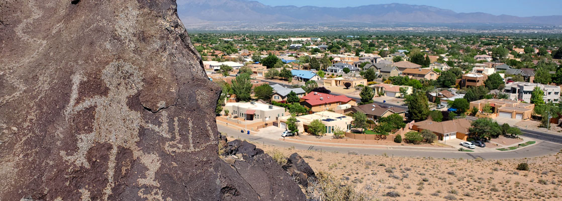
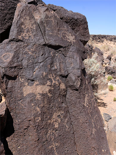
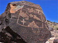
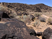
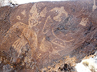
Beyond the Rio Grande, Albuquerque is bordered on the west side by a low, barren, volcanic plateau (West Mesa) - 200 feet high and extending for over 15 miles, the only feature rising above the flat grasslands are the cones of several long-extinct volcanoes, but even these are small and unremarkable. More interesting is the eastern edge, a steep slope of broken lava blocks, since here are found approximately 24,000 petroglyphs, most dating from the Ancestral Pueblo period of 1300 to 1600 AD, made by chipping away the dark, weathered surface of the lava to reveal the light-colored rock underneath.
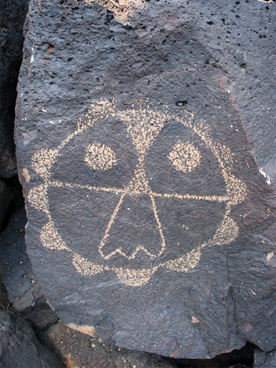
The carvings have a huge variety of designs, some very complex, including animals, hunting scenes, people, masks, geometric patterns and abstract shapes, and in many places occur in dense groups with dozens on a single boulder.
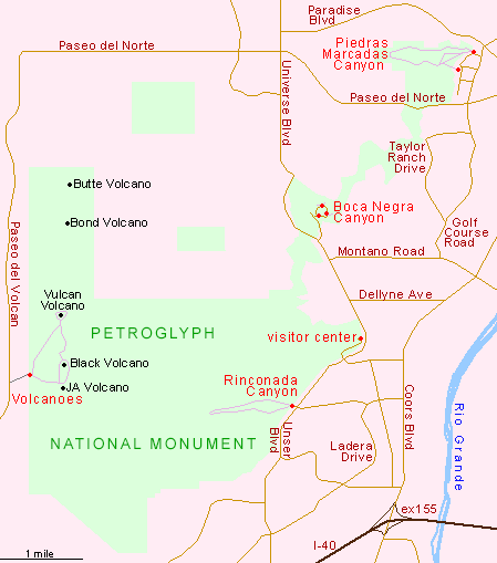
There are three designated sites for visitors, at Boca Negra Canyon, Piedras Marcadas Canyon, Rinconada Canyon (see map), part of Petroglyph National Monument, which was created relatively recently (1990) and includes 11 square miles of the mesa together with five fissure volcanoes, reached by a less-traveled route to the west.
The carvings have a huge variety of designs, some very complex, including animals, hunting scenes, people, masks, geometric patterns and abstract shapes, and in many places occur in dense groups with dozens on a single boulder.
There are three designated sites for visitors, at Boca Negra Canyon, Piedras Marcadas Canyon, Rinconada Canyon (see map), part of Petroglyph National Monument, which was created relatively recently (1990) and includes 11 square miles of the mesa together with five fissure volcanoes, reached by a less-traveled route to the west.
Petroglyph National Monument Table of Contents
Map of Petroglyph National Monument
Photographs
Boca Negra Canyon, Piedras Marcadas Canyon, Rinconada Canyon.
Video - Piedras Marcadas Canyon
Introduction
The main part of the monument, in the east, adjoins the Albuquerque suburbs so a visit here is a long way removed from a wilderness experience but the land on the plateau is suitably arid and desert-like, sprinkled with cacti and home to rattlesnakes, lizards and other elusive creatures. Despite the proximity to the city, the petroglyphs are largely free of modern graffiti, and although some are faded and indistinct, many are crisp and well defined. Visiting times can range from half an hour for a quick walk along one of the paths or a full day if hiking all trails and exploring the volcanoes.
National Monument Access Points
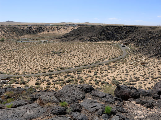
The national monument, to which entry is free, is well signed from both nearby interstate highways (I-15 and I-40), and reached by wide city streets through residential districts. First stop should be at the visitor center, situated at the foot of the mesa along Western Trail NW, from where the most interesting site (Rinconada Canyon, which has the longest trail) is one mile south, while the other two are a few miles further north. Off-trail hiking is possible though not encouraged, and the mesa edge stretches for over ten miles within the monument so there is plenty of scope for discovering new petroglyphs, away from the popular areas. The Volcanoes section in the west is 5 miles north of I-40 exit 149; a short, recently paved spur road leads to the trailhead for a 3 mile loop path around three cones (JA Volcano, Black Volcano and Vulcan Volcano), where such features as spatter magma, cinders and ash can be seen.
Units of Petroglyph National Monument
Small canyon at the north end of Unser Boulevard, with loop road and short trails, visiting around 150 petroglyphs
Wide, branched valley containing several hundred petroglyphs on the north side, toured by a one mile trail; the least-visited section
The main section of the national monument, including the headquarters building; off busy Unser Boulevard, with many hundreds of petroglyphs
Petroglyph National Monument - Nearby Places
- Kasha-Katuwe Tent Rocks (55 miles) - fantastic volcanic rock formations
- Route 66 (40 miles to Laguna) - long stretch of the famous old road
Petroglyph National Monument - Similar Places
- Newspaper Rock, Utah - many petroglyphs on a cliff face, near Canyonlands National Park
- Petroglyph Canyon, Valley of Fire State Park, Nevada - short ravine with ancient rock art
All Contents © Copyright The American Southwest | Comments and Questions | Contribute | Affiliate Marketing Disclosure | Site Map