Boca Negra Canyon, Petroglyph National Monument
New Mexico > Petroglyph National Monument > Boca Negra Canyon
Boca Negra Canyon Trails
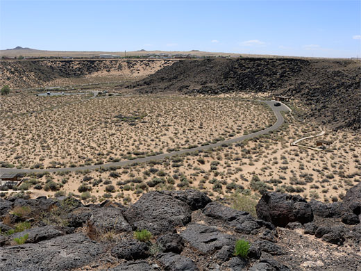
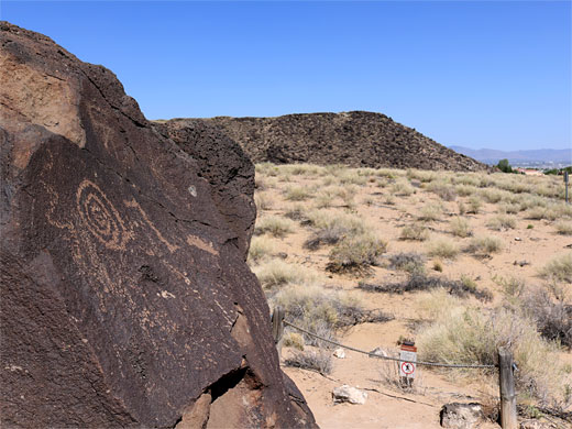
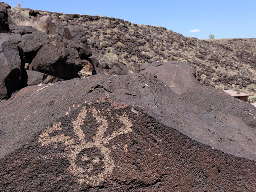
The smallest section of Petroglyph National Monument, comprising a small basin lined to the north by a curving lava slope. Three short, linked trails, visiting around 150 petroglyphs; one path climbs to the top of the mesa, for good views over the city
Length: 0.8 miles, round trip, for all trails
Elevation change: 140 feet
Difficulty: Easy
Type: Loop
Usage: High
Season: All year
Trailhead: Atrisco Drive
Rating (1-5): ★★★★★
Elevation change: 140 feet
Difficulty: Easy
Type: Loop
Usage: High
Season: All year
Trailhead: Atrisco Drive
Rating (1-5): ★★★★★

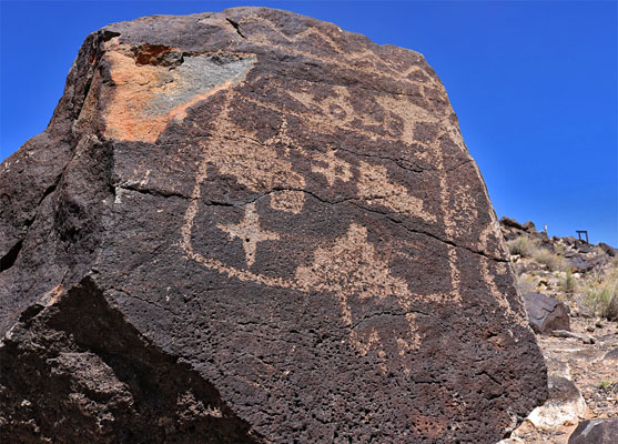
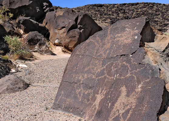
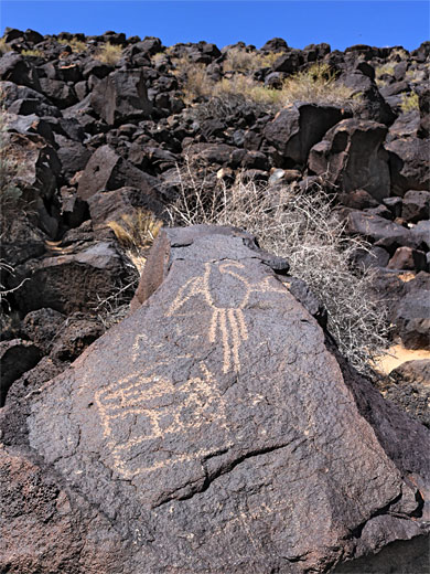
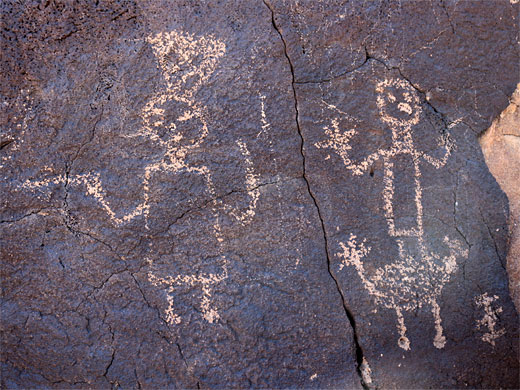
The smallest and most developed part of Petroglyph National Monument is Boca Negra Canyon at the north end of Unser Boulevard, where facilities include drinking water, restrooms and shaded picnic areas. A loop road passes the trailheads for three short, partly paved walks to petroglyph sites, visiting about 150 drawings - many fewer than Rinconada Canyon which has over 1,000, but there are still plenty of impressive panels. Unlike other areas of the monument, a parking fee is charged here, of $1 weekdays and $2 weekends. More petroglyphs can be viewed by another, less used path (the Canyon Trail) a little further north.
This section of the national monument is owned and staffed by the City of Albuquerque, who enforce a last entry time of 4 pm each day; the place closes at 4:30. Prior to creation of the monument, the canyon was protected as Indian Petroglyph State Park, established in 1973, and it contains about 5% of all the petroglyphs in the area.
The three paths can be hiked individually, though parking at the actual trailheads is rather limited, and it is best to leave vehicles in the main lot at the entrance, and hike all together, since they are linked, to make a loop of 0.8 miles.
From the entrance parking place, a path heads east, close to the road, to the start of the Mesa Point Trail, a lollipop loop of a quarter of a mile. This encounters several particularly fine petroglyph panels, all on large, dark borders, some right beside the path. A little spur at the upper end leads to a good, elevated viewpoint. Several of the panels along the upper reaches of the path offer a grand and striking juxtaposition, of the ancient designs right above the modern suburbs of Albuquerque. Back at the start, another link trail continues alongside the road, past the picnic ramadas to a pair of very short loops, the Macaw Trail and the Cliff Base Trail, both also with a good variety of panels. It is then just a couple of minutes walk back to the parking lot.
This section of the national monument is owned and staffed by the City of Albuquerque, who enforce a last entry time of 4 pm each day; the place closes at 4:30. Prior to creation of the monument, the canyon was protected as Indian Petroglyph State Park, established in 1973, and it contains about 5% of all the petroglyphs in the area.
The three paths can be hiked individually, though parking at the actual trailheads is rather limited, and it is best to leave vehicles in the main lot at the entrance, and hike all together, since they are linked, to make a loop of 0.8 miles.
The Trails
From the entrance parking place, a path heads east, close to the road, to the start of the Mesa Point Trail, a lollipop loop of a quarter of a mile. This encounters several particularly fine petroglyph panels, all on large, dark borders, some right beside the path. A little spur at the upper end leads to a good, elevated viewpoint. Several of the panels along the upper reaches of the path offer a grand and striking juxtaposition, of the ancient designs right above the modern suburbs of Albuquerque. Back at the start, another link trail continues alongside the road, past the picnic ramadas to a pair of very short loops, the Macaw Trail and the Cliff Base Trail, both also with a good variety of panels. It is then just a couple of minutes walk back to the parking lot.
All Contents © Copyright The American Southwest | Comments and Questions | Contribute | Affiliate Marketing Disclosure | Site Map