Rinconada Canyon, Petroglyph National Monument
New Mexico > Petroglyph National Monument > Rinconada Canyon
Rinconada Canyon Trail
Path into the main section of Petroglyph National Monument, along the base of a south-facing slope of basalt boulders, passing many hundreds of petroglyphs
Length: 2.2 miles, round trip
Elevation change: 60 feet
Difficulty: Easy
Type: Loop
Usage: High
Season: All year
Trailhead: Unser Boulevard
Rating (1-5): ★★★★★
Elevation change: 60 feet
Difficulty: Easy
Type: Loop
Usage: High
Season: All year
Trailhead: Unser Boulevard
Rating (1-5): ★★★★★

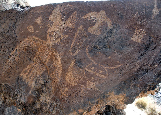
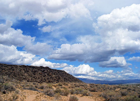
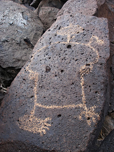
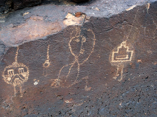
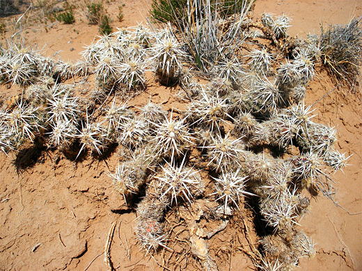
Rinconada Canyon is the most visited section of Petroglyph National Monument, at the east edge of the park - a wide valley, half a mile across at its mouth and about one mile long, bordered on both sides by steep slopes of lava blocks, up to 250 feet high. Further west is the rarely-explored interior of the monument, an extensive, rather featureless plateau crossed by a few dry washes. The canyon contains many hundreds of petroglyphs, with a great variety of designs, while other evidence of ancient peoples include the remains of rock walls and shelters.
The parking lot for the canyon (open 8 am to 5 pm daily) is just off busy Unser Boulevard, at the junction with St Josephs Avenue, half a mile south of the visitor center. A trail runs all along base of the slope on the north side of the valley, passing the petroglyphs, which are concentrated towards the west end; the furthest group is around the start of one of two rocky drainages (North Rinconada Arroyo) that leads up to the plateau. An optional return is by another path that runs right down the middle of the valley, all across sandy ground covered only by small bushes.
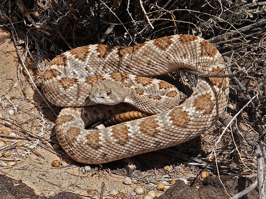
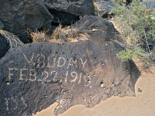
The 2.2 mile loop path to the petroglyphs leads westwards along the north edge of the canyon all the way to its upper end, then returns through grass and sagebrush in the middle. The ground is quite sandy underfoot so the walk can be slow, and hot in summer (up to 95°F), though there is no significant elevation change. The drainage is edged by steep slopes covered by big lava blocks, which are easy enough to climb, and reach the plateau above, for good views over the Rio Grande valley, the Sandia Mountains and the volcanoes to the west. The petroglyphs are generally more faded and fewer in number at the start, becoming more numerous and more complex around the upper end of the canyon. A few more recent designs have been added by later visitors, including signatures dating back to the early 20th century, but most rocks have only the original carvings. Perhaps the very best locations are a little way above the path at the far western edge.
The parking lot for the canyon (open 8 am to 5 pm daily) is just off busy Unser Boulevard, at the junction with St Josephs Avenue, half a mile south of the visitor center. A trail runs all along base of the slope on the north side of the valley, passing the petroglyphs, which are concentrated towards the west end; the furthest group is around the start of one of two rocky drainages (North Rinconada Arroyo) that leads up to the plateau. An optional return is by another path that runs right down the middle of the valley, all across sandy ground covered only by small bushes.
The Canyon
The 2.2 mile loop path to the petroglyphs leads westwards along the north edge of the canyon all the way to its upper end, then returns through grass and sagebrush in the middle. The ground is quite sandy underfoot so the walk can be slow, and hot in summer (up to 95°F), though there is no significant elevation change. The drainage is edged by steep slopes covered by big lava blocks, which are easy enough to climb, and reach the plateau above, for good views over the Rio Grande valley, the Sandia Mountains and the volcanoes to the west. The petroglyphs are generally more faded and fewer in number at the start, becoming more numerous and more complex around the upper end of the canyon. A few more recent designs have been added by later visitors, including signatures dating back to the early 20th century, but most rocks have only the original carvings. Perhaps the very best locations are a little way above the path at the far western edge.
All Contents © Copyright The American Southwest | Comments and Questions | Contribute | Affiliate Marketing Disclosure | Site Map