Highlights:
Extensive outcrops of red, yellow and pink rocks, eroded into striking formations. Park also has petrified dunes, narrow canyons, sheer cliffs and petroglyphs, and is one of the most photogenic locations in the Southwest. Viewed along Hwy 169 and a scenic drive
Nearby town:
North Las Vegas, 43 miles
Management:
Location:
36.429, -114.513 (visitor center)
Seasons:
All year; very hot in summer, however
Rating (1-5):
★★★★★
Weather:


Valley of Fire SP is part of the Grand Canyon itinerary
Valley of Fire - Scenic Drive
Six mile road through colorful formations at the center of the park, passing viewpoints and trailheads; paths lead to petroglyphs, rock formations and narrow canyons
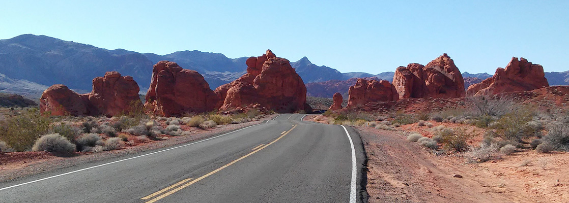
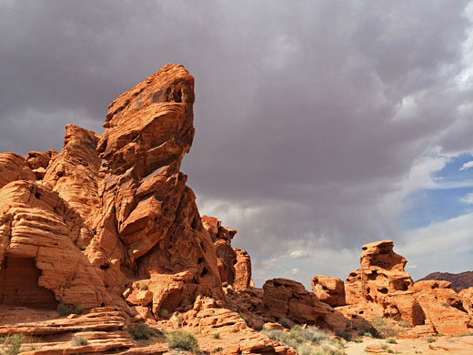
New Mexico has a Valley of Fires Recreation Area, containing a large expanse of black, twisted lava deposits set amongst barren land in the center of the state, but the similarly named park near Overton, 30 miles northeast of Las Vegas in Nevada offers a stark contrast - here, red is the dominant color, next to large expanses of contrasting pale yellow rock, both part of an undulating landscape of petrified dunes, strangely-shaped boulders and sheer sandstone cliffs set amongst an empty, very scenic region near the north end of Lake Mead.
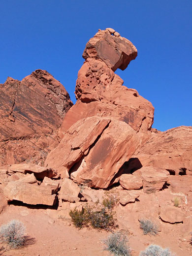
The drive to the area from the south (state road NV 167) passes buckled, layered cliffs and desert basins, often quite colorful, and has occasional views over the blue waters of Lake Mead to the east, but the valley is the most unusual place in the area. It is one of the most photogenic locations in the Southwest, especially at sunset when the rocks glow deep red and do indeed seem to be ablaze when seen from a distance. The landscape is made more striking by the surrounding black hills of somber appearance.
The drive to the area from the south (state road NV 167) passes buckled, layered cliffs and desert basins, often quite colorful, and has occasional views over the blue waters of Lake Mead to the east, but the valley is the most unusual place in the area. It is one of the most photogenic locations in the Southwest, especially at sunset when the rocks glow deep red and do indeed seem to be ablaze when seen from a distance. The landscape is made more striking by the surrounding black hills of somber appearance.
Valley of Fire Table of Contents
Valley of Fire FAQ
- Because of the red rocks! And also because the place is very hot for much of the year, with temperatures up to 110°F in midsummer. All the exposed rocks are Aztec sandstone, an early Jurassic formation, of two units, the upper of which is mostly red, while the lower unit is white to brown; both strata are found in the park.
- One hour is an absolute minimum, to drive the main road (7 miles) and stop at the roadside overlooks, but 3 hours is more realistic, to additionally drive the 5 mile scenic drive and try one or two of the shorter hikes, such as to Pastel Canyon or Mouse's Tank. One full day would be best, to see all overlooks and hike additional trails such as Fire Wave and White Domes.
- About an hour's drive - the east entrance is 58 miles from the Boulder Highway, along Northshore Road through Lake Mead NRA, while the west entrance is 62 miles from the same point, via Interstate 15.
- Yes, in daytime; in the evenings the two entrance stations are not staffed, and the road is never closed, being a public highway.
- Yes, though certain areas may be closed during the hottest times of midsummer, such as the trail to Fire Wave.
- Definitely one of the landscape highlights of Nevada - incredibly photogenic, full of fascinating geological formations, yet relatively compact and easy to explore.
- Both are very good, and different in geology, though Valley of Fire is more photogenic, and easier to explore.
- White Domes (1 mile loop), Mouse's Tank Petroglyphs (0.4 miles one-way) and Fire Wave/Pastel Canyon (2 mile loop).
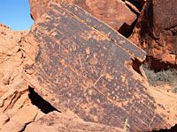
- Yes; the easiest-reached locations are along the short trail to Mouse's Tank, and at Atlatl Rock, beside the campground.
- In the 1920s, by the AAA, by an official travelling on the dirt road through the formations, which was constructed in 1912. The area became a state park in 1934.
Valley of Fire Tours
Hiking and sight-seeing tours of the valley, from Las Vegas.
Location
Map of Valley of Fire State Park.
Photographs
General views, Fire Canyon Wash, Magnesite Wash.
Valley of Fire Access
The approach to Valley of Fire State Park from the north is along straight roads across the wide valley of the Muddy River, through Logandale then Overton, which is a small town but one that has all necessary facilities. Access from the west starts at I-15 exit 75, from where NV 169 (Valley of Fire Road) crosses a vast desert plain for 7 miles then winds through a range of low, arid hills to the park entrance. Just before the hills, a track leaves to the south and leads to some old gravel piles and scattered concrete relics after half a mile, a place that makes a perfect (if rather lonely) place to camp - in sight of the distant interstate but many miles from any settlement. East of the state park, the nearest free camping is along side tracks leading into dusty hills a few miles south of Overton. All through traffic along NV 169 has to pay a fee to cross the state park ($20 in 2024), yet still the highway can become quite busy in summer, and forms part of a scenic diversion between Las Vegas and I-15 to the north - the journey involves an extra 55 miles, but is much more interesting than the interstate, which passes rather barren land between Las Vegas and the Arizona border.
The State Park
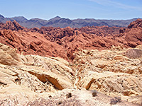
Driving to the Valley of Fire from east or west is equally scenic. Although red rocks are exposed at scattered locations all over the desert adjoining the west side of Lake Mead, the state park boundaries enclose the most interesting formations, found along 10 miles of the highway and extending over 30 miles to the north, over a large area of mostly trackless land almost as far as Glendale, at exit 90 of the interstate. The exposed rock responsible for the dramatic colors and formations is Aztec sandstone, formed by petrifaction of ancient sand dunes during the Jurassic era (ca. 160 million years ago). The park has a good visitor center near the west entrance, with a few interesting cacti outside, although it seems rather large and well staffed for this relatively small park. There are various viewpoints and named features along the main road (NV 169), including several short foot paths, and arguably even better scenery along the 6 mile scenic drive (White Domes Road) which forks northwards by the visitor center; along here are found more viewpoints and the most popular trails, plus rocks in a range of other colors besides red.
Viewpoints along the Main Road in Valley of Fire SP
Notable places along highway NV 169 are (from west to east):
The Beehives
- these weathered, layered sandstone mounds were originally sand dunes in an ancient desert, but are now preserved in stone. A short path winds through the rocky dunes, beyond which are empty desert plains, with dark hills in the distance, part of the barren Muddy Mountains. Nearby are three group campgrounds (each accommodating up to 50 people), useable only by advance reservation.Atlatl Rock
- a large but somewhat isolated group of red rocks provides a striking backdrop to the main campsite in the state park; the other is a short distance away at Arch Rock. Together these total 73 sites (some with hookups). Ancient petroglyphs can be found at many places amongst the rocks, and even for those not staying overnight, the 2 mile road past the campgrounds makes for a scenic diversion.Petrified Logs
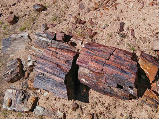
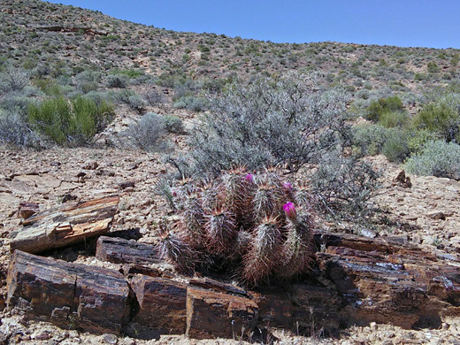
- the logs are several colorful fossilized tree trunks lying close to the road, safely fenced off to deter souvenir hunters. A 0.3 mile loop trail continues to other logs, while even more may be seen on ranger-led hikes into the surrounding hills.Seven Sisters
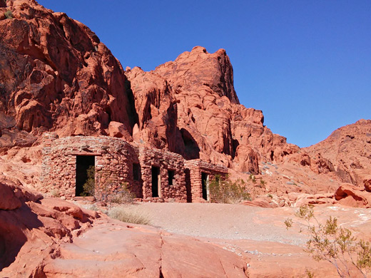
- a group of tall, red, eroded boulders surrounded by sandy desert provides a nice setting for a roadside picnic area, with tables and chairs - a perfect place for children to play hide and seek.The Cabins
- three CCC-constructed stone cabins were built at the base of high red cliffs during the 1930s, and now form a backdrop for one of two picnic areas along the highway.Elephant Rock
- this small but intricately shaped rock really does look like an elephant, and as it is close to the east entrance, many people get to take its photograph. The rock is actually right next to the road, but as parking is limited along this stretch of the highway, visitors have to take a 1/3 mile trail to reach the formation, starting at the main parking area by the entrance station. Also beginning here is a rather longer loop trail through the red rocks north of the highway.
Trails of the Valley of Fire
Atlatl Rock
★★★★★
★★★★★
0.3 miles, 40 feet
Isolated red rock butte adorned with many petroglyhs, on boulders and cliff faces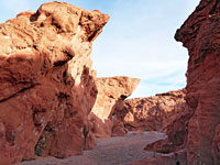
Charlies Spring Trail
★★★★★
★★★★★
2.5 miles, 200 feet
Shallow drainage containing narrows, a spring, palm trees, and a section of flowing stream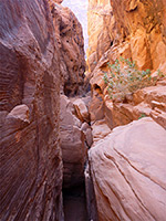
Fire Canyon Wash
★★★★★
★★★★★
2.8 miles, 300 feet
Narrow, red rock ravine continuing below the popular route down Petroglyph Canyon to Mouse's Tank; dryfalls, boulders, vertical-walled passages and open sections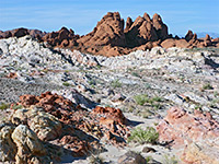
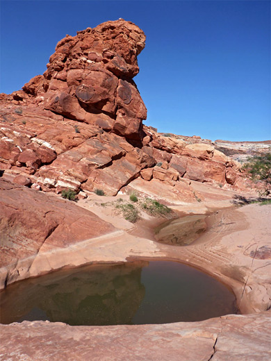
Magnesite Wash
★★★★★
★★★★★
3.5 miles, 300 feet (loop)
Mostly dry wash with a few deep potholes, enclosed by rocks in a great range of colors and forms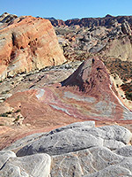
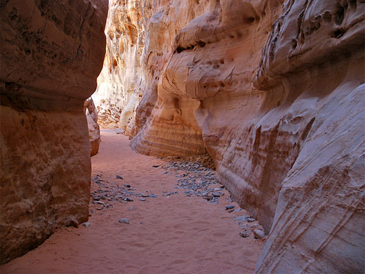
Kaolin Wash and Pastel Canyon
★★★★★
★★★★★
2 miles, 230 feet (loop)
Mostly off-trail loop along a colorful canyon that includes short slot sections; also passes other photogenic sites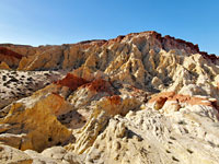
Painted Pinnacles
★★★★★
★★★★★
3.2 miles, 300 feet (loop)
Photogenic backcountry area east of Silica Dome; spires, ravines and ridges, colored pink, red, white and yellow, explored by an off-trail hike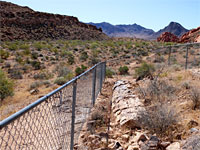
Petrified Logs Loop
★★★★★
★★★★★
0.3 miles, 50 feet (loop)
Short circuit of a sandy basin flanked by red rock outcrops, past several large petrified logs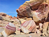
Prospect Trail
★★★★★
★★★★★
4.6 miles, 340 feet
The longest trail in the park, following washes through amazing rock formations, initially red, then more varied in color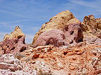
White Domes Trail
★★★★★
★★★★★
1.1 miles, 150 feet (loop)
Varied loop through colorful mounds and gullies, and a short but pretty section of slot canyonValley of Fire Wildflowers
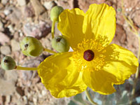
Photographs and descriptions of over 150 flowering plants found in the state park
Valley of Fire - Nearby Places
- Lake Mead (10 miles) - desert lake with many inlets and beaches, and other Aztec sandstone outcrops including the Bowl of Fire
- Whitney Pockets (68 miles) - more outcrops of deep red rocks
Valley of Fire - Similar Places
- Red Rock Canyon National Conservation Area, Nevada - colorful, eroded formations just west of Las Vegas
- Red Rock Canyon NCA, California - angled strata that have been eroded into cliffs, ravines and badlands
All Contents © Copyright The American Southwest | Comments and Questions | Contribute | Affiliate Marketing Disclosure | Site Map