The American Southwest
Home | Parks | Trails | Plants | Canyons
Maps | Landscapes | Site Map | Whats New? |
More...
Follow americansouthwest.net on Facebook
×
General Pages
Home
Parks
Trails
Plants
Slot Canyons
Maps
Landscapes
Itineraries
Site Map
What's New?
More pages...

States
Arizona
California
Colorado
Idaho
Nevada
New Mexico
Oregon
Texas
Utah
Wyoming


ARIZONA
CALIFORNIA
COLORADO
IDAHO
NEVADA
NEW MEXICO
OREGON
TEXAS
UTAH
WYOMING
NEVADA
MAPS | PARKS | HOTELS

Map of Valley of Fire State Park


Nevada > Valley of Fire State Park > Map
Map of Valley of Fire State Park, Nevada

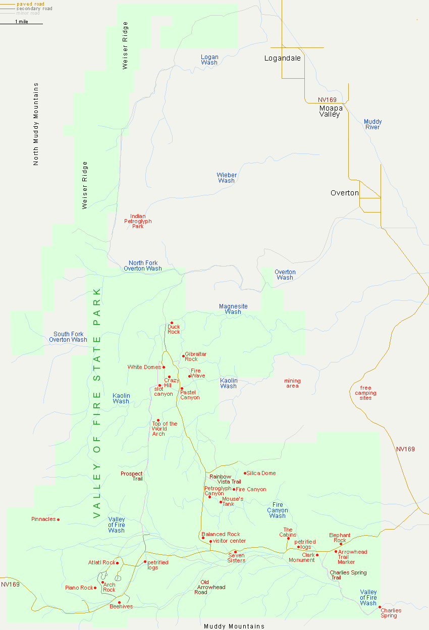
The Valley of Fire State Park visitor center is 50 miles from downtown Las Vegas via I-15 and NV 169, or 68 miles via Lake Mead Blvd and NV 167 (Northshore Rd). The northern approach through Logandale and Overton, also along NV 169, is 25 miles, starting at I-15 exit 93.

Area Map - Lake Mead NRA

Back to Top
Arizona | California | Colorado | Idaho | Nevada | New Mexico | Oregon | Texas | Utah | Wyoming | Slot Canyons | Travelogue | SOUTHWEST

All Contents © Copyright The American Southwest | Comments and Questions | Contribute | Affiliate Marketing Disclosure | Site Map