Atlatl Rock
Isolated red rock butte adorned with many petroglyphs; one large, elevated panel, reached by a metal staircase, and many others, on nearby boulders and cliff faces
Length: 0.3 miles, round trip
Elevation change: 40 feet
Difficulty: Easy
Type: Very short path to the main panel; social trails to the others
Usage: High
Season: All year
Trailhead: Along the side road to Atlatl Rock campground
Rating (1-5): ★★★★★
Elevation change: 40 feet
Difficulty: Easy
Type: Very short path to the main panel; social trails to the others
Usage: High
Season: All year
Trailhead: Along the side road to Atlatl Rock campground
Rating (1-5): ★★★★★

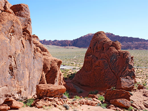
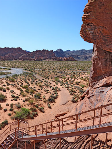
Atlatl Rock is a summit of red Aztec sandstone rising 150 feet above flat desert surroundings, at the north end of a 0.8 mile-long group of similar peaks, towards the west side Valley of Fire State Park. The two park campgrounds are located here - Atlatl Rock on the east side and Arch Rock to the west, this named after one of the many photogenic arches in the area. The group of buttes, and the ravines between them, is interesting to explore, in particular for the many petroglyphs found here, which are concentrated towards the north end, close to the actual Atlatl Rock summit.
The most well-known petroglyph panel is right next to a parking area, and accessed by a metal staircase, while close by to the south are many others, on cliffs and boulders; a couple of hours could be spent looking for them. Some are quite high above the ground, on vertical rockfaces, without any obvious way to climb up.
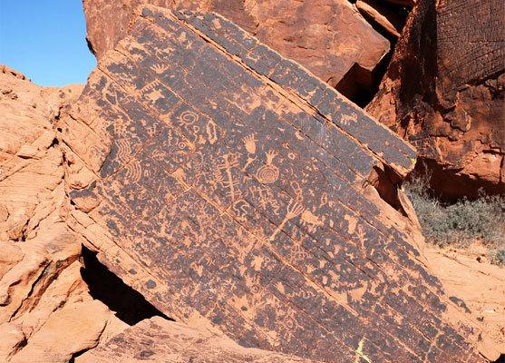
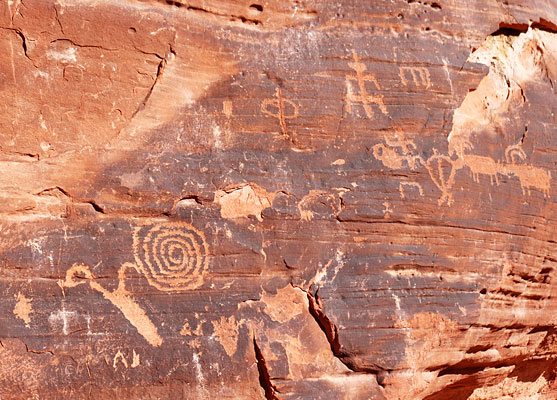
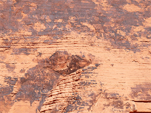
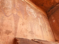
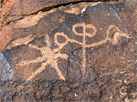
The Atlatl Rock parking place is along the campground spur road, between the two camps. The main petroglyph panel is just to the south, on a steeply inclined rockface about 100 feet above the desert floor, once reached by a narrow pathway chiselled into the sandstone, but now by a metal staircase. The many figures here include the atlatl (a spear-throwing device) after which the rock is named; there are also animals, concentric circles, human figures and geometric shapes. Some overlay others and are brighter in appearance, indicating the panel was created over a long period of time. The petroglyphs face northeast and are partly beneath an overhanging rock so are often half in shade and half in sun, in the morning, so afternoon might be the best time to visit. Just above the panel is a gap or window in the rocks, allowing elevated views of lands to the west. As is often the case with easy to reach petroglyphs, the panel is marred by graffiti.
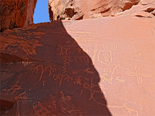
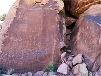
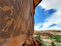
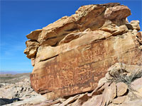
Two hundred feet south of the staircase is a gap in the rocks, a branched gully, with more petroglyphs on the cliffs at either side, relatively low down, and also perhaps the best group in the whole area, dozens of crisp designs on the flat face of a big boulder, known informally as Newspaper Rock. Further south, a line of cliffs extends about 1000 feet towards the campground, and here are plenty more petroglyphs along here, some 20 feet or more above the ground.
The most well-known petroglyph panel is right next to a parking area, and accessed by a metal staircase, while close by to the south are many others, on cliffs and boulders; a couple of hours could be spent looking for them. Some are quite high above the ground, on vertical rockfaces, without any obvious way to climb up.
The Main Panel
The Atlatl Rock parking place is along the campground spur road, between the two camps. The main petroglyph panel is just to the south, on a steeply inclined rockface about 100 feet above the desert floor, once reached by a narrow pathway chiselled into the sandstone, but now by a metal staircase. The many figures here include the atlatl (a spear-throwing device) after which the rock is named; there are also animals, concentric circles, human figures and geometric shapes. Some overlay others and are brighter in appearance, indicating the panel was created over a long period of time. The petroglyphs face northeast and are partly beneath an overhanging rock so are often half in shade and half in sun, in the morning, so afternoon might be the best time to visit. Just above the panel is a gap or window in the rocks, allowing elevated views of lands to the west. As is often the case with easy to reach petroglyphs, the panel is marred by graffiti.
Other Petroglyphs
Two hundred feet south of the staircase is a gap in the rocks, a branched gully, with more petroglyphs on the cliffs at either side, relatively low down, and also perhaps the best group in the whole area, dozens of crisp designs on the flat face of a big boulder, known informally as Newspaper Rock. Further south, a line of cliffs extends about 1000 feet towards the campground, and here are plenty more petroglyphs along here, some 20 feet or more above the ground.
Atlatl Rock - Similar Hikes
All Contents © Copyright The American Southwest | Comments and Questions | Contribute | Affiliate Marketing Disclosure | Site Map