Maze Rock Art Site, Vermilion Cliffs National Monument
Arizona > Vermilion Cliffs National Monument > Maze Rock Art Site
Maze Rock Art Site
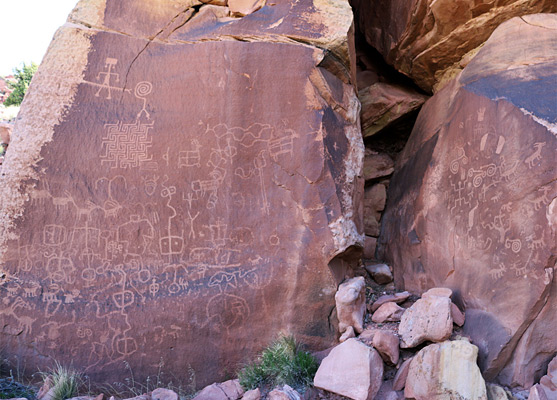
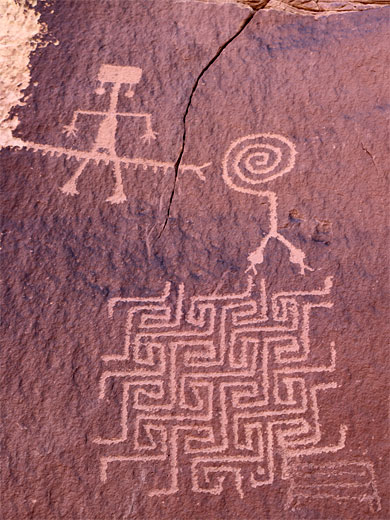
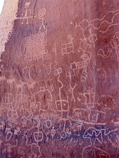
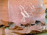
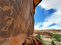
Impressive panel of many petroglyphs, on a red rock cliff on the east side of House Rock Valley; the most unusual design is an intricate maze, topped by a two-headed snake with spiral tail.
Length: 0.7 miles
Elevation change: 150 feet
Difficulty: Easy
Type: One-way trail
Usage: Low
Season: All year, though not when road is wet or snowy
Trailhead: Pullout along House Rock Valley Road
Rating (1-5): ★★★★★
Elevation change: 150 feet
Difficulty: Easy
Type: One-way trail
Usage: Low
Season: All year, though not when road is wet or snowy
Trailhead: Pullout along House Rock Valley Road
Rating (1-5): ★★★★★

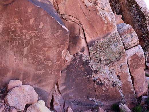
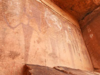
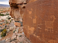
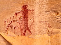
Vermilion Cliffs National Monument contains numerous rock art sites, the majority remote, hidden and far from roads. Amongst the better-known locations, and one provided with a marked, BLM trailhead, is the Maze Rock Art Site in House Rock Valley, in the northwest corner of the monument, one mile from the Utah stateline. At the foot of a low red cliff of the Moenave Formation (Dinosaur Canyon Member) are dozens of petroglyphs, the most unusual an intricate maze, topped by a two-headed snake with spiral tail, adjoining a centipede and human figure. The heads of the snake appear to be entering different sections of the maze.
This site is quite easily reached, by a 0.7 mile hike, climbing 150 feet, and is well worth seeking out. The trailhead is 10.8 miles south of US 89 along on the unpaved House Rock Valley Road, which is always bumpy and potentially impassable when wet, but if dry, most vehicles can make the trip, including small RVs. From the southern end of the road, starting along US 89A, the distance is 18.7 miles, and the road somewhat bumpier.
The trail also forms the start of the Notch Route, an alternative way to reach the Wave, in the Coyote Buttes area.
Guidelines for visiting archaeological sites.
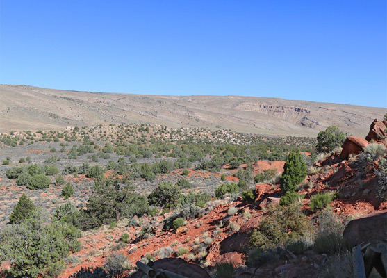
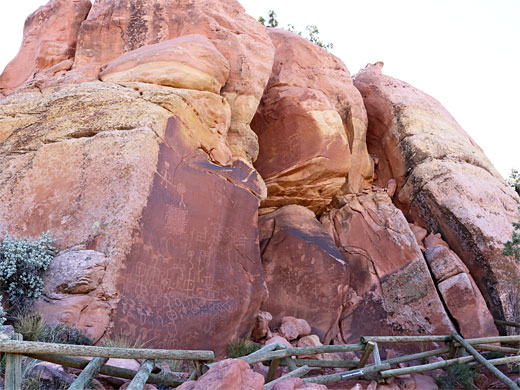
Parking for the rock art site is a good sized pull-out on the west side of House Rock Valley Road. The narrow but obvious trail climbs a gentle slope to the east, rising through red rock boulders and scattered wildflowers, passes through a fence with metal gate, and crosses a wide sagebrush flat, heading towards a bigger line of cliffs. The petroglyphs are towards the north end of the cliffs, mostly on two flat rockfaces separated by a vertical cavity, plus a few others on some adjacent boulders. The main area is loosely fenced off and marked with a notice. The site faces due west so is in shade until the afternoon, and high enough for good views up and down the valley.
This site is quite easily reached, by a 0.7 mile hike, climbing 150 feet, and is well worth seeking out. The trailhead is 10.8 miles south of US 89 along on the unpaved House Rock Valley Road, which is always bumpy and potentially impassable when wet, but if dry, most vehicles can make the trip, including small RVs. From the southern end of the road, starting along US 89A, the distance is 18.7 miles, and the road somewhat bumpier.
The trail also forms the start of the Notch Route, an alternative way to reach the Wave, in the Coyote Buttes area.
Guidelines for visiting archaeological sites.
The Hike
Parking for the rock art site is a good sized pull-out on the west side of House Rock Valley Road. The narrow but obvious trail climbs a gentle slope to the east, rising through red rock boulders and scattered wildflowers, passes through a fence with metal gate, and crosses a wide sagebrush flat, heading towards a bigger line of cliffs. The petroglyphs are towards the north end of the cliffs, mostly on two flat rockfaces separated by a vertical cavity, plus a few others on some adjacent boulders. The main area is loosely fenced off and marked with a notice. The site faces due west so is in shade until the afternoon, and high enough for good views up and down the valley.
Maze Rock Art Site - Similar Hikes
All Contents © Copyright The American Southwest | Comments and Questions | Contribute | Affiliate Marketing Disclosure | Site Map