The American Southwest
Home | Parks | Trails | Plants | Canyons
Maps | Landscapes | Site Map | Whats New? |
More...
Follow americansouthwest.net on Facebook
×
General Pages
Home
Parks
Trails
Plants
Slot Canyons
Maps
Landscapes
Itineraries
Site Map
What's New?
More pages...

States
Arizona
California
Colorado
Idaho
Nevada
New Mexico
Oregon
Texas
Utah
Wyoming


ARIZONA
CALIFORNIA
COLORADO
IDAHO
NEVADA
NEW MEXICO
OREGON
TEXAS
UTAH
WYOMING
ARIZONA
MAPS | PARKS | TRAILS | HOTELS

Map of Vermilion Cliffs National Monument


Arizona > Vermilion Cliffs National Monument > Map
Map of Vermilion Cliffs National Monument

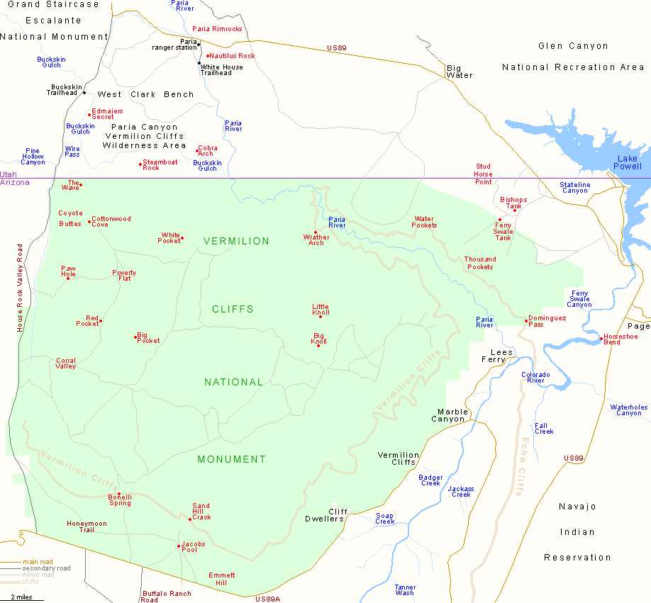
Vermilion Cliffs National Monument is bounded by House Rock Valley to the west, US 89A to the southwest and southeast, Glen Canyon NRA to the east and the Utah stateline to the north. Most of the Paria Canyon-Vermilion Cliffs Wilderness Area falls within the monument - the Paria River corridor and the Vermilion Cliffs themselves, but the boundaries extend north into Utah, incorporating another few miles of the river and most of Buckskin Gulch.

Back to Top
Arizona | California | Colorado | Idaho | Nevada | New Mexico | Oregon | Texas | Utah | Wyoming | Slot Canyons | Travelogue | SOUTHWEST

All Contents © Copyright The American Southwest | Comments and Questions | Contribute | Affiliate Marketing Disclosure | Site Map